2DCubed
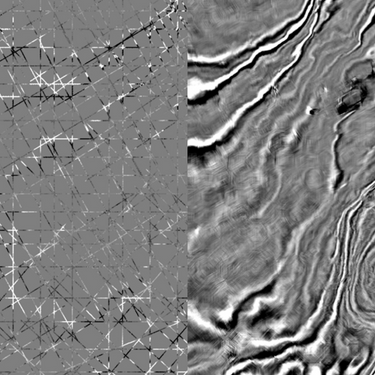
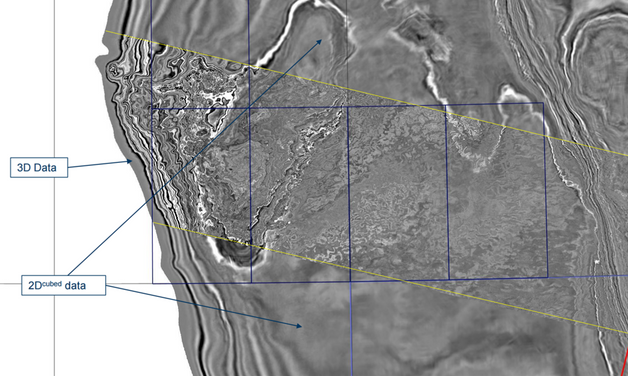
2DCubed is a structurally conformable interpolation engine that uses 2D data and creates a 3D volume that is interpretable on a regional scale. This allows the user to fully utilize the capability of their 3D interpretation software on 2D, which not only improves the analysis, it aids the communication of the geological play.


Turning 2D into 3D for Regional Screening
Our workflow uses an advanced structurally conformable interpolation algorithm to maximize the potential of existing 2D multivintage and 3D data. The first step is to create a unified 2D dataset from existing data by demigrating and then matching amplitude and phase. Dip and coherency attributes are estimated and this information is used to guide the interpolation of a 3D volume, which is then 3D migrated. The volume can be used for regional interpretation and optimization of 3D survey design and positioning.
Technical Details
2DCubed is a regional screening tool to identify structures. It allows you to decide where to acquire 3D data. The gross structural picture is validated, but obviously, smaller-scale features are limited and 3D data is required.


2DCubed Experience
We have processed and generated more than 2,300,000 km2 of 2D cubed data in various basins around the world, over 75% of which has been generated since 2020. The project size has varied from as little as 1,000 km2 to over 500,000 km2.
- 200,000 sq km in the Barents Sea
- 25,000 sq km in North East Greenland
- 300,000 sq km in Atlantic Margin
- 600,000 sq km in North Sea
- West of Shetlands
- 570,000 sq km in India's East Coast
- 85,000 sq km in Sea of Okhotsk
- 1,000 sq km in Saka
- 270,000 sq km in East Java Sea
- 40,000 sq km in Timor Leste
- 980 sq km in Papua New Guinea
- 30,000 sq km in Cooper Basin PSTM
- 30,000 sq km in Cooper Basin PSDM
- 1,000 sq km in New Zealand
- 373,000 sq km in Browse Basin
- 40,000 sq km in Beagle Bedout

