


The Location
Location
Midland Basin, Texas, USA
Survey
Pontiac 3D
Survey Year
2025
Date Processed
2025 - 2026
Data Deliverables
Depth-imaged volumes; interpretation-ready products
Survey Type
Multi-client 3D Land Seismic
Survey Size
Approx. 267 sq. mi.

The Challenge
Imaging a Complex Onshore Basin
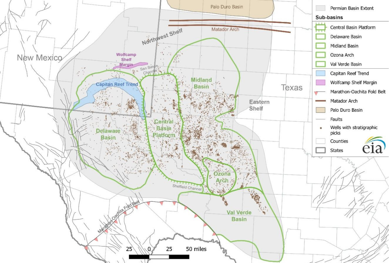
The Pontiac 3D survey, acquired within the Midland Basin limits, lies in a geologically complex portion of the Permian Basin where structural deformation associated with the Central Basin Platform transition can impact subsurface imaging quality. Accurate positioning of seismic events is critical for understanding reservoir architecture and reducing uncertainty associated with development planning.
Achieving this objective requires advanced acquisition and imaging workflows capable of preserving geological fidelity across multiple target intervals.
Extracting More Reservoir Detail
Operators evaluating unconventional reservoirs increasingly require greater stratigraphic detail to identify subtle reservoir variability and optimize development programs. Even high-quality seismic datasets can be limited in their ability to resolve thin beds and subtle geologic features.
Improved seismic resolution and interpretability are therefore essential to support horizon mapping, thickness assessment, reservoir characterization, and well-planning workflows.
Maximizing Long-Term Data Value
In mature, highly active basins such as the Midland Basin, operators are under pressure to make faster development decisions while maximizing the value of existing subsurface data investments. A single seismic survey is expected to support multiple workflows, from regional evaluation and prospect screening to reservoir characterization and development planning.
To maximize return on investment, seismic datasets must continue delivering value beyond the initial imaging workflow through new technologies and derived subsurface insights.


The Solution
Acquisition Solution(s)
- Broadband Vibroseis
Pre-Processing Solution(s)
VMB and Imaging
Reservoir-Oriented Solution(s)
- High-Resolution Multi-Parameter FWI (field test)
- Lumina DeepInvert™ bandwidth enhancement
Commercial Model
- TGS Multi-Client
Data Management
- Imaging AnyWare® processing platform
TGS designed Pontiac 3D as a premium seismic imaging project capable of supporting the full exploration-to-development lifecycle. The survey utilized broadband Vibroseis acquisition and a comprehensive imaging workflow that included advanced signal conditioning, noise attenuation, velocity model building, and depth imaging designed to maximize subsurface fidelity. The resulting seismic dataset provides a robust foundation for interpretation across key Midland Basin reservoirs. Building upon this foundation, TGS continued to expand the value of the dataset through imaging innovation and interpretation-focused enhancements.
The Pontiac survey was subsequently used to demonstrate TGS’ high-resolution Multi-Parameter FWI capabilities, while a collaboration with Lumina Geophysical enabled DeepInvert™ machine learning-driven seismic inversion technology to generate additional interpretation-focused products for clients.

The Results
Improved Subsurface Understanding
The Pontiac 3D survey delivers a high-quality seismic foundation for evaluating structurally and stratigraphically complex reservoirs across the Midland Basin. Through modern acquisition and FWI-driven model building and imaging workflows, TGS created a dataset that supports improved subsurface understanding, more reliable structural interpretation and greater confidence in the evaluation of key unconventional targets.
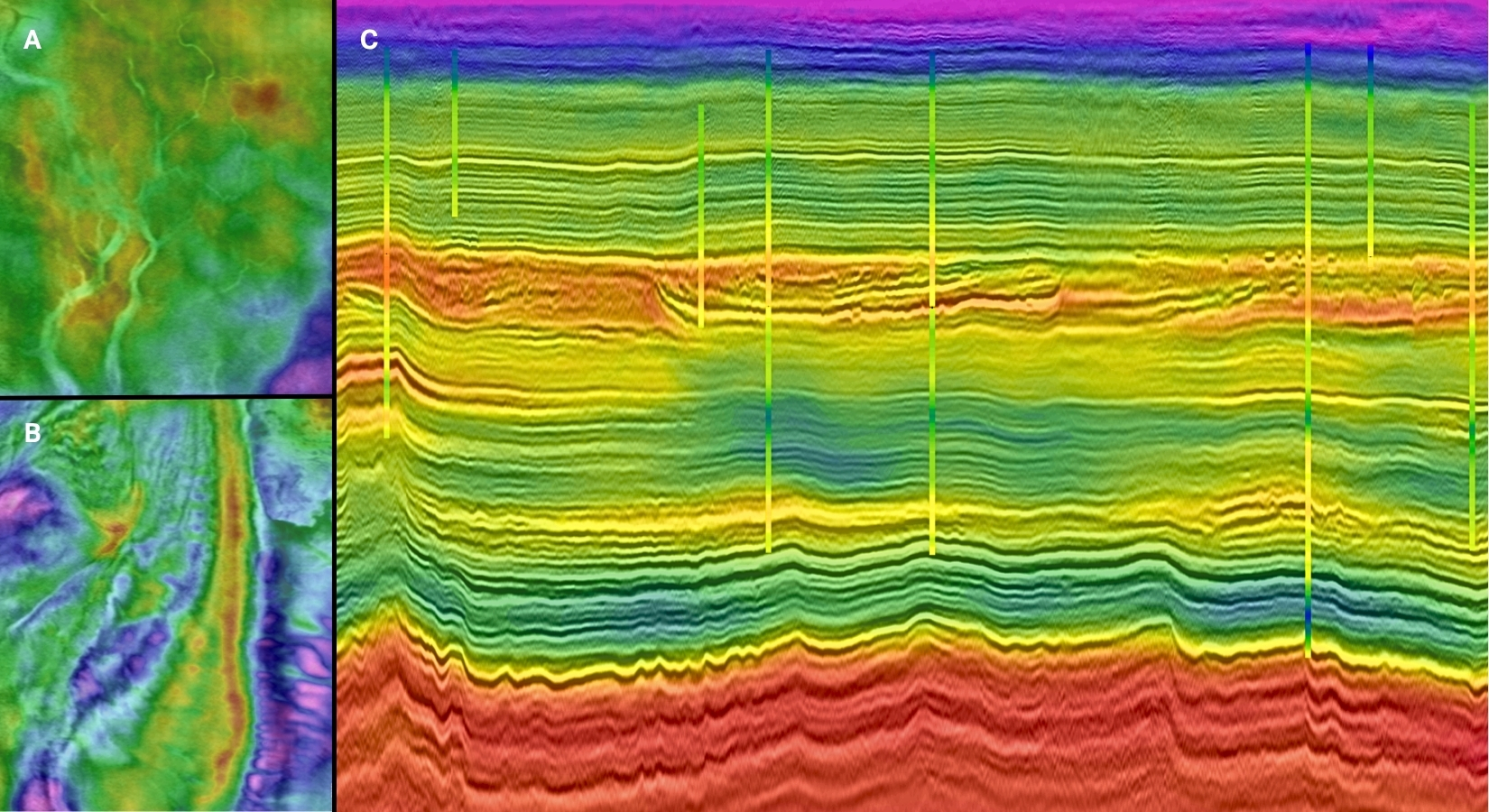
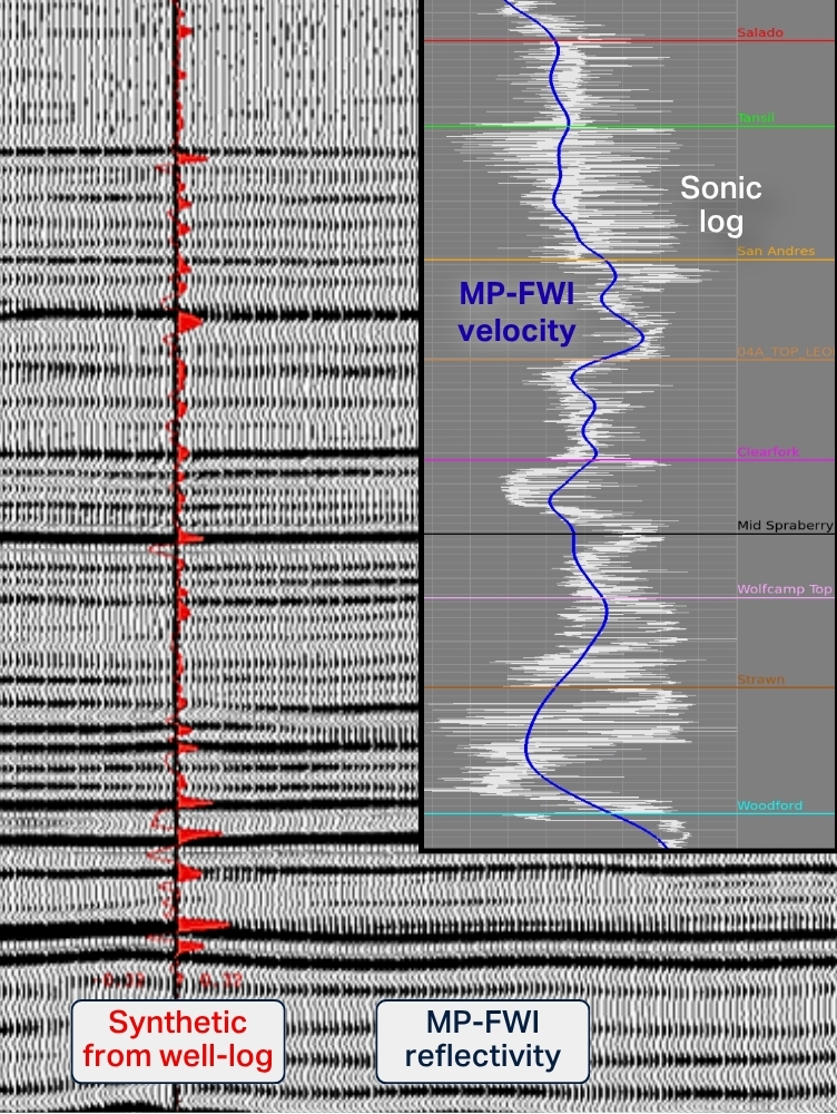
TGS’ proprietary Dynamic Matching FWI (DM FWI) workflow produced a velocity model with a high degree of correlation with well logs, validating its capability to accurately delineate both structural geometries and lithologic variations within complex onshore geological environments.
Enhanced Interpretation Value
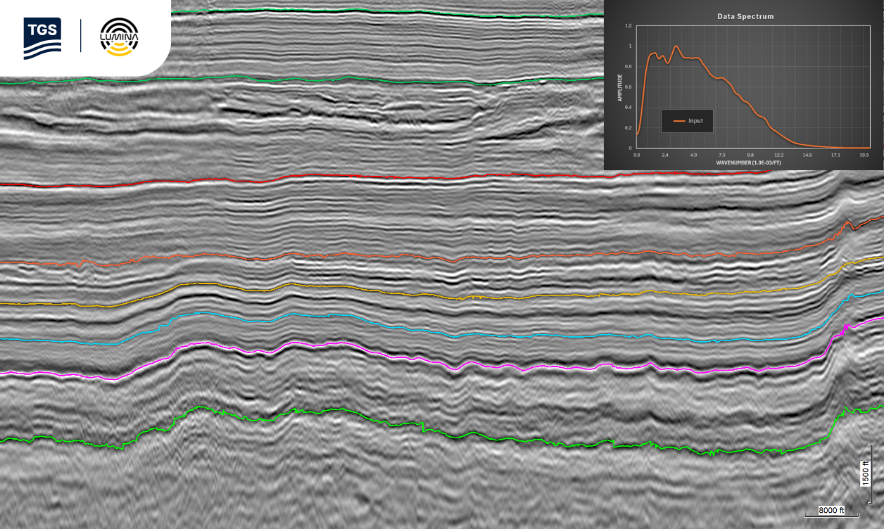
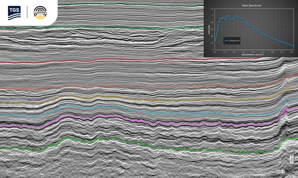
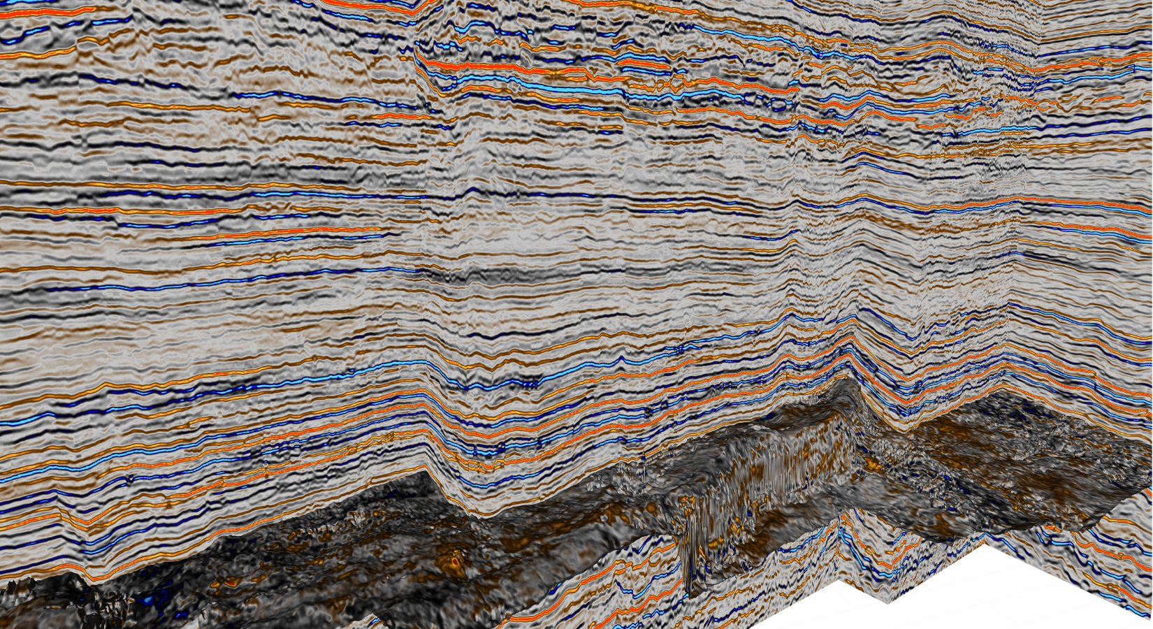
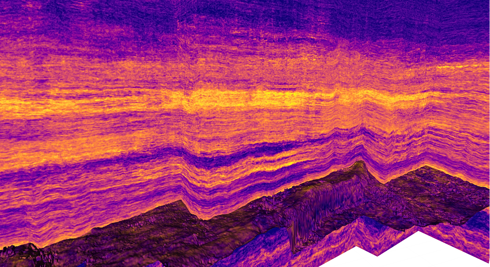
Building on the strength of the core dataset, the DeepInvert™ enhancement provided additional interpretive value by improving visibility of subtle stratigraphic features and thin reservoir intervals. Interpreters can benefit from enhanced event continuity and greater stratigraphic definition, enabling more confident horizon mapping, thickness evaluation and reservoir characterization workflows.
The combination of high-quality TGS imaging and Lumina’s ML-driven seismic inversion technology expands the overall utility of the Pontiac 3D dataset for development-focused operators.
Expanding Value Beyond Seismic
Pontiac 3D evolved beyond a conventional seismic survey into a multi-purpose interpretation platform. Clients can leverage the core seismic volumes for structural and stratigraphic evaluation while also benefiting from advanced imaging studies and enhanced interpretation products derived from the same dataset.
This scalable approach increases the longevity and utility of the survey, helping operators maximize the return on their seismic investment while supporting a wider range of exploration and development workflows.
Extracting Additional Insights from Existing Seismic Data
Beyond the core Pontiac 3D commercial deliverables, the dataset provided an excellent opportunity for TGS to demonstrate the capabilities of its Multi-Parameter Full Waveform Inversion (MP-FWI) technology.
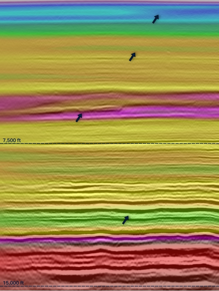
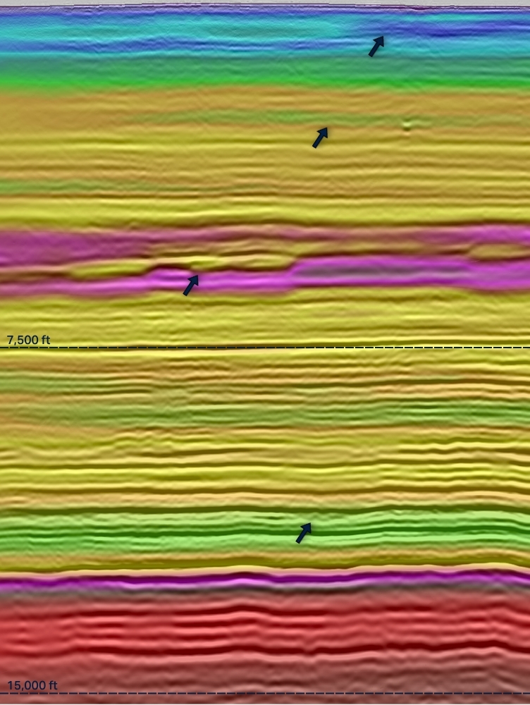
MP-FWI jointly estimates velocity and reflectivity through a scale-separated inversion framework designed to reduce parameter crosstalk while improving geological resolution. Combined with TGS' Dynamic Matching objective function, the workflow leverages both refracted and reflected energy to improve model accuracy in challenging land environments.
Application on the Pontiac dataset demonstrated enhanced geological detail, while maintaining good correlation with well log information. This highlights the additional value that advanced imaging technologies can extract from land seismic data.
Conclusion
Pontiac 3D demonstrates TGS' ability to deliver onshore value throughout the seismic lifecycle, from survey design and acquisition through advanced imaging and interpretation products. The project provides operators with a high-quality seismic dataset capable of supporting exploration, appraisal and development decisions across key Midland Basin reservoirs. Beyond delivering a robust imaging foundation, TGS continues to create incremental client value through advanced imaging innovation and interpretation-focused enhancements.
The application of Multi-Parameter FWI demonstrated the potential for additional imaging insight, while the collaboration with Lumina Geophysical expanded the interpretive potential of the dataset through a DeepInvert™-enhanced product focused on reservoir characterization workflows.
Together, these efforts reinforce the long-term value of the Pontiac 3D dataset and showcase how a modern seismic investment can continue generating new insights over time.
Commercial Impact

Accelerating Basin Evaluation
Provides a premium multi-client seismic dataset across a highly active Midland Basin development area.
Supporting Better Development Decisions
Reducing Interpretation Uncertainty
Showcasing Imaging Innovation