
- OBN
-
OBN
- UHR3D
-
UHR3D
- Multi-Azimuth
-
GeoStreamer X
-
Multi-Azimuth
- Multi-Component
-
GeoStreamer Pure 3D
-
GeoStreamer 3D
- 3D
-
Vision
-
Conventional 3D
-
MegaSurvey 3D
-
2D-cubed
- 2D
-
GeoStreamer 2D
-
Megasurvey 2D
-
Conventional 2D
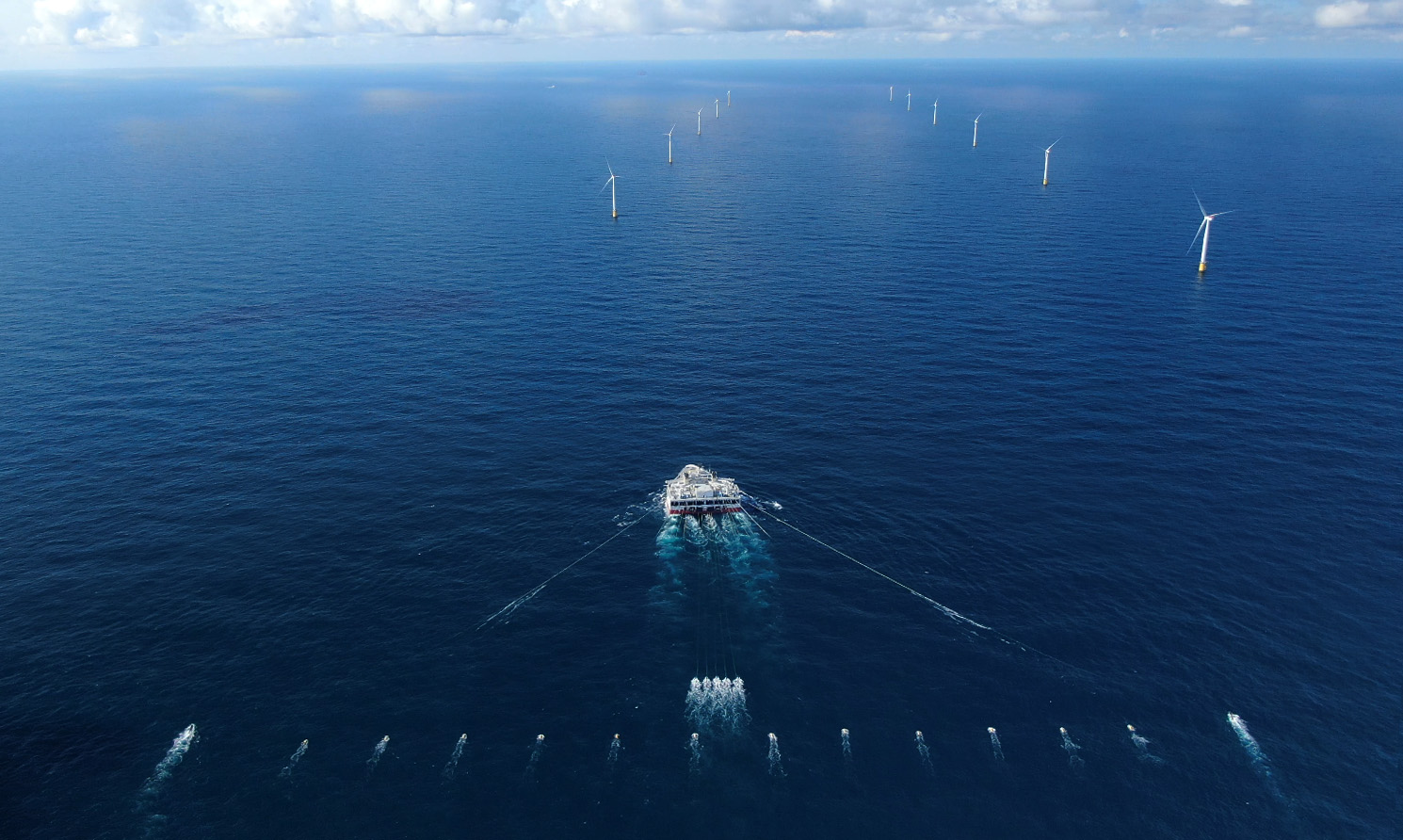
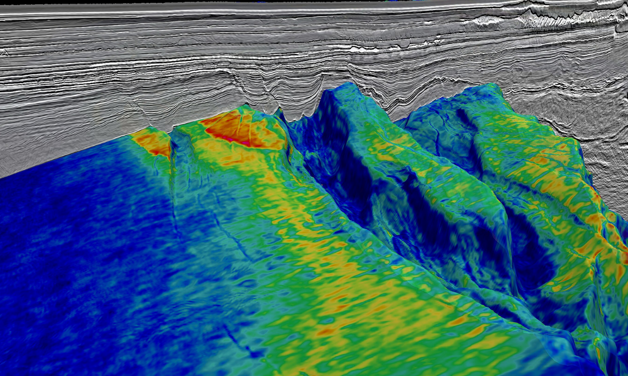
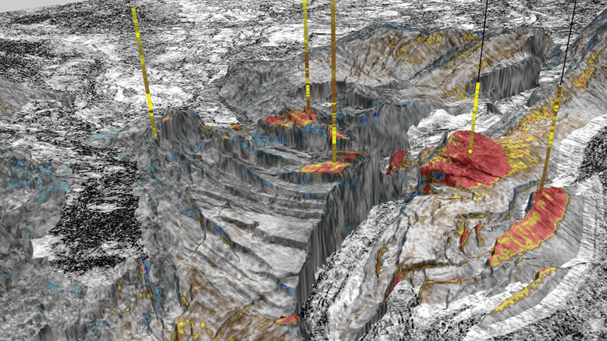
OBN
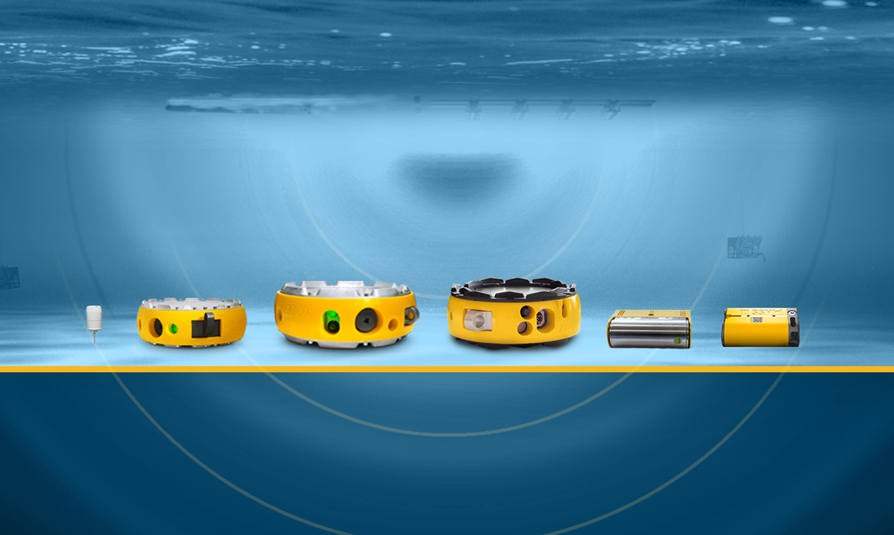
OBN
Ocean Bottom Node (OBN) seismic acquisition delivers high-resolution, full-azimuth, long-offset multi-component seismic data by placing autonomous nodes directly on the seafloor to capture detailed subsurface imagery. Designed for complex, technically demanding environments, OBN surveys provide clearer reservoir insight, improved structural definition, and greater confidence in exploration and field development decisions.
With more than 20 years of OBN experience and over 130 surveys completed worldwide, TGS combines proven nodal technology, automated handling systems and integrated project workflows to deliver predictable, high-value outcomes. Our modular MASS and ZNodal systems operate from shallow water to 4,000 meters depth, supporting safe, efficient deployment across diverse offshore settings — from infrastructure-led exploration to reservoir monitoring, CO₂ storage and marine resource projects.
Through our ECHOVA integrated workflow, we connect planning, acquisition and processing into a streamlined, transparent execution model. This end-to-end approach reduces operational risk, improves environmental performance and ensures consistent data quality, helping clients move forward with clarity, accountability and confidence.

20+ YEARS OF OBN LEADERSHIP
FLEXIBLE AND SCALABLE SOLUTIONS
Integrated Value Chain Execution
Proven Global Performance
Learn More
Explore our OBN solutions, technology and project experienceUHR3D
UHR3D
Ultra-High Resolution 3D seismic delivers precision imaging of the shallow subsurface, providing exceptional clarity of near-seafloor conditions. Using short streamers, shallow tow depths and high-frequency sources, UHR3D captures fine-scale geological features that are critical for offshore wind development, infrastructure planning and complex site investigations.
Fully imaged 3D data volumes provide consistent spatial detail across compact or congested marine environments, improving detection of geohazards, soil variability and buried obstructions that conventional 2D or sparse 3D methods may overlook. Optimized for smaller survey areas and shallow targets, UHR3D supports early-stage decision-making with reliable, high-resolution subsurface insight. Advanced processing workflows including deghosting, statics correction and high-resolution velocity model building ensure data consistency and vertical precision down to a few meters. The result is a clear and actionable understanding of shallow geology that reduces uncertainty, improves design confidence and supports efficient project execution across offshore energy, wind and carbon storage developments.
Ultra-High Resolution Imaging in Shallow Settings
Optimized for Complex and Congested Environments
Advanced Processing for Consistent Data Quality
Integrated Multi-Sensor Data Acquisition
Learn More
Explore detailed UHR3D capabilities, configurations and processing workflowsGeoStreamer X
GeoStreamer X
GeoStreamer X supports multi-azimuth, multi-sensor towed-streamer acquisition using single- or multi-vessel wide-tow source configurations to solve complex clastic and subsalt imaging challenges. By tailoring acquisition geometries to optimize offset and azimuth sampling, it delivers richer seismic illumination, improved near-offset distribution, enhanced velocity model building, and stronger full-waveform inversion performance. The result is sharper imaging at all depths and a cost-effective, flexible solution for advancing exploration and reservoir characterization in both mature and frontier basins.
Flexible Multi-Azimuth Survey Design
Enhanced Near-Offset and AVO Performance
Long-Offset Capability for Deeper Imaging
Hybrid Streamer and Node Integration
Learn More
Explore GeoStreamer X acquisition geometries, configurations and case studiesMulti-Azimuth
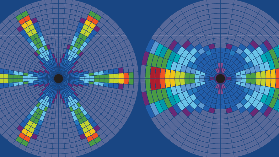
Multi-Azimuth
Multi-azimuth towed streamer configurations, deployed with single or multi-vessel wide-tow sources, address complex clastic and subsalt imaging challenges while providing an economic solution for richer seismic illumination and improved velocities. By tailoring azimuth acquisition to subsurface complexity, additional azimuths can enhance target illumination, improve lateral resolution and strengthen coherent noise attenuation. From cost-effective single-vessel multi-azimuth surveys to wide-azimuth and rich-azimuth multi-vessel geometries, acquisition design is optimized to balance geophysical objectives and project economics.
Multi-azimuth acquisition improves subsurface characterization in clastic and carbonate environments and can be applied to new surveys or integrated with legacy narrow-azimuth data for rapid upgrades. Wide-azimuth and rich-azimuth geometries expand offset and azimuth diversity to enhance imaging beneath complex overburdens such as salt, while extended long-offset strategies strengthen Full Waveform Inversion and velocity model building. In the most demanding environments, hybrid acquisition approaches combining towed streamers and ocean bottom nodes further enrich offset and azimuth coverage to support advanced inversion and elastic property analysis. The result is improved reservoir delineation, reduced uncertainty in amplitude and inversion workflows, and clearer subsurface understanding across exploration and field development projects.
Tailored Azimuth Design for Imaging Challenges
Enhanced Illumination and Lateral Resolution
Stronger Velocity Model Building
Hybrid Streamer and Node Integration
Learn More
Explore richer azimuth acquisition strategies and survey design optionsGeoStreamer Pure 3D
GeoStreamer Pure 3D
GeoStreamer PURE 3D merges only multi-component GeoStreamer broadband data into unified, contiguous regional 3D volumes that are fully depth processed using advanced modern imaging workflows, including Full Waveform Inversion. Built on a common grid with consistent amplitudes and phase-balanced integration, these datasets deliver true broadband clarity and reliable elastic properties across basin scale areas. The result is a premium, drill-ready regional framework that supports basin screening, play fairway evaluation and confident prospect maturation within a single, consistent 3D volume.
TRUE BROADBAND CLARITY
DEPTH-PROCESSED REGIONAL FRAMEWORK
SEAMLESS CONTIGUOUS 3D INTEGRATION
RELIABLE ELASTIC PROPERTY INSIGHT
Learn More
Explore GeoStreamer PURE 3D coverage and imaging methodologyGeoStreamer 3D
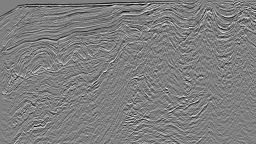
GeoStreamer 3D
GeoStreamer seismic surveys record both pressure and particle motion using variable-depth, multi-sensor streamers, delivering true broadband data. By separating upgoing and downgoing wavefields, GeoStreamer enables effective receiver deghosting, improves signal-to-noise ratio and preserves low frequencies critical for velocity model building and inversion workflows.
The broadband response enhances AVO reliability and amplitude stability while supporting deeper penetration and clearer imaging beneath complex overburden such as salt or basalt. Long-offset acquisition options further strengthen velocity analysis, full waveform inversion workflows and subsurface illumination across regional scales.
MULTISENSOR BROADBAND ACQUISITION
PROVEN PROPRIETARY TECHNOLOGY
ENHANCED IMAGING IN COMPLEX SETTINGS
QUANTITATIVE INTERPRETATION CONFIDENCE
Learn More
Explore GeoStreamer 3D broadband acquisition capabilitiesVision
Vision
This integrated regional 3D solution merges multi-component GeoStreamer and other conventional large-scale seismic datasets into unified, seamless depth volumes processed as a joint prestack processing project using modern imaging workflows. By applying advanced technologies, including Full Waveform Inversion, tomography, and RTM/LSM, the data are optimized for consistent illumination across complex geological settings using a single velocity model. The result is a continuous regional 3D volume that not only supports basin screening and regional interpretation continuity, but also infrastructure-led exploration and prospect maturation, with improved velocity accuracy, attribute extractions, and AVO analysis, all with drill-ready confidence.
INTEGRATED REGIONAL 3D CONTEXT
DEPTH IMAGING WITH MODERN WORKFLOWS
COMMON GRID, CONSISTENT MERGE
VELOCITY MODELING ADVANTAGE
Conventional 3D
Conventional 3D
Conventional 3D seismic includes single-component towed-streamer surveys acquired in narrow-azimuth configurations with optional long offsets and tailored tow depths. These programs provide cost-efficient structural imaging and reservoir characterization for development-focused objectives and mature basin settings.
For projects requiring broader bandwidth, improved low-frequency recovery and enhanced quantitative interpretation, GeoStreamer multisensor acquisition delivers superior subsurface clarity and imaging performance.
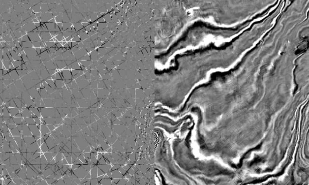
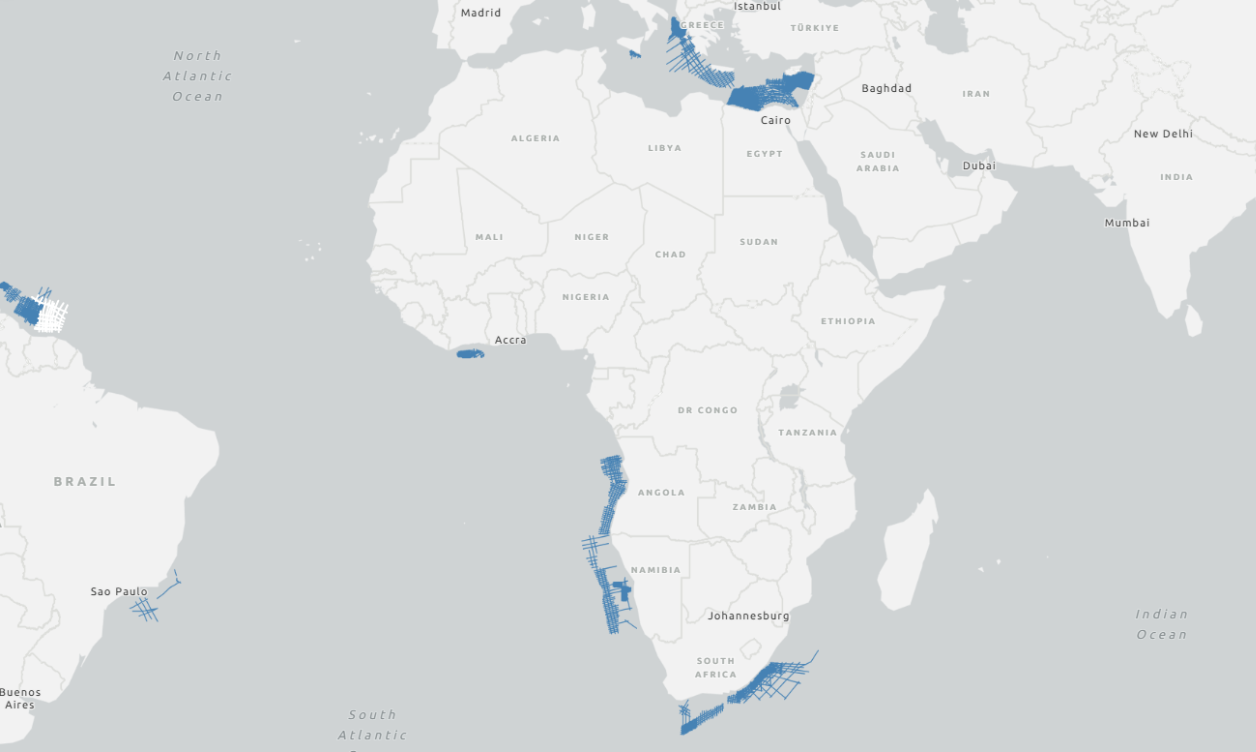
MegaSurvey 3D
MegaSurvey 3D
MegaSurvey 3D merges the final 3D seismic poststack datasets onto a common grid, creating an amplitude-balanced, phase-matched, contiguous regional volume on a common geometry. By integrating public, multi-client and proprietary data into a consistent basin-wide framework, it enables regional screening, play fairway mapping and petroleum system analysis with seamless coverage of a structural subsurface image. The result is fast mega-regional insight that provides geological context beyond block boundaries using a unified 3D dataset.
REGIONAL CONTEXT AT BASIN-SCALE
COMMON GRID MERGE
PHASE MATCHED AND AMPLITUDE BALANCED
BASIN-WIDE SCREENING EFFICIENCY
Learn More
Explore the MegaSurvey 3D concept and methodology2D-cubed
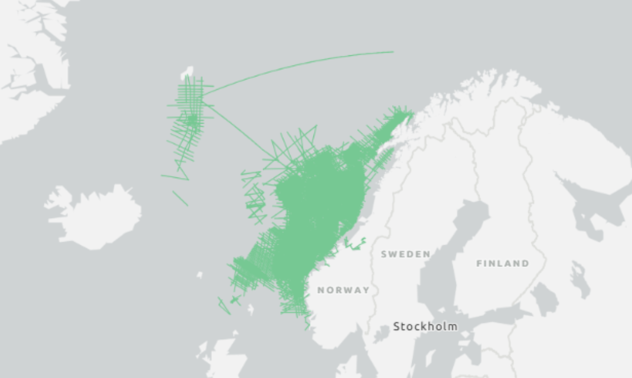
2D-cubed
2D-cubed seismic volumes transform dense 2D lines into a structurally conformable 3D volume at regional or basin scale, enabling 3D interpretation where 3D coverage is sparse, at close to 2D cost. By integrating multivintage 2D and selected 3D data into a unified dataset, 2Dcubed creates an interpretable 3D volume that unlocks the full capability of modern 3D interpretation software for regional screening and play evaluation.
The workflow demigrates and matches existing data for amplitude and phase consistency before applying dip and coherency-guided interpolation to generate a continuous 3D volume. The resulting dataset is 3D migrated and optimized for regional structural interpretation, helping validate the gross structural framework, identify prospective trends and guide future 3D survey design. While smaller-scale features still require conventional 3D acquisition, 2Dcubed provides a cost-effective solution for basin-scale screening and portfolio evaluation.
With more than 2.3 million square kilometers processed globally across diverse basins, 2Dcubed has proven its value as a regional decision-support tool, enabling companies to prioritize acreage, reduce exploration risk and communicate geological plays with greater clarity.
Structurally Conformable 3D from 2D Data
Maximizes Multivintage Data Value
Cost-Effective Regional Screening
Proven Global Application
Learn More
Explore the 2D-cubed workflow, technical methodology and global case studiesGeoStreamer 2D
GeoStreamer 2D
Learn More
Explore GeoStreamer 2D acquisition capabilities and broadband performanceMegasurvey 2D
Megasurvey 2D
MegaSurvey 2D compiles large regional 2D seismic datasets onto a common grid, matched for phase and scale and optionally incorporating selected 3D-derived lines. The result is a contiguous basin-scale framework that defines structural architecture and play trends with consistent regional quality.
Conventional 2D

Conventional 2D
Conventional 2D seismic includes single-component towed-streamer surveys designed for efficient frontier evaluation, basin architecture mapping and well ties. It delivers rapid regional coverage and cost-effective structural insight across large offshore areas.