
Offshore Brazil’s Open Acreage Permanent Offer Bid Rounds
With over 965,000 kilometers in 2D multi-client data and 590,000 square kilometers in 3D multi-client data in Brazil, our seismic data covers every basin, sector and block offshore Brazil in the upcoming bid round cycles.
Brazil’s Open Acreage Permanent Offer (OPP)
The Brazilian National Agency of Petroleum, Natural Gas and Biofuels (ANP) plans to launch the third Open Acreage Permanent Offer (OPP) cycle under the Production Sharing Regime in the second half of 2025. The cycle offers key investment opportunities in Brazil’s oil and gas sector, especially the pre-salt polygon.
The Open Acreage Permanent Offer (OPP) allows year-round bidding on exploratory blocks and returned fields, replacing fixed rounds. This flexible model aims to boost investment and speed Brazil’s oil and gas development. Under the Production Sharing Regime, OPP targets pre-salt and strategic areas. These areas are only included in the offer after specific authorization from the National Energy Policy Council (CNPE), ensuring that the most valuable and technically challenging blocks are managed with high regulatory standards.
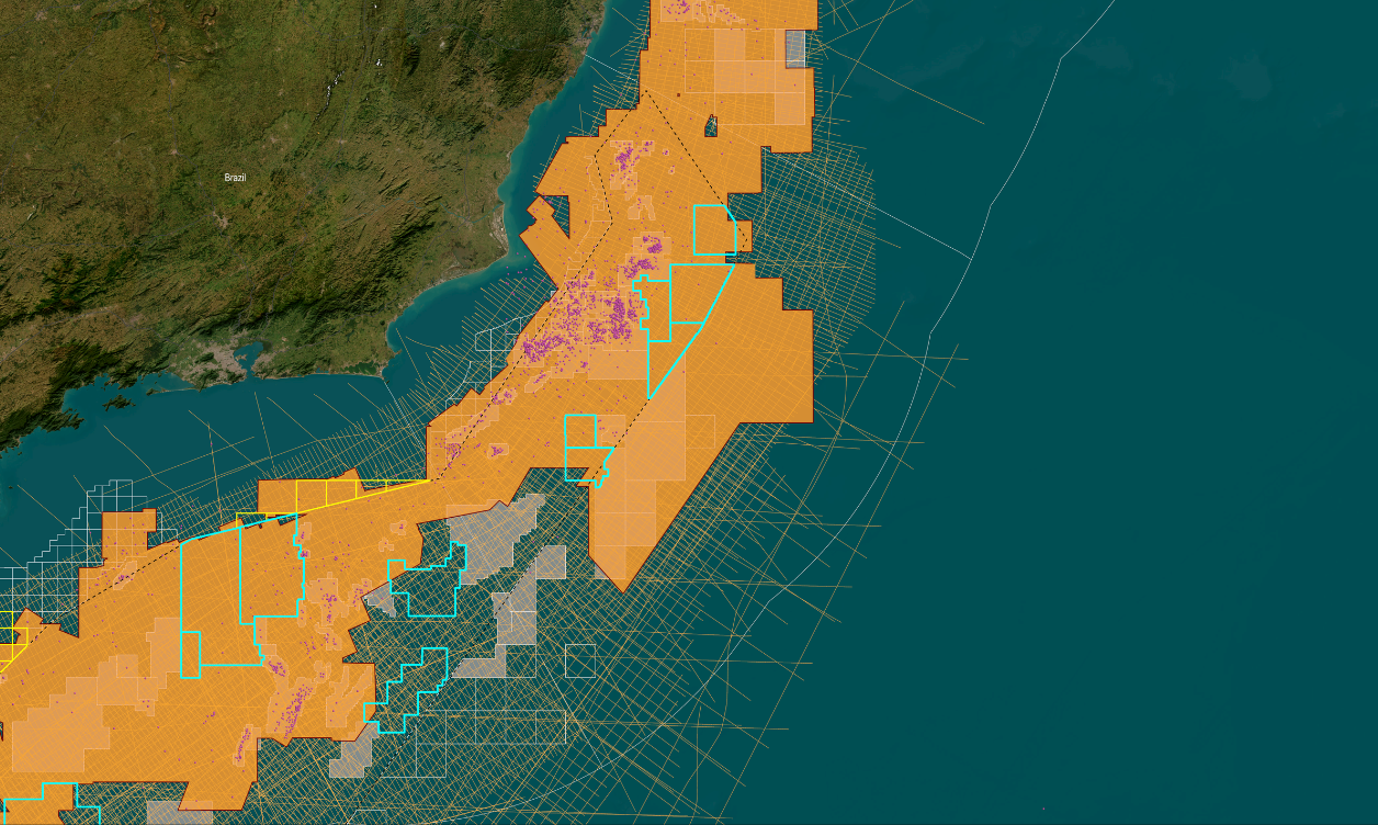
.png?width=2000&height=1333&name=MAP-LATAM-Santos%26Campos2%20(1).png "MAP-LATAM-Santos&Campos2 (1)")
OPP Current Cycle Timeline
The bid round is expected to close in the second half of 2025 and will offer 13 pre-salt blocks, including six in the Campos Basin and seven in the Santos Basin. TGS offers extensive seismic data coverage over this region, providing the insights needed to de-risk exploration.

.png)
Santos Basin
There are 7 blocks in the Santos Basin that will be included in the bid round: Esmeralda, Ametista, Amazonita, Safira Oeste, Safira Leste, Jade and Agata.
TGS’s Picanha 3D and Santos Vision 3D datasets offer detailed subsurface insights to identify opportunities and reduce risk in this prolific basin.
Campos Basin
There are six blocks in the Campos Basin that will be included in the upcoming licensing cycle: Jaspe, Itaimbezinho, Ônix, Citrino, Larimar, and Turmalina.
TGS offers recent 3D seismic and reprocessed data covering all of these areas. Notably, our Campos 3DMC, Campos Deepwater 3DMC, and the reprocessed Picanha 3DMC datasets stand out as key exploration tools for industry.

Speak to a Specialist
Let us know your needs and we’ll connect you to the right person or team.
Book a Data Viewing
Want to see the latest seismic data solutions and imaging technologies in your region of interest or for the next license round? Book a data viewing with one of our experts.
Discuss Your Seismic Data Needs
Every need is different and we'd like the opportunity to discuss yours further. Speak to one of our data or geoscience experts to customize seismic solutions specific to your requirements.