
First Published: Geo Expro, March 2023 by Andrew Hartwig
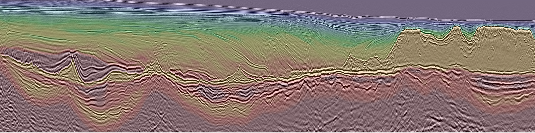
Legacy 3D seismic datasets dating back to the 1980’s through mid-2010’s have been reprocessed and imaged from field tape allowing for updated regional 3D mapping and evaluation of paleo-environmental conditions relating to the development of Brazil’s super basin petroleum system. Isopach maps and semblance extraction assist in identifying Cretaceous and younger sediment depo-centers, salt thickness and evacuation patterns, and pre-salt source probability to reduce risk and increase exploration success.
Power of Picanha
Exploration and production in Campos and Santos Basins, Brazil has hit a crossroads unlike anything in the past two decades. Increases in sub-economic discoveries and dry holes are leading the industry to postpone investments and strategically await key well results before making further long-term commitments.
Trends such as infrastructure led exploration (ILX) and geopolitical policy uncertainties around low-carbon energy solutions continue to convolute the scope of the ever-evolving energy market. Through this lens, reprocessed 3D seismic data at the regional scale is the most cost-effective, fit-for-purpose subsurface instrument which can provide the risk reducing intelligence the industry covets to guide their disciplined investment strategies.
TGS' Picanha 3D seismic dataset provides a unique visual scope of the subsurface through three of the most prolific Brazilian offshore basins using an unprecedented reach of reprocessing and contiguous merging of vintage datasets over 260,000 km2
of Brazil’s Atlantic waters.
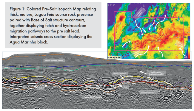
The results of the reimaged, seamlessly merged 3D seismic and subsequent attribute data allow for diverse applications to ILX or frontier exploration. Seismic interpretation and analysis of regional subsurface data supports the evaluation of basin’s geologic history, depositional systems, and paleoclimate as they relate to the offshore petroleum system. Picanha 3D can be used to define these characteristics more confidently by differentiating key features based on broad observations which can be used to interpret hydrocarbon fetch and migration pathways to a high-profile lease blocks, such as Agua Marinha (Figure 1).
One hundred and seventeen datasets were merged and reimaged in a phased approach, from field tape, with a consistent workflow to achieve a contiguous, seamless result. Throughout the imaging process the team interpreted meaningful, well-tied stratigraphic horizons, not only to calibrate velocity model building, but also to build structure and isopoach maps at major geologic boundaries to evaluate sediment thickness, salt evacuation patterns, and pre-salt carbonate accumulations.
Applying such strategies in the evaluation of high-profile blocks on offer in during the Permanent Production Sharing Offer Round and future ILX territories, gives a substantial advantage to those with access to bulk Picanha licenses. Comprehensive maps of the three most distinct isopachs can be evaluated for broad basin architecture and exploration purposes for improved understanding of the heterogeneous petroleum system characteristics across the basins.
PRE-SALT SUPREMACY
The pre-salt isopach reveals where the deepest, most probable source kitchens are present in the syn-rift and sag basins. The underlying continental and transitional crust display...
<continued>
Download the full article using the link at the top of this page.