The Location
Location
Orphan Basin, Newfoundland and Labrador
Survey
Blomidon
Survey Year
2020
Survey Type
3D GeoStreamer
Configuration
16 streamers x 100 m x 8 km
Survey Size
3 526 sq. km

The Challenge
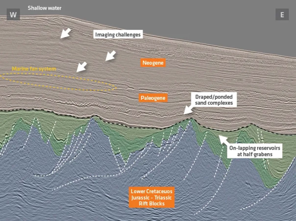

The Solution
Data
Broadband 3D GeoStreamer
Processing
AVO/AVA compliant
Model Building
Reflection tomography and TGS Multi-Parameter FWI
Imaging
Kirchhoff and TGS Multi-Parameter FWI
In a traditional sequential imaging workflow, velocity and reflectivity are inverted separately. Exploration teams must wait until the end of the data processing phase to be able to generate a density attribute from the data. TGS Multi-Parameter FWI implements Full Waveform Inversion (FWI) and Least Squares Migration (LSM) in a joint scheme and updates both velocity and reflectivity simultaneously at each iteration. It is a data-driven approach and can be run very quickly to deliver direct estimates of the subsurface velocity, reflectivity, relative impedance and relative density.
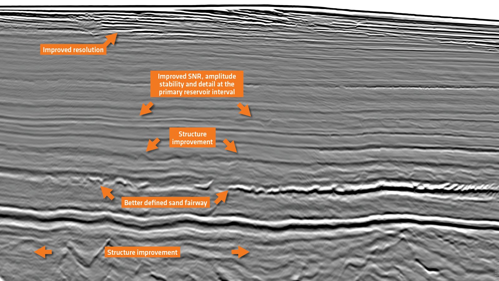
Reliable Structures, Balanced Amplitudes and Improved Reservoir Definition
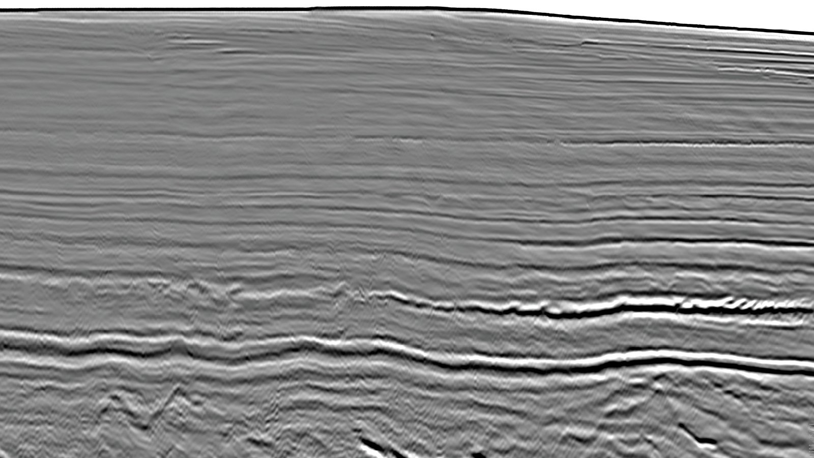
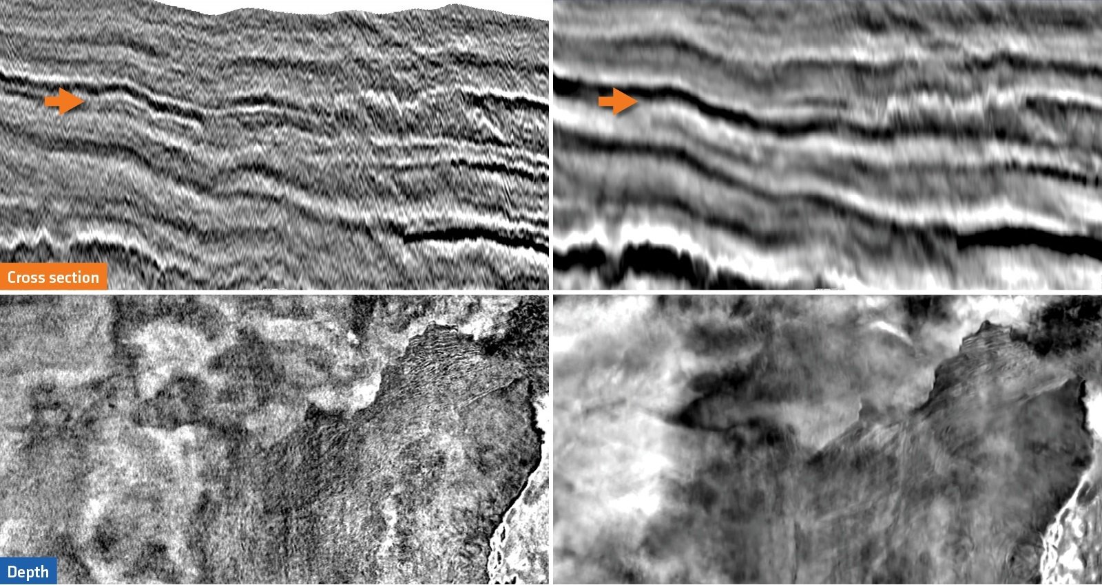
TGS Multi-Parameter FWI Delivers Better Event Continuity and Image Sharpness
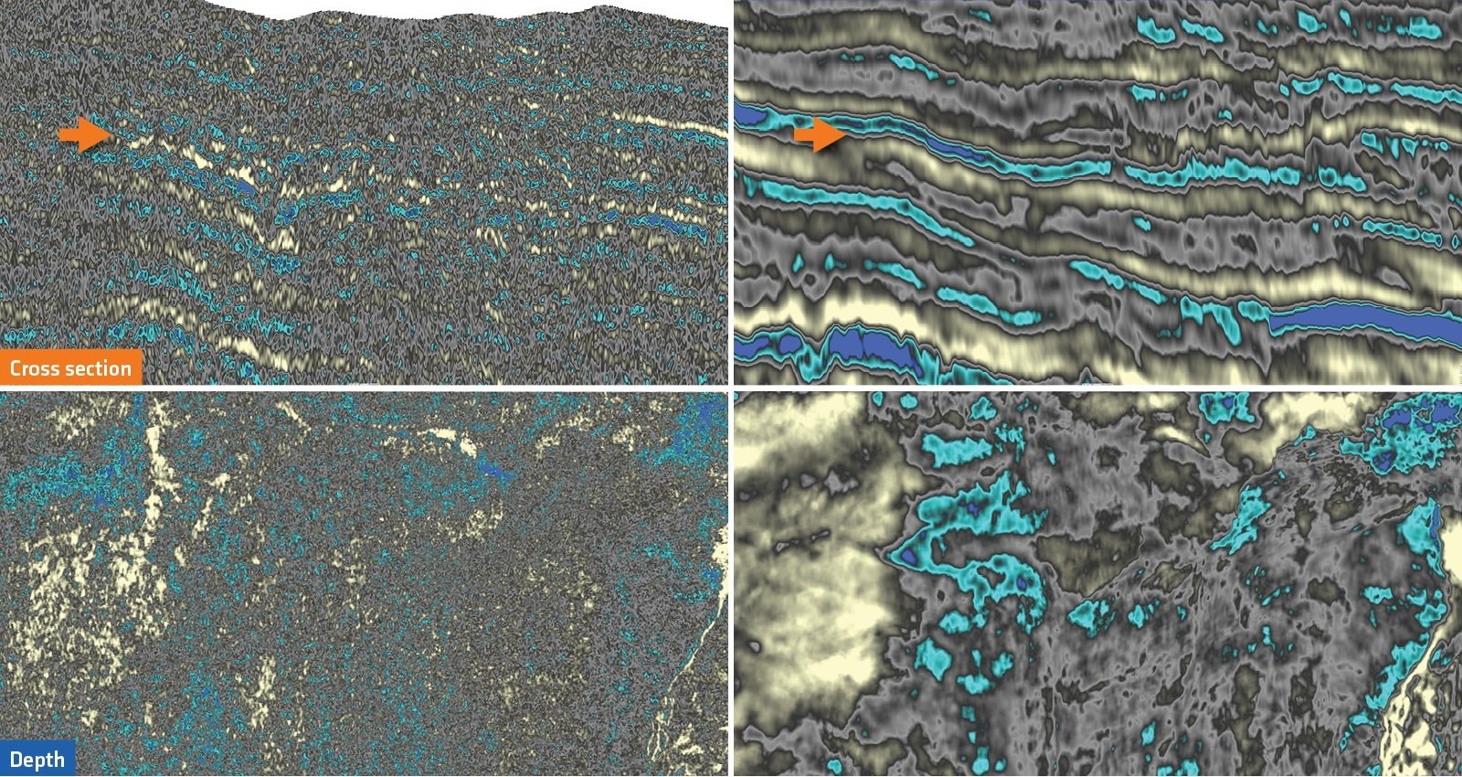
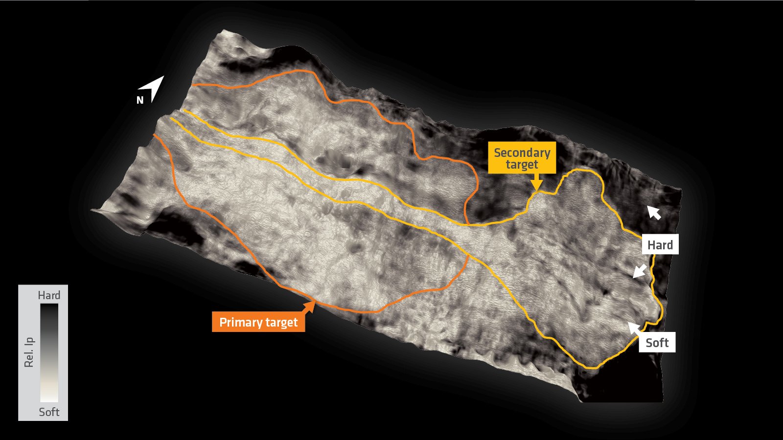
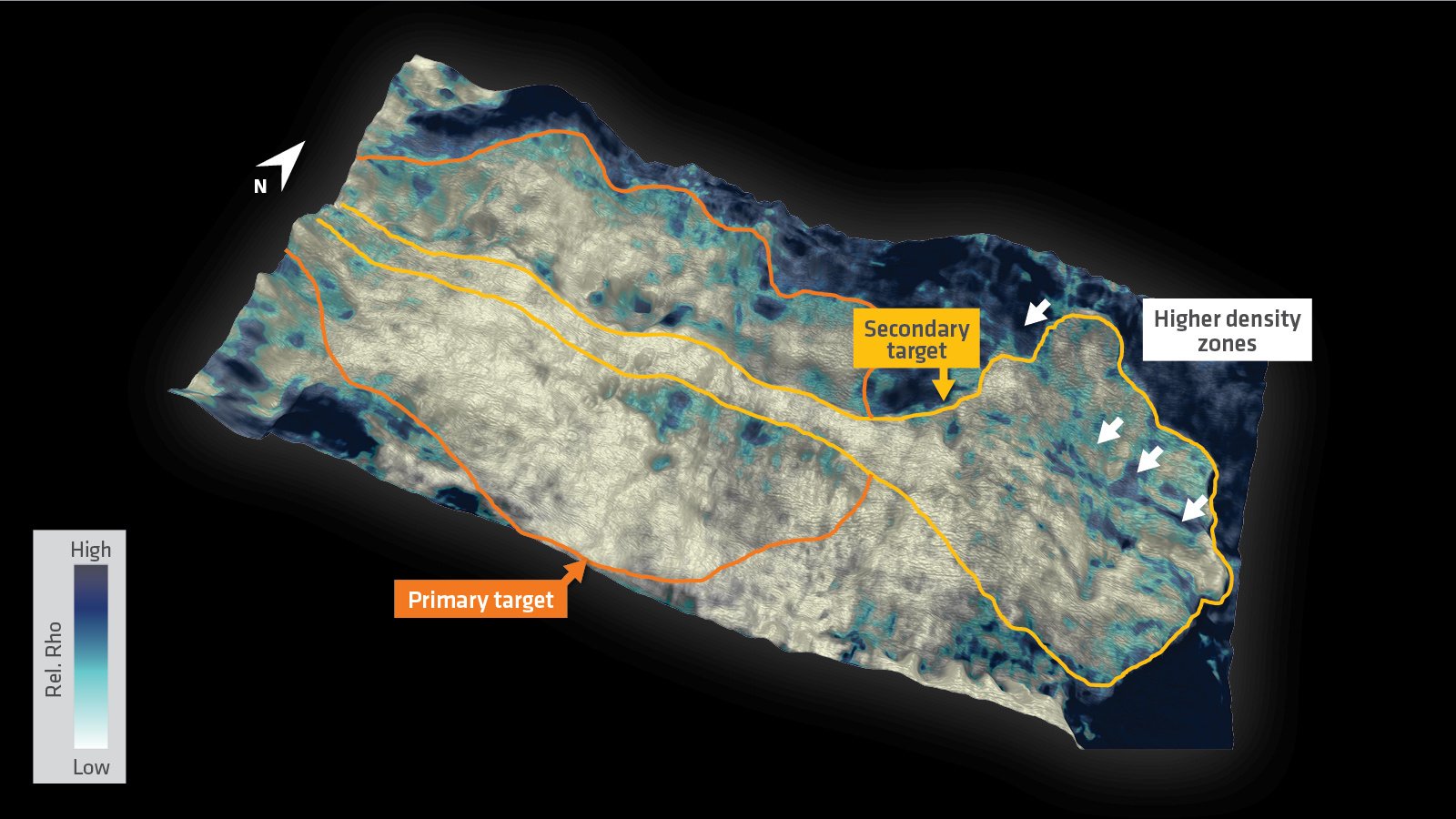
Understanding Leads with a Robust Density Property
Without TGS Multi-Parameter FWI it is difficult to produce a relative density attribute. Final and fully processed angle stacks with good signal-to-noise ratio are required. The pre-stack elastic inversion methodology normally used to predict density requires significant input and assumptions from geoscientists. This adds an extra layer of bias to the final deliverables. TGS Multi-Parameter FWI provides data-driven direct estimates of the subsurface velocity, reflectivity and their derivatives relative impedance and relative density. In enables technical teams to perform prospectivity and lead assessments with confidence.
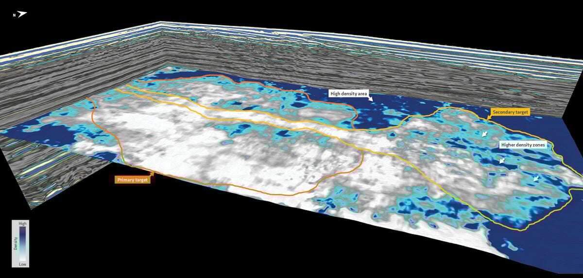
Mitigating Exploration Risks Through an Improved Reservoir Assessment with TGS Multi-Parameter FWI