Brazil
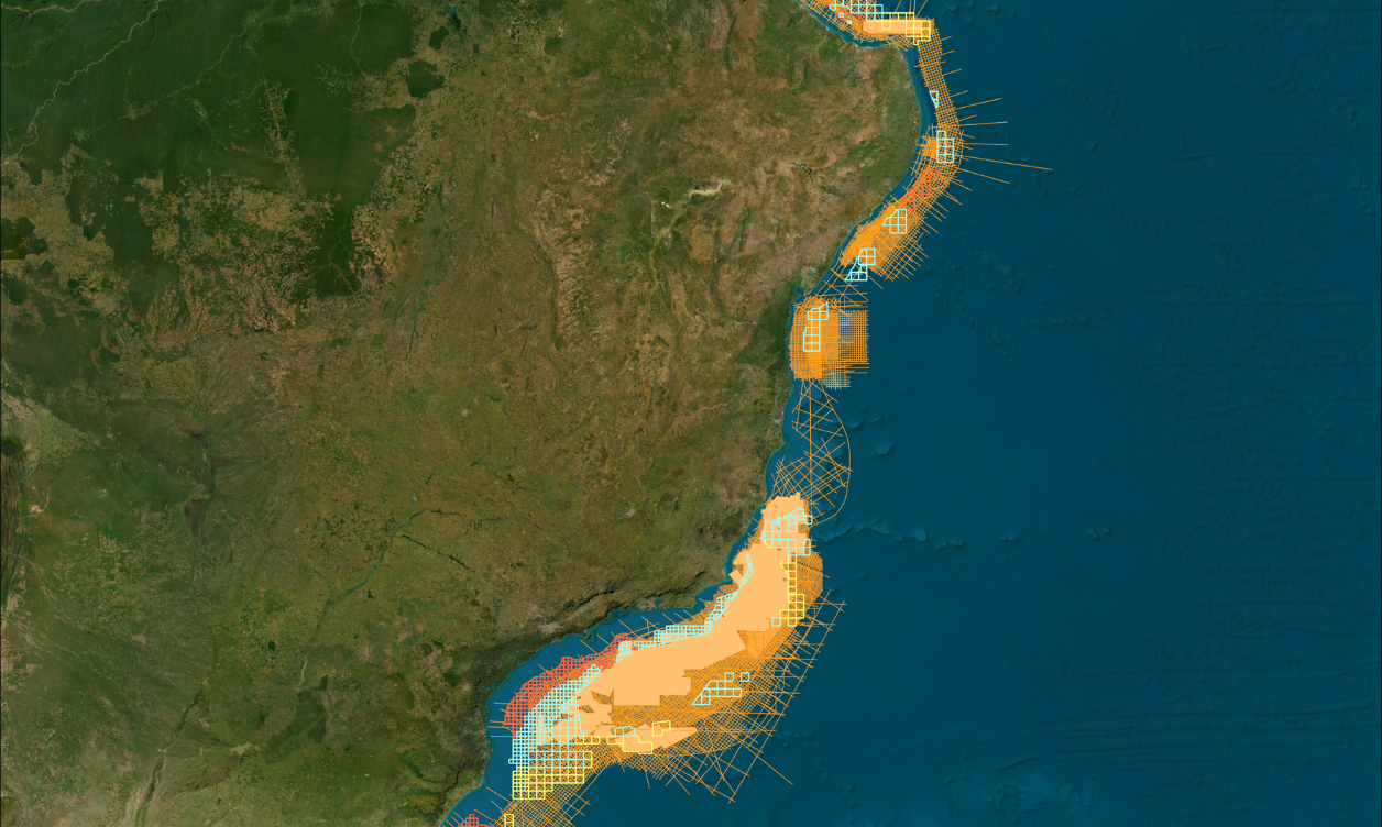
Our exploration programs in Brazil are most often built around basin-specific licensing rounds and are designed to provide regional geological understanding to de-risk prospective bids. Our library of modern, long-offset data, available in both time (PSTM) and depth (PSDM), comprises the largest and most comprehensive high-quality dataset offshore Brazil.

Our Data Coverage
Foz do Amazonas, Pará-Maranhão & Barreirinhas
- ~130,000 km 2D
- ~11,335 km² 3D
- Create a comprehensive, deep-basin framework and model for the hydrocarbon potential of Brazil’s frontier basins
- Numerous hydrocarbon indicators are present throughout these northern basins
Ceará & Potiguar
- ~100,000 2D km
- ~11,740 km² 3D
- Basin wide interpretations available
- Conjugate ties in the transform margin between Africa and Brazil will establish a new basis for introducing similar plays in Brazil’s Equatorial Margin
- Data from the Brazilian Equatorial Margin reveals the relationship of the Cretaceous fans and basin geometry with the transform faults
Pernambuco-Paraíba & Sergipe-Alagoas
- ~58,000 km 2D
- Located over Permanent Offer Round Blocks
- Develop plays based on proven and conceptual deepwater petroleum systems
- Data assists in building paleo-tectonic ties with corresponding regions in the conjugate margins of Africa
Camamu-Almada & Jequitinhonha Basins
- ~27,000 km 2D
- Located over the ANP Permanent Offer blocks
- Data reveals excellent crustal architecture and basin geometry
- Comprehensive coverage for interpretation of the area's active petroleum systems, the limits of existing plays, and the location of new plays
Espirito-Santo & Campos Basins
- ~53,000 km 2D
- ~15,400 km² 3D
- Located over an exclusive position of ANP Permanent Offer Round blocks
- Data coverage reveals deep basin architecture and information on the rifting architecture, pre-rift sequences, and paleo-movement of salt in Santos and Campos basins
Santos Basin
- 155,300 km 2D
- 20,500 km² 3D
- Located over an exclusive position of ANP Permanent Offer Round blocks
- Highly coveted area holds blocks surrounded by major operators.
- Our supporting data in the area allow the structural highs for the blocks on offer in Permanent Offer round to be clearly identified and mapped
Pelotas Basin
- Over 41,800 km 2D
- Modern 2D data covering ANP Permanent Offer Round blocks
- Data provides sub-basin and regional framework to promote better understanding of the area’s stratigraphic architecture and basement structure
- Improved understanding of the distribution of Cretaceous source rocks and reservoirs

Offshore Brazil Open Bid Rounds
With over 649,000 kilometers in 2D multi-client data and ~270,900 square kilometers in 3D multi-client data in Brazil, our seismic data covers every basin, sector and block offshore Brazil in the upcoming bid round cycles.
Data Library
Search our interactive map portal to see the industry-leading subsurface data we offer in Brazil. View available data types, projects and deliverables in your areas of interest.

Well Data
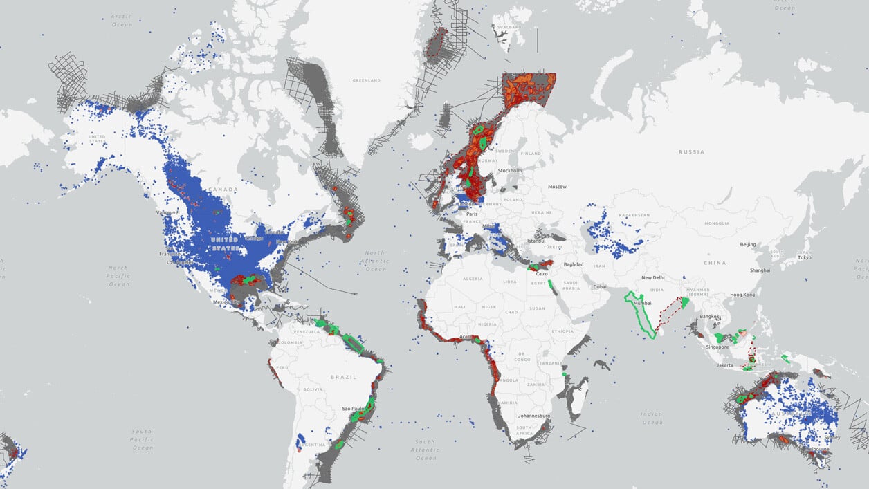
TGS has the industry's largest well data library comprised of nearly 100 years of public and non-public sources. This data is processed, normalized, and validated to our industry-leading standards with the most up-to-date data available.
.png?width=1388&height=779&name=MicrosoftTeams-image%20(53).png)
Other Subregions
-
Mexican GoM
-
Argentina
-
Suriname
-
Uruguay
Mexican GoM
Mexican GoM
Our offerings in the Mexican GoM market are designed to create a comprehensive set of products that facilitate understanding of the entire Gulf of Mexico basin. The Gigante survey provides a regional seismic grid with consistent acquisition and processing parameters that into U.S. GOM data, gravity & magnetic studies, structural interpretations, and evaluation of prospective areas through use of bathymetry and geochemical analyses from seafloor core targets.
Argentina
Argentina
Offshore Argentina currently presents some of the world's most promising exploration opportunities. We offer exploration programs designed to provide geological insights, including regional 2D seismic, basin-wide 3D seismic, well data, interpretive products and more.
Suriname
Suriname
Recent oil and gas discoveries in offshore Suriname are furthering the exploration and appraisal strategies in this world-class basin. Our seismic library offers 2D and 3D data coverage that tie to key exploration wells, providing valuable insights to evaluate offshore acreage.
Uruguay
Uruguay
We provide a robust regional framework off the coast of Uruguay, one of the southern hemisphere’s most under-explored offshore regions. Our comprehensive coverage includes seismic and well data, providing you with the insights needed to support the future of exploration success Offshore Uruguay.

