Seismic Interpretation and Prospectivity
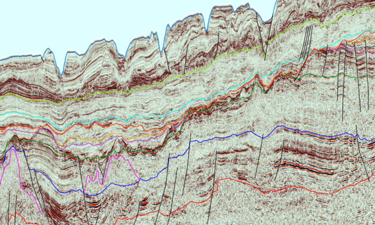
We interpret geological and geophysical datasets to support the entire exploration cycle from regional interpretations through to detailed prospect evaluations, including petrophysical and volumetric analyses.
Improve Understanding Through Regional Interpretation
To maximize the value of subsurface datasets, it is vital to integrate geological, geophysical and petrophysical data. This is critical from the large-scale regional play-based work to detailed prospect mapping. We use our extensive experience to integrate the data and provide an advancement of the client's understanding of the area and help fast-track the work program.
Our geoscientists work with the data from acquisition design and operations through input to processing workflow and velocity models, which allows complete immersion in the datasets. Our multi-client datasets across the globe, in both regional scale 2D basin-wide areas and in 3D areas, benefit from interpretation to help with the understanding of the area and advance the value that can be realized from the data. In 2D areas, seismic interpretation, fault grids and regional reports are often available. In 3D areas, advanced workflows and prospectivity analysis can be provided to fast-track development.
Existing Interpreted Seismic Data Products
TGS geoscientists work with the data often from acquisition design and operations through input to processing workflow and velocity models, this allows full immersion in the datasets. TGS multiclient datasets across the globe in both regional scale 2D basin wide areas and in 3D areas benefit from interpretation to help with the understanding of the area and advance the value that can be realised from the data. In 2D areas seismic interpretation, fault grids and regional reports are often available in 3D areas advanced workflows and prospectivity analysis can be provided to fast track development.
- 2D and 3D seismic interpretation
- Attribute analysis
- AVO studies
- Wavelet extraction and synthetics
- Depth conversion
- Prospect generation
- Barents Sea, Norway
- East Canada
- Gulf of Mexico
- Labrador Sea
- Northwest Africa Atlantic Margin (Mauritania, Senegal, The Gambia, Guinea Bissau, Guinea Conakry)
- Porcupine Basin, Ireland
- UK Atlantic Margin
- UK Moray Firth 3D
- Croatia
- Madagascar


