2Dcubed
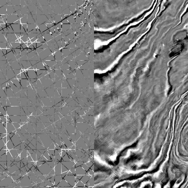
2Dcubed is a structurally conformable interpolation engine that uses 2D data and creates a 3D volume that is interpretable on a regional scale. This allows the user to fully utilize the capability of their 3D interpretation software on 2D, which not only improves the analysis, it aids the communication of the geological play.

Accelerating Regional Screening
with ML-Enhanced 2Dcubed
Machine learning is embedded throughout TGS' 2Dcubed workflow to maximize the value of existing seismic data. Advanced ML-powered denoising and quality control processes improve signal fidelity, streamline data conditioning and optimize inputs prior to interpolation. The result is a higher-quality regional seismic framework that accelerates exploration screening, enhances geological understanding and helps explorers identify opportunities with greater confidence.

2Dcubed Experience
We have processed and generated more than 2,300,000 sq km of 2Dcubed data in various basins around the world. The project sizes have varied from as little as 1,000 sq km to over 500,000 sq km.
- Norway
- Over 1,110,000 sq km
- Denmark
- 16,716 sq km
- Geenland
- 24,115 sq km
- India
- 520,000 sq km in East Coast
- 645,000 sq km in West Coast
- Indonesia
- 35,019 sq km in West Berau
- 279,529 sq km in East Java Sea
- 110,982 sq km in Kutei Basin
- Timor-Leste
- Over 53,500 sq km
- Australia
- 42,470 sq km in Beagle Basin
- 227,289 sq km in Browse Basin
- Malaysia
- 167,777 sq km in Sarawak Basin
- 2,830 sq km in East Sabah Basin
Turning Multi-Vintage 2D Into
Basin-Scale Insights
The East India 2Dcubed case sudy showcases how massive multi-vintage 2D seismic data can be transformed into a unified regional exploration framework spanning the multiple basins.
By converting fragmented 2D datasets into a continuous 3D seismic volume, TGS enabled consistent sequence stratigraphic interpretation, regional GDE mapping and basin-scale geological understanding across approximately 525,000 km² of offshore India.
Technical Details
2Dcubed is a regional screening tool to identify structures. Our workflow uses an advanced structurally conformable interpolation algorithm to maximize the potential of existing 2D multivintage and 3D data. The first step is to create a unified 2D dataset from existing data by demigrating and then matching amplitude and phase. Dip and coherency attributes are estimated and this information is used to guide the interpolation of a 3D volume, which is then 3D migrated. The volume can be used for regional interpretation and optimization of 3D survey design and positioning.
Data Library
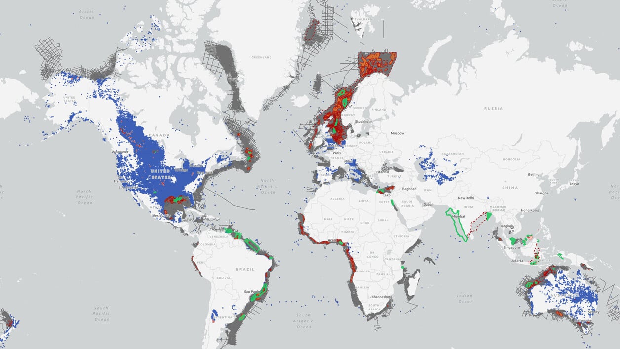
Future-Ready Seismic for Smarter Exploration. A vast global library that accelerates exploration, enhances subsurface insight, and refreshes vintage volumes with today’s imaging power. Search our interactive map portal to see the industry-leading subsurface data we offer worldwide, including 2Dcubed products, in your areas of interest.

Speak to a Specialist
Interested in a live data review or demo? Let us know your needs and we’ll connect you to the right person or team.
Book a Data Viewing
Want to see the latest seismic data solutions and imaging technologies in your region of interest or for the next license round? Book a data viewing with one of our experts.
Discuss Your Seismic Data Needs
Every need is different and we'd like the opportunity to discuss yours further. Speak to one of our data or geoscience experts to customize seismic solutions specific to your requirements.