

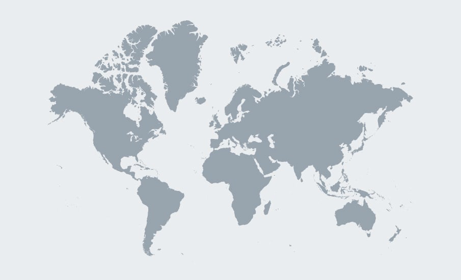
 Select an icon on the map to learn more
New prospects are revealed in important producing fairways and exciting new exploration frontiers are ready to be explored in our world-class library of seismic data.
 Hotspots — producing fairways & exploration frontiers
 Open license rounds — active application windows
Angola
The Angolan continental margin hosts significant proven reserves as well as untapped potential. TGS seismic data and geoscience studies provide a solid foundation to build a regional understanding of the hydrocarbon potential, by unraveling and derisking both pre- and post-salt prospectivity.
Brazil Pre-salt Basins
TGS holds the most extensive 2D and 3D seismic data coverage in the Campos and Santos basins, maintaining a unique position across multiple ANP bid rounds. This highly sought-after region includes blocks situated among leading operators, and our comprehensive data enables the precise identification and mapping of structural highs for the available blocks.
East Coast Canada
East Coast Canada stands out as a leading deepwater exploration region, with producing basins and significant potential for new discoveries. The area includes highly prospective basins with opportunities for world-class oil production. Frontier acreage lies near discoveries like Bay du Nord, Mizzen, and Harpoon, as well as established fields such as Hibernia, White Rose, Terra Nova and Hebron.
Norwegian Sea
The Norwegian Sea gained geological prominence in 1981 with the discovery of Midgard, now integrated into Åsgard. Over time, it has evolved into a vital petroleum region, remaining active and mature with numerous oil and gas fields currently in production.
Eastern Mediterranean
The Eastern Mediterranean is a gas-prone region attracting increased exploration, with recent discoveries, active license rounds, seismic acquisition and offshore drilling highlighting its growing significance. TGS has an extensive regional presence, providing high-quality Multi-Client 2D and 3D seismic data across Sicily, Greece, Egypt, Cyprus and Lebanon. Spanning multiple geological domains, this data library includes mature regions like the Nile Delta, alongside largely frontier areas.
US Onshore Basins
The Lower 48 holds some of the most productive unconventional plays on earth, active across every major basin. TGS seismic, geological and well data provide operators a comprehensive view of the subsurface, supporting faster, more informed drilling decisions.
Southern Brazil Basins
TGS is significantly investing in the Pelotas Basin, offering comprehensive data coverage through advanced 2D data reprocessing and new acquisitions, providing valuable regional insights. This enhanced data supports resource evaluation in an increasingly promising area, with growing interest following successful drilling campaigns and recent discoveries, like the "Venus" find. TGS remains a key partner for operators navigating this high-potential basin.
Northern Brazil Basins
TGS’ data library plays a key role in advancing exploration across Brazil’s Northern Basins by delivering the seismic insights needed to evaluate deepwater targets along the Equatorial Margin.
India
India's East and West coasts offer significant offshore exploration potential. TGS brings together seismic reprocessing and geological analysis to help operators better understand the region's subsurface. Our proprietary 2Dcubed technology and Facies Map Browser give operators the data foundation they need to identify and evaluate opportunities with greater confidence.
MSGBC Basin
The MSGBC Basin has become a key region for oil and gas exploration, driven by recent high-profile discoveries.TGS supports exploration across the basin with extensive 2D and 3D seismic data, including the 28,000 km² Jaan 3D project, which integrates new and existing seismic data for a seamless, high-quality dataset. Additionally, a 114,000 km² multi-beam and seafloor sampling (MBSS) project provides vital geochemical insights to help de-risk exploration and identify new opportunities.
Orange Basin
The Orange Basin, extending offshore Namibia and South Africa, has become a focal point for energy exploration following significant oil discoveries such as Venus and Graff. These findings have highlighted the basin's deepwater potential, attracting increased interest from exploration and production companies aiming to tap into its underexplored resources.
North Sea
With over 40 years of expertise in the North Sea, TGS has been a leader in seismic data acquisition and processing. Since launching our first 2D survey in 1981, we have built an unmatched library of modern regional 2D and 3D seismic coverage, leveraging advanced technologies. Our multi-client data has been a crucial asset for exploration efforts. We continuously advance seismic acquisition and processing to refine subsurface imaging, improve interpretation accuracy, and boost discovery success throughout the region.
West African Transform Margin
WATM: The West African Transform Margin (WATM), extending from Sierra Leone to Benin, has transitioned from frontier territory to a hotspot for significant oil and gas discoveries in recent years. Notably, Ghana's Tano Basin stands out as the country's most prolific petroleum basin, with the 2007 Jubilee field serving as a catalyst for renewed exploration activity and subsequent discoveries. The region's diverse geological features and proven hydrocarbon systems continue to attract exploration and production companies seeking new opportunities.
Gulf of America
The Gulf of America is a key energy hub, with growing exploration in challenging areas driving demand for advanced seismic technologies. TGS delivers high-quality regional datasets, including streamer and ocean bottom node (OBN) data, to improve subsurface imaging, prospect identification and reservoir characterization. Their insights help operators make informed decisions, optimize resource extraction and reduce risk in deep water environments.
Indonesia
Indonesia remains one of the most attractive countries for offshore exploration, with substantial undiscovered hydrocarbon potential across frontier and near-field basins. An active licensing environment continues to attract major energy companies, and TGS data and insights help operators make the most of those opportunities.
Brazil's Open Ocreage Permanent Offer (OPP)
Brazil's pre-salt is one of the world's most sought-after exploration plays, and the ANP's fourth OPP cycle, planned for 2026, opens it up on your timeline with year-round bidding. With over 965,000 km of 2D and 590,000 km² of 3D multi-client data offshore Brazil, TGS gives you the insight to evaluate pre-salt acreage with confidence.
Brazil’s Permanent Concession Offer (OPC)
Brazil's sixth OPC cycle, launching in 2026, targets the Campos, Santos and Ceará basins, putting high-profile pre-salt frontier blocks within continuous reach. With over 965,000 km of 2D and approximately 590,000 km² of 3D multi-client data offshore Brazil, TGS delivers extensive seismic coverage across every block on offer.
Gulf of America Lease Sale Big Beautiful Gulf 3
BOEM has set a Final Notice of Sale for Big Beautiful Gulf 3 (BBG3) on Aug. 12, 2026, offering approximately 15,066 unleased blocks across 80.4 million acres on the U.S. Outer Continental Shelf. With extensive seismic and geological data across the Gulf of America, TGS provides subsurface insight to bid with confidence.


New prospects are revealed in important producing fairways and exciting new exploration frontiers are ready to be explored in our world-class library of seismic data.
- Hotspots — producing fairways & exploration frontiers
- Open license rounds — active application windows
The Angolan continental margin hosts significant proven reserves as well as untapped potential. TGS seismic data and geoscience studies provide a solid foundation to build a regional understanding of the hydrocarbon potential, by unraveling and derisking both pre- and post-salt prospectivity.
TGS holds the most extensive 2D and 3D seismic data coverage in the Campos and Santos basins, maintaining a unique position across multiple ANP bid rounds. This highly sought-after region includes blocks situated among leading operators, and our comprehensive data enables the precise identification and mapping of structural highs for the available blocks.
East Coast Canada stands out as a leading deepwater exploration region, with producing basins and significant potential for new discoveries. The area includes highly prospective basins with opportunities for world-class oil production. Frontier acreage lies near discoveries like Bay du Nord, Mizzen, and Harpoon, as well as established fields such as Hibernia, White Rose, Terra Nova and Hebron.
The Norwegian Sea gained geological prominence in 1981 with the discovery of Midgard, now integrated into Åsgard. Over time, it has evolved into a vital petroleum region, remaining active and mature with numerous oil and gas fields currently in production.
The Eastern Mediterranean is a gas-prone region attracting increased exploration, with recent discoveries, active license rounds, seismic acquisition and offshore drilling highlighting its growing significance. TGS has an extensive regional presence, providing high-quality Multi-Client 2D and 3D seismic data across Sicily, Greece, Egypt, Cyprus and Lebanon. Spanning multiple geological domains, this data library includes mature regions like the Nile Delta, alongside largely frontier areas.
The Lower 48 holds some of the most productive unconventional plays on earth, active across every major basin. TGS seismic, geological and well data provide operators a comprehensive view of the subsurface, supporting faster, more informed drilling decisions.
TGS is significantly investing in the Pelotas Basin, offering comprehensive data coverage through advanced 2D data reprocessing and new acquisitions, providing valuable regional insights. This enhanced data supports resource evaluation in an increasingly promising area, with growing interest following successful drilling campaigns and recent discoveries, like the "Venus" find. TGS remains a key partner for operators navigating this high-potential basin.
TGS’ data library plays a key role in advancing exploration across Brazil’s Northern Basins by delivering the seismic insights needed to evaluate deepwater targets along the Equatorial Margin.
India's East and West coasts offer significant offshore exploration potential. TGS brings together seismic reprocessing and geological analysis to help operators better understand the region's subsurface. Our proprietary 2Dcubed technology and Facies Map Browser give operators the data foundation they need to identify and evaluate opportunities with greater confidence.
The MSGBC Basin has become a key region for oil and gas exploration, driven by recent high-profile discoveries.TGS supports exploration across the basin with extensive 2D and 3D seismic data, including the 28,000 km² Jaan 3D project, which integrates new and existing seismic data for a seamless, high-quality dataset. Additionally, a 114,000 km² multi-beam and seafloor sampling (MBSS) project provides vital geochemical insights to help de-risk exploration and identify new opportunities.
The Orange Basin, extending offshore Namibia and South Africa, has become a focal point for energy exploration following significant oil discoveries such as Venus and Graff. These findings have highlighted the basin's deepwater potential, attracting increased interest from exploration and production companies aiming to tap into its underexplored resources.
With over 40 years of expertise in the North Sea, TGS has been a leader in seismic data acquisition and processing. Since launching our first 2D survey in 1981, we have built an unmatched library of modern regional 2D and 3D seismic coverage, leveraging advanced technologies. Our multi-client data has been a crucial asset for exploration efforts. We continuously advance seismic acquisition and processing to refine subsurface imaging, improve interpretation accuracy, and boost discovery success throughout the region.
WATM: The West African Transform Margin (WATM), extending from Sierra Leone to Benin, has transitioned from frontier territory to a hotspot for significant oil and gas discoveries in recent years. Notably, Ghana's Tano Basin stands out as the country's most prolific petroleum basin, with the 2007 Jubilee field serving as a catalyst for renewed exploration activity and subsequent discoveries. The region's diverse geological features and proven hydrocarbon systems continue to attract exploration and production companies seeking new opportunities.
The Gulf of America is a key energy hub, with growing exploration in challenging areas driving demand for advanced seismic technologies. TGS delivers high-quality regional datasets, including streamer and ocean bottom node (OBN) data, to improve subsurface imaging, prospect identification and reservoir characterization. Their insights help operators make informed decisions, optimize resource extraction and reduce risk in deep water environments.
Indonesia remains one of the most attractive countries for offshore exploration, with substantial undiscovered hydrocarbon potential across frontier and near-field basins. An active licensing environment continues to attract major energy companies, and TGS data and insights help operators make the most of those opportunities.
Brazil's pre-salt is one of the world's most sought-after exploration plays, and the ANP's fourth OPP cycle, planned for 2026, opens it up on your timeline with year-round bidding. With over 965,000 km of 2D and 590,000 km² of 3D multi-client data offshore Brazil, TGS gives you the insight to evaluate pre-salt acreage with confidence.
Brazil's sixth OPC cycle, launching in 2026, targets the Campos, Santos and Ceará basins, putting high-profile pre-salt frontier blocks within continuous reach. With over 965,000 km of 2D and approximately 590,000 km² of 3D multi-client data offshore Brazil, TGS delivers extensive seismic coverage across every block on offer.
BOEM has set a Final Notice of Sale for Big Beautiful Gulf 3 (BBG3) on Aug. 12, 2026, offering approximately 15,066 unleased blocks across 80.4 million acres on the U.S. Outer Continental Shelf. With extensive seismic and geological data across the Gulf of America, TGS provides subsurface insight to bid with confidence.

