
Offshore Brazil’s Permanent Concession Offer Bid Rounds
With over 965,000 kilometers of 2D multi-client data and approximately 590,000 square kilometers of 3D multi-client data offshore Brazil. TGS offers unmatched seismic coverage across key basins, supporting exploration across all available territory within the Sixth Permanent Concession Offer, and hundreds of blocks under study for future release.
Brazil’s Permanent Concession Offer (OPC)
Brazil’s Permanent Concession Offer (OPC) is a continuous bidding process for oil and gas exploration, managed by Brazil’s National Agency of Petroleum, Natural Gas and Biofuels (ANP). Unlike traditional auctions, companies can bid on specific blocks at any time. Once fees are paid, a 120-day cycle begins, with sealed bids evaluated based on signature bonuses and work commitments. The process offers flexibility and ongoing access to both onshore and offshore blocks.
Brazil’s sixth OPC cycle, set to launch in 2026, will focus on the Campos and Santos basins, as well as the Ceará Basin. Once the round begins, companies are expected to submit bids for high-profile blocks in the pre-salt frontier. From Espírito Santo to outboard Campos and southwest Santos, these prospective blocks show potential linkages to internal and external lacustrine source kitchens and are located near producing fields across the area.

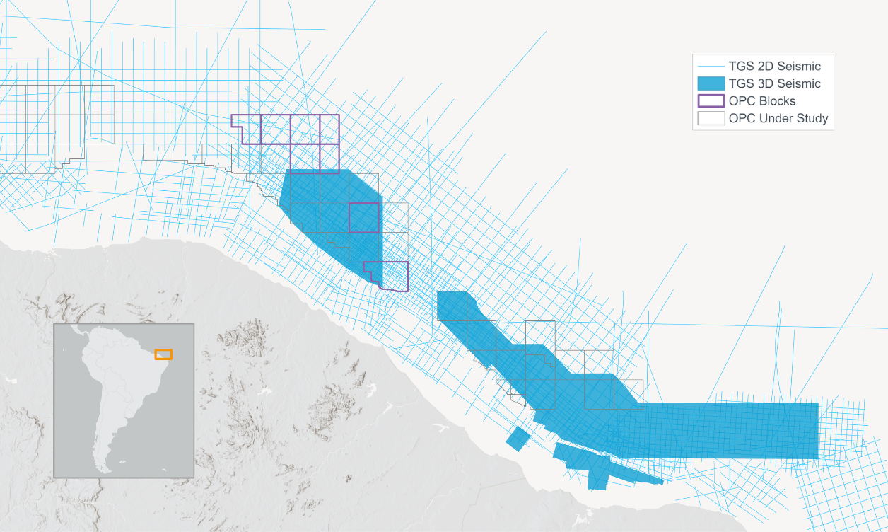
Ceará and Potiguar Basins
The Potiguar and Ceará basins are key hydrocarbon exploration frontiers along Brazil’s equatorial margin. Eight exploratory blocks in the Ceará Basin are included in the 2026 Permanent Concession Offer cycle. The area has attracted growing interest, driven by recent drilling successes and improved seismic interpretation, notably from TGS’ Aquiraz 3D survey, which highlights well-defined mid- to late-Cretaceous channel and fan systems characteristic of turbidite reservoirs.
TGS offers extensive 2D seismic coverage across both the Ceará and Potiguar basins, complemented by high-quality 3D streamer surveys, including the Ceará Fortaleza GeoStreamer survey, which covers several of the blocks included in the sixth OPC cycle.
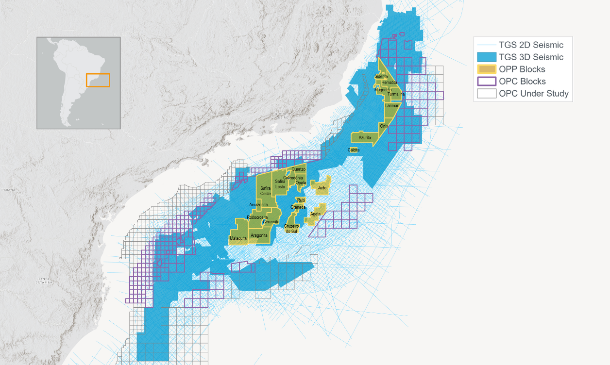
Campos and Santos Basins
TGS holds the most extensive 2D and 3D seismic coverage in the Campos and Santos basins, with a strong position across 277 blocks included in the 2026 Permanent Concession Offer cycle. The area includes blocks surrounded by major operators, and the supporting data allow structural highs within the blocks on offer to be clearly identified and mapped.
In the Campos Basin, outboard blocks are available within TGS’ Campos Deepwater GeoStreamer dataset, where carbonate buildups can be identified along the edge of the salt basin overlying an untested Lagoa Feia source graben. In the Santos Basin, TGS’ advanced 3D EFM FWI program covers blocks S-M-163 and S-M-1617, where deepwater settings feature thick evaporite layers overlying pre-salt horsts and grabens, forming multiple four-way closures similar to the prolific Outer High at Tupi.
Shallow-water areas of the Santos Basin also present significant opportunities in the 2026 OPC and are supported by regional reprocessing programs such as Picanha and Vision 3D. Located updip of several prolific discoveries and within a distinct salt tectonic domain, these blocks show potential in both pre-salt and post-salt plays and share a petroleum system with Aram to the east and Baúna and the “string of pearls” to the southwest.

depositional systems directed to deepwater blocks into Northern Pelotas Basin.
Speak to a Specialist
Let us know your needs and we’ll connect you to the right person or team.
Book a Data Viewing
Want to see the latest seismic data solutions and imaging technologies in your region of interest or for the next license round? Book a data viewing with one of our experts.
Discuss Your Seismic Data Needs
Every need is different and we'd like the opportunity to discuss yours further. Speak to one of our data or geoscience experts to customize seismic solutions specific to your requirements.