GeoStreamer X Delivers Reliable Prospectivity Metrics

​GeoStreamer X illuminates targets from multiple azimuths to deliver accurate reservoir parameters for opportunity assessment, volumetric estimates and as a baseline for production monitoring.

location-pin

The Location

Location

South Viking Graben, Norway

Survey Year

2011, 2019 & 2020

Survey Type

GeoStreamer X multi-azimuth

Streamer Configuration

Dense multisensor streamers (84/94 m), long tails (10 km)

Source Configuration

Wide-tow triple-source​ (225/250 m spread)

Data is available for two GeoStreamer X surveys in the South Viking Graben (orange outline, 2019 survey to the south and 2020 to the north). The rockAVO wells used in this study are shown as black circles. GeoStreamer X is an advanced high-density multi-azimuth solution that is complementary to existing GeoStreamer coverage. The data is multipurpose and can be used for exploration, nearfield exploration, field development (where high-fidelity seismic data is necessary) and also as a baseline survey for production monitoring.

MagnifyingGlass

The Challenge

Imaging challenges with shallow subsurface features

There are a number of imaging challenges in the area associated with shallow subsurface features such as glacial channels and gas pockets, which can be seen on this very shallow (179 m) depth slice. Alongside this, traditional NAZ surveys in the area were plagued with migration effects due to the rugosity of the chalk causing multiples and artifacts for targets above and below the chalk. GeoStreamer X resolves these challenges by delivering excellent resolution in all directions and eliminating any acquisition footprint in the seismic amplitudes and in the velocity model.

cs-challenge-image
light-bulb

The Solution

Data

GeoStreamer from 2011 and multi-azimuth from 2019 & 2020

Ultra Efficient

Single vessel, wide-tow sources, dense spreads, long tails

Well Data

rockAVO

Processing

High-resolution broadband multi-azimuth

Velocity Model Building

Unique FWI kernel exploiting the full wavefield
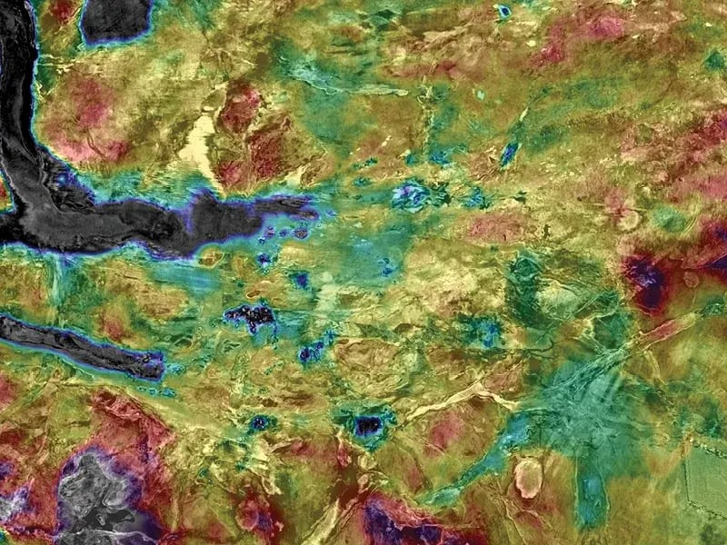
QI

Azimuthal seismic inversion analysis

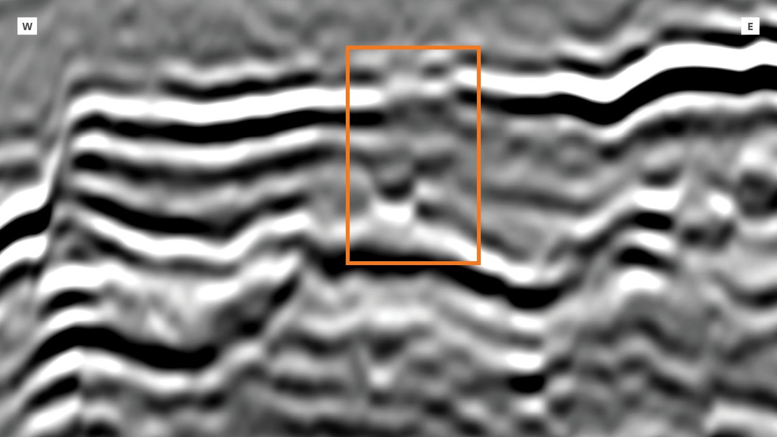
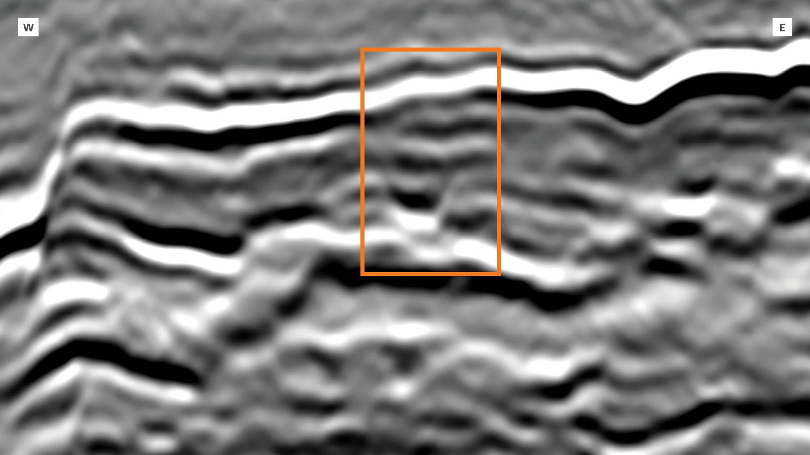
This full-stack GeoStreamer X PSDM line runs from North to South through the two recent multi-azimuth seismic surveys in the South Viking Graben. In addition to the high-resolution seismic display (in relief grey color scale) a full waveform inversion velocity section is co-rendered. This combination of high-resolution velocity and accurate imaging of the overburden highlights various geological features in this part of the seismic section such as: channels (causing seismic distortion below and correctly picked up by the FWI velocity field), deep imaging and some small gas pockets represented by a very slow velocity (blue color).

GeoStreamer X | Improved Resolution from Shallow to Deep

Before Image After Image
Legacy
GeoStreamer X
These relative acoustic impedance images illustrate the uplift obtained from high-grading existing data with complementary new acquisition and using more advanced imaging workflows. The improvements are observed from shallow to deep, in reflector continuity and resolution, as well as clear improvements in the interpretability, the definition of the faults and structural elements. ​

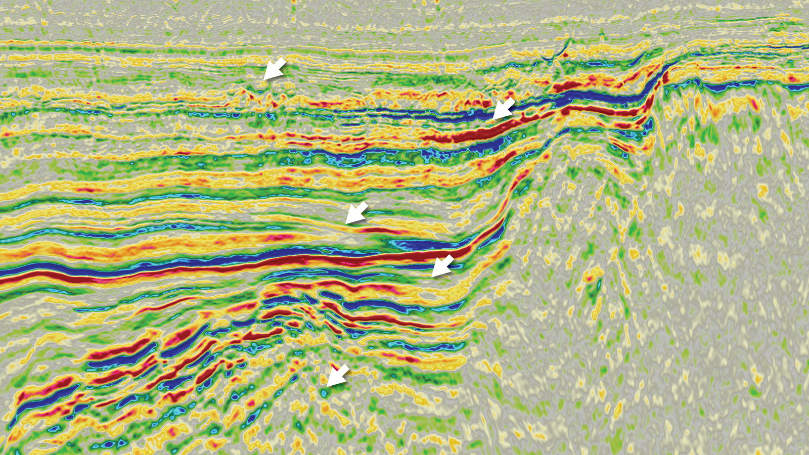
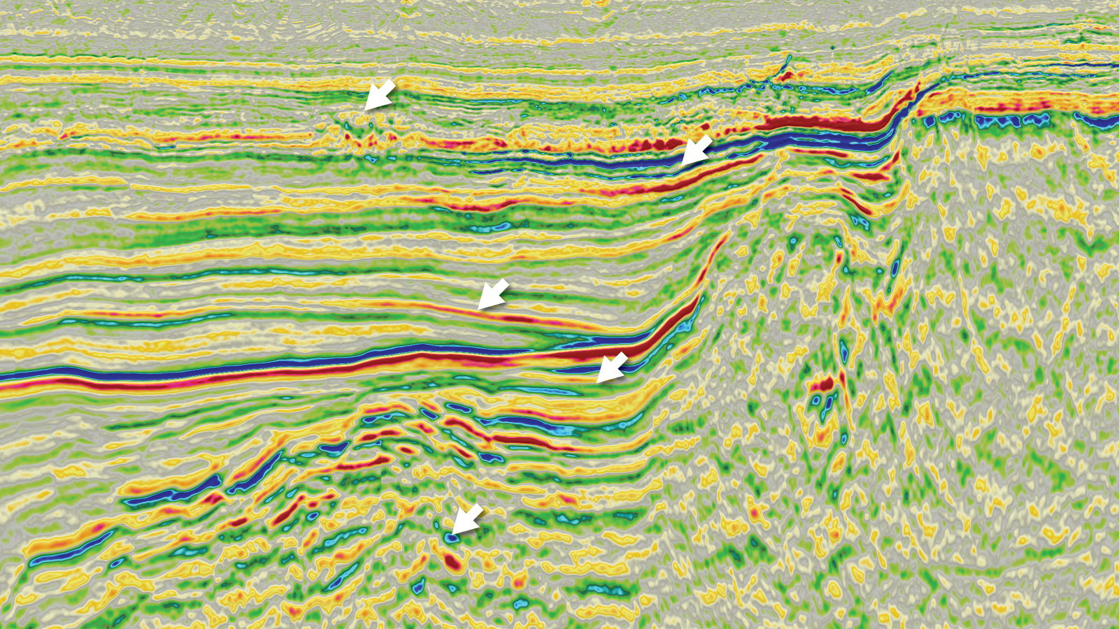
Revealing Potential Reservoir Sands at Jurassic Level

geostreamerx_results_geobodies_casestudy2022

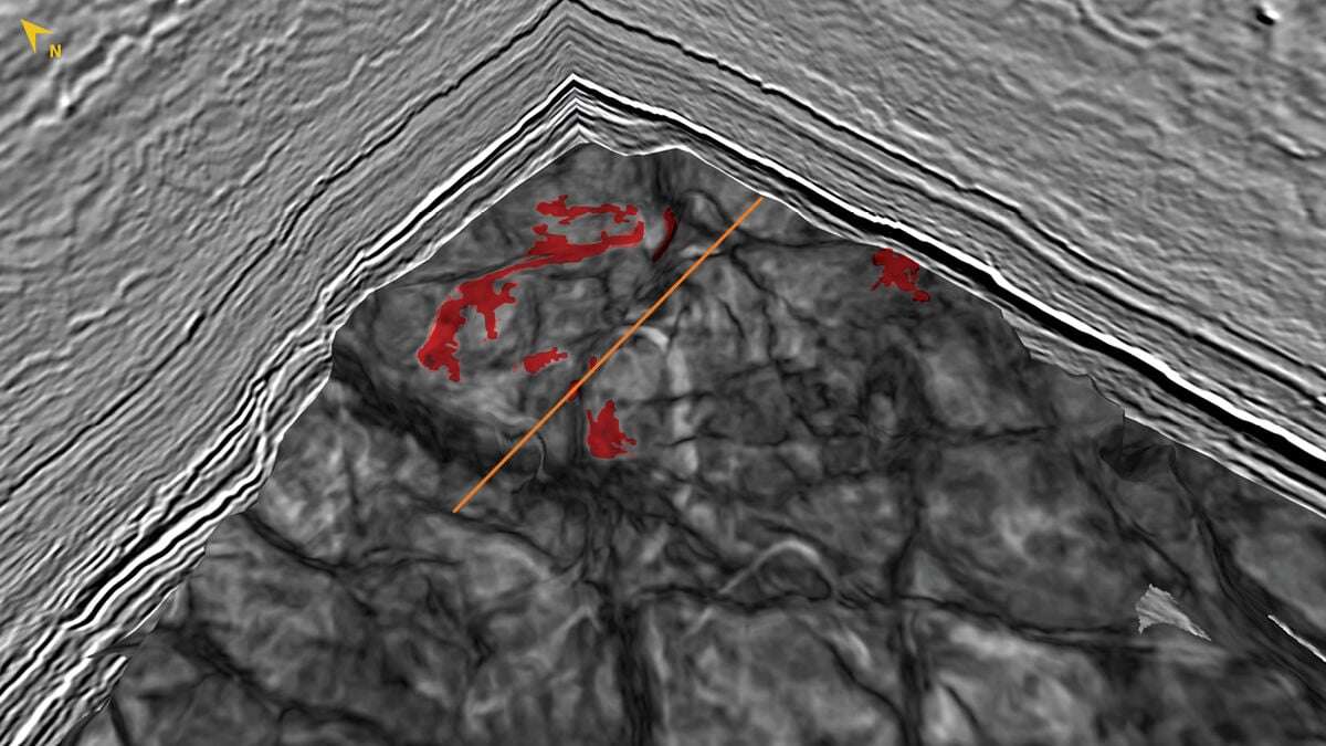
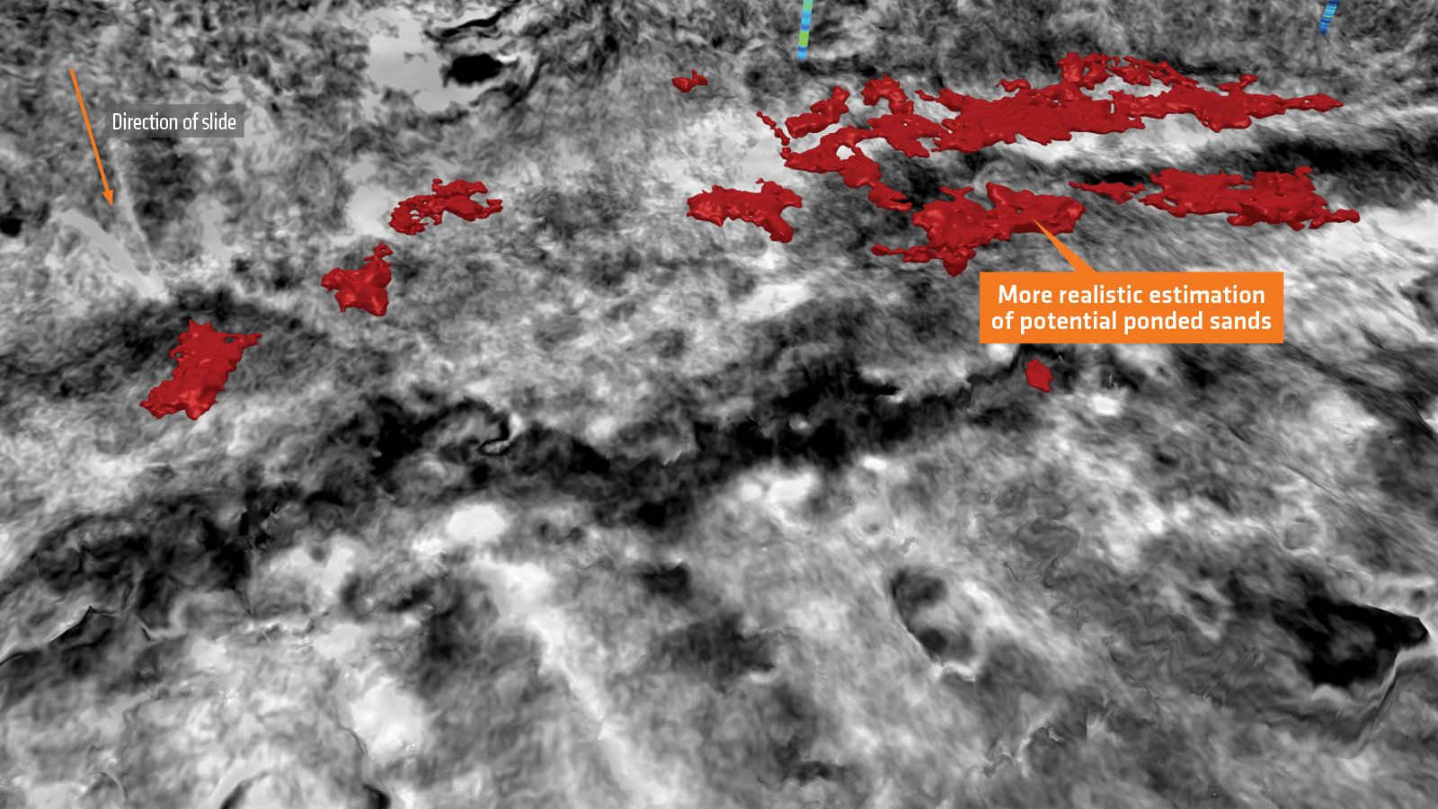
Better Illumination with GeoStreamer X Enables Detection of Fluvial Sands

Before Image After Image
Legacy
GeoStreamer X
A comparison of legacy versus GeoStreamer X of a Jurassic-Triassic fault block at a scale needed for well planning. The section line is illustrated with an orange line on the previous image. The box illustrates a channel that is better resolved on the GeoStreamer X data with much clearer incision and interpretable marginal facies. Also note the incomplete Chalk reflector on the legacy data, caused by faulting out of plane.

Complementary Information from Different Azimuth Delivers ​Accurate Volume Estimates

Before Image After Image
Legacy
GeoStreamer X
Here porosity is estimated using data-driven elastic attributes and the geobodies shown represent the most porous sand associated with a deeply buried submarine mass transport complex (submarine slide). The legacy narrow azimuth dataset porosity estimation is noisier and less coherent compared to the newly acquired and processed GeoStreamer X multi-azimuth dataset. Using the NAZ data could potentially lead to an overestimation of the volume of porous sands and disappointing drilling results.
ChartBar-1

The Results

New Opportunities Found in this Mature Basin

New opportunities have been found and characterized in this mature basin using a combination of innovative acquisition, quantitative interpretation, and seismic morphology interpretation. These GeoStreamer X datasets are ideally suited for reservoir evaluation, the delineation of nearfield exploration opportunities, and to provide better trap and reservoir understanding. Reservoir properties are accurately estimated and reveal the potential in the under-explored Vana Sub-basin and nearfield opportunities on the Utsira High.