For over 40 years, TGS has led the way in subsurface imaging and insight. Today we apply our vast experience and the world's largest data library to enhance subsurface and cabling decisions for offshore wind.
Site Characterization for Offshore Wind Development
TGS site characterization for offshore wind combines Ultra High-Resolution 3D (UHR3D) seismic with complementary survey technologies to deliver a clearer understanding of seabed and shallow subsurface conditions. These integrated insights support foundation and cable route planning, strengthen ground models, optimize geotechnical investigations and help developers manage project risk with greater confidence.
Site Characterization for Offshore Wind
Build offshore wind projects on a clearer understanding of the subsurface. TGS integrates UHR3D seismic with MBES, SSS, SBP and MAG data to identify buried hazards, resolve variable ground conditions and support foundation and cable route planning. This integrated view helps developers strengthen ground models and make informed decisions on turbine placement, foundation design and inter-array cable routing, while targeting geotechnical investigations more effectively.
With better information earlier in the project lifecycle, developers can reduce uncertainty, avoid unnecessary design conservatism and lower the risk of costly changes during construction. The result is a stronger technical basis for optimizing project design, supporting investment decisions, controlling costs and maintaining project schedules.
Offshore Wind Challenges & Solutions
High-quality site data supports more confident offshore wind development
Reliable site data is fundamental to reducing uncertainty, controlling costs and progressing offshore wind projects efficiently. UHR3D provides spatially complete, ultra-high-resolution subsurface information that helps developers make better-informed decisions throughout project planning, design and construction.
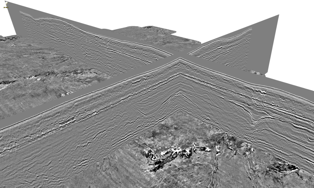
Reduce subsurface uncertainty: Sub-meter vertical resolution and comprehensive 3D coverage reveal shallow geology and geohazards that can be missed between conventional 2D survey lines.
Optimize design and construction: Detailed ground models support foundation design, cable routing and installation planning, helping teams balance risk, performance and cost.
Support investment and project decisions: Reliable subsurface data provides a stronger technical basis for stakeholder alignment, project approvals and progression toward FID.
Accelerate site characterization: Integrated, single-pass acquisition of UHR3D, MBES, SSS, SBP and magnetic data reduces the need for separate survey campaigns, limiting vessel time and improving project efficiency.
The Technology
UHR3D seismic provides spatially complete, high-resolution insight into seabed and shallow subsurface conditions, giving offshore wind developers a stronger foundation for engineering and project planning decisions. By revealing geological complexity early in the development process, it helps improve site understanding, focus investigations and reduce technical risk.