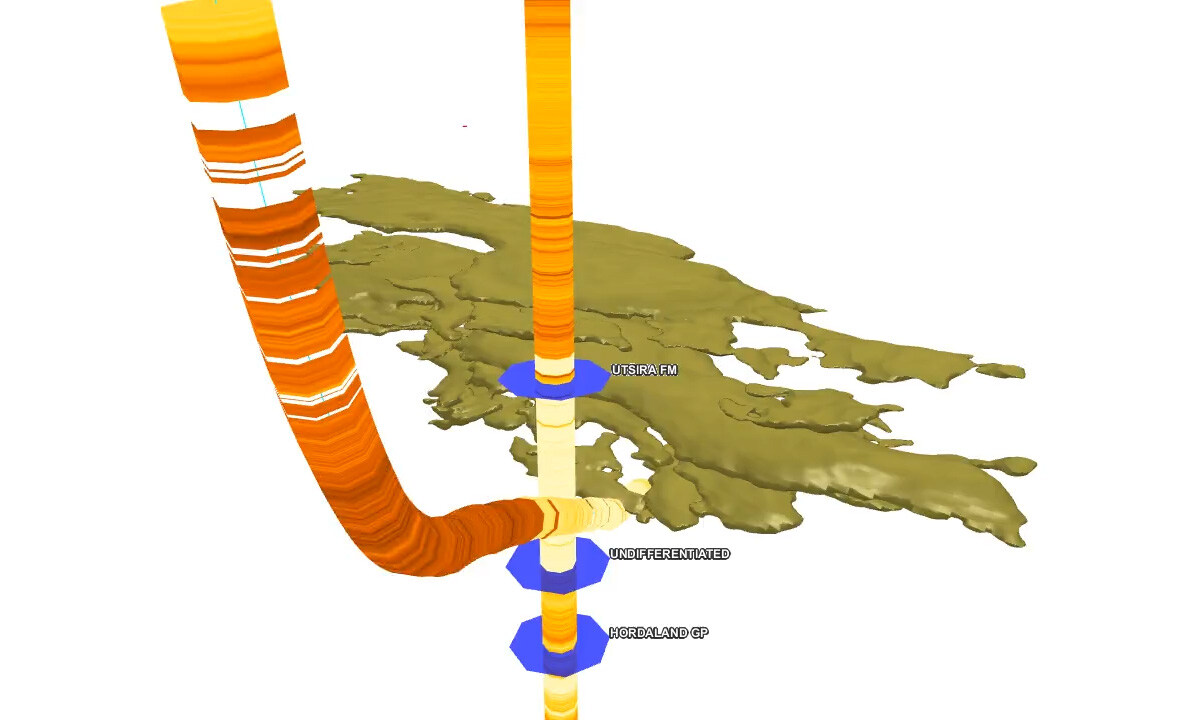
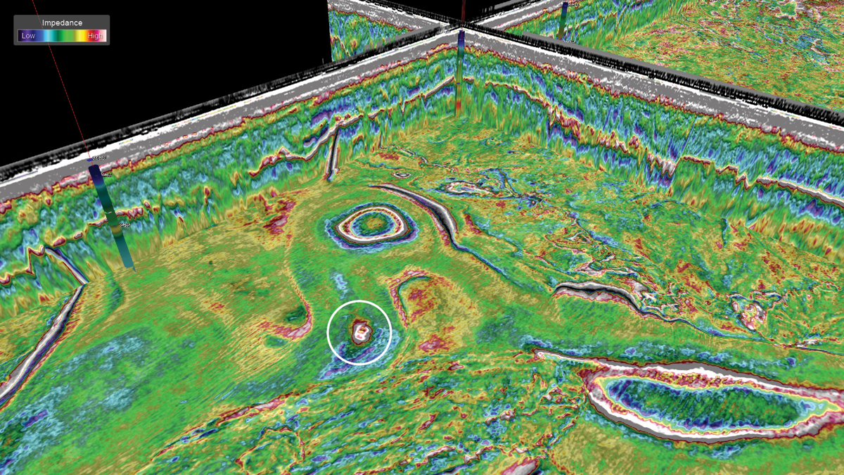
Gain ultimate clarity with Ultra-high resolution 3D (UHR3D) seismic for a more detailed understanding of the near-surface seafloor for applications across the offshore energy industry.
Precision Imaging of the Shallow Subsurface
TGS provides ultra-high-resolution 3D (UHR3D) seismic services to deliver detailed insight into the shallow subsurface. Using short streamers, shallow tow depths, and high-frequency sources, UHR3D captures fine-scale features critical to offshore wind development, including geohazards, soil variability, and buried obstructions.
Fully imaged data volumes offer consistent spatial detail, giving engineers and developers a reliable basis for early-stage planning. This level of detail improves detection of near-surface features that conventional 2D or sparse 3D methods may overlook, reducing uncertainty and informing foundation design, trenching, and cable routing decisions.
Advantages of UHR3D
Applications for UHR3D
UHR3D supports a wide range of offshore applications, from hydrocarbon exploration and 4D reservoir monitoring to high-resolution mapping and site characterization for offshore wind and carbon storage site development. It meets the needs of geological investigations for site surveys, de-risking infrastructure construction, jack-up rig siting, geohazard mapping, marine mineral exploration, offshore nuclear infrastructure, and CCS site assessments, including congested environments.
-
Offshore Energy
-
Carbon Storage
-
Offshore Wind
Offshore Energy

Offshore Energy
UHR3D benefits multiple offshore energy sectors, including hydrocarbon exploration and appraisal, wind farm development, and carbon storage. Using a wide-tow configuration with ultra-high-frequency sources, the technology delivers the detail needed to resolve complex geological features and reduce uncertainty in early-stage planning.
- Higher resolution, broader bandwidth, and improved signal-to-noise performance in ultra-shallow settings
- Detailed and accurate characterization of seabed and near-surface conditions
- Supports faster development timelines for offshore wind projects
- Enhances site assessment and risk mitigation strategies
- Reduces lead time and cost by minimizing the need for extensive geotechnical investigations
Carbon Storage

Carbon Storage
UHR3D provides a flexible, repeatable, and cost-effective solution for both initial site identification and long-term 4D seismic monitoring of carbon storage reservoirs. Its high spatial resolution supports early risk assessment and helps monitor containment integrity over time.
-
Designed to enable geophysical early phase 3D mapping and 4D monitoring of injected CO2
-
De-risk the overburden with enhanced imaging resolution
-
Pair with ocean bottom nodes (OBN) for velocity information
- Cost-efficient, consistent repeatability
Offshore Wind

Offshore Wind
Ultra-high-resolution 3D seismic delivers the subsurface clarity offshore wind developers need to de-risk turbine placement and optimize intra-array cable routing. UHR3D data helps identify buried hazards, variable soil conditions, and shallow geological complexity, supporting safer, more efficient design and installation.
- Reduce intrusive techniques such as boreholes
- Optimize wind farm engineering applications.
- Access ultra-high-resolution imagery. Less than 1 m vertical scale sub 100 meters depth
- Leverage geological expertise and the world’s largest subsurface data library with TGS
Acquisition Configurations & Targets
UHR3D is optimized for smaller areas and complex shallow targets, especially in constrained marine environments. Short streamers towed at shallow depths (2–4 meters) allow for high maneuverability and excellent vertical resolution.
Typical configurations use 8 to 14 streamers spaced 6.25 to 12.5 meters apart, with streamer lengths of 50 to 170 meters and receiver intervals from 3.125 to 6.25 meters. Sample rates down to 0.25 milliseconds and source frequencies up to 4,000 Hz provide detailed near-surface imaging.
TGS vessels can concurrently acquire complementary geophysical and hydrographic datasets, including Multibeam Echosounder (MBES), Side Scan Sonar (SSS), Sub-bottom Profiler (SBP), and Magnetometer (MAG) data.


Imaging & Processing of UHR3D Data
TGS delivers UHR3D data with advanced processing workflows designed specifically for ultra-high-resolution requirements. Our workflows include advanced deghosting, statics correction, and velocity model building to ensure the highest fidelity subsurface imaging.
Our deghosting solution overcomes the challenges of shallow towing, moderate signal-to-noise ratios, and variable sea states. Statics correction accounts for variations in elevation and acquisition geometry, ensuring data consistency. Velocity model building enables high-resolution imaging with vertical precision down to a few meters and lateral resolution within tens of meters.
Let’s Discuss Your Acquisition Needs
With the industry’s most diverse fleet and integrated expertise, from survey design and acquisition to seismic data imaging, TGS delivers trusted, tailored solutions for complex exploration challenges.
Learn More About Our Fleet
Discover the capabilities, configurations and proven performance of our diverse fleet. Built for reliability and efficiency, our vessels are ready to meet your exploration needs, anywhere in the world.
Start the Conversation
Every project is different. Talk to a TGS expert about your specific acquisition requirements. With decades of trusted experience and integrated capabilities, we’ll help you design the right solution from the start.


