GeoStreamer X for Accurate and Efficient Lead Characterization

GeoStreamer X is an integrated acquisition and imaging solution. In the Viking Graben, it delivers high-definition seismic and precise rock properties, and reveals new nearfield opportunities.​

location-pin

The Location

Location

South Viking Graben, Norway

Survey Year

2011 & 2019

Survey Type

GeoStreamer X (three survey directions combined)

Streamer Configuration

Dense multisensor streamers (84 m), long tails (10 km)

Source Configuration

Wide-tow triple-source​ (225 m spread)

GeoStreamer X is an advanced high-density multi-azimuth solution that is complementary to existing GeoStreamer coverage. It provides high-end nearfield exploration data to resolve the imaging challenges present in the Viking Graben and reveal the remaining potential.​ Final data from the 2019 GeoStreamer X survey (orange, used in this case study) and the GeoStreamer X 2020 survey (dark blue, north of orange) are available now.

MagnifyingGlass

The Challenge

The Challenge

The area is known for high-quality hydrocarbon reservoirs and complex geology. A number of features are visible that either impede subsurface imaging (e.g. shallow channels, rugose chalk) or are challenging targets to image (e.g. sand injectites). Late Jurassic rifting led to the formation of numerous horsts and tilted fault blocks along the margins of the Viking Graben. Reservoir targets range from sand injectites, deep marine clastic fans, shallow marine sands, carbonates, to fractured basement.

cs-challenge-image
light-bulb

The Solution

Data

GeoStreamer from 2011 and multi-azimuth from 2019

Ultra Efficient

Single vessel, wide-tow sources, dense spreads, long tails

Processing

High-resolution broadband multi-azimuth

Velocity Model Building

TGS FWI using additional long offsets

QI

Azimuthal seismic inversion analysis

​GeoStreamer X combines multisensor broadband fidelity with multi-azimuth illumination, wide-tow sources and dense streamer spacing for improved near-offset distribution, and long streamers for accurate velocity model building.​

​GeoStreamer X | Faster & Smarter than OBS

geostreamerx-vikinggraben-05

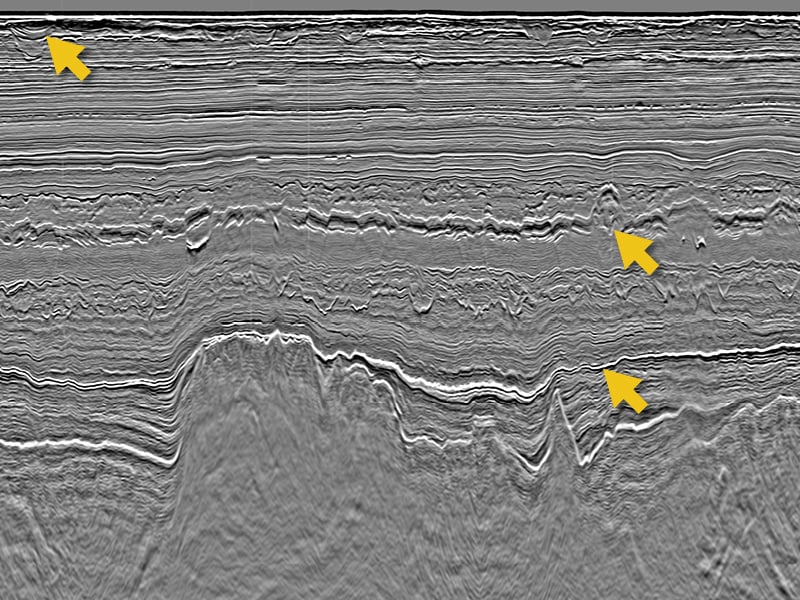
Exploration teams can get reliable data faster as GeoStreamer X data can be delivered quicker than node data. This comparison illustrates the quality of both datasets. They are in many ways very similar but with clear differences. For example, GeoStreamer X delivers high quality from shallow to deep. With a more accurate velocity model and a tailored multi-azimuth imaging workflow, it delivers a new level of detail. This can be seen in the middle of the image (highlighting injectites and grid sands) and deeper in the stratigraphy.​

geostreamerx-vikinggraben-06

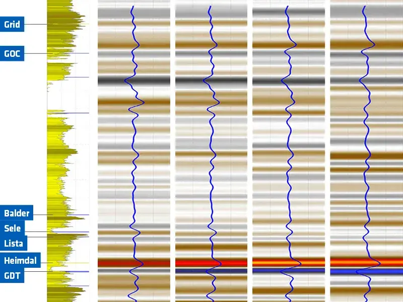
This relative acoustic impedance is generated from the GeoStreamer X multi-azimuth angle stack and shows significant uplift. Some clear improvements (marked with the white arrows) can be observed at the Heimdal sands level and provide fresh insight. Low impedance (blue/purple) downdip of the main structure (right hand-side) indicates some hydrocarbon potential as well as some hydrocarbon presence at the Zechstein level from the Lille Prinsen well (well show on the left).

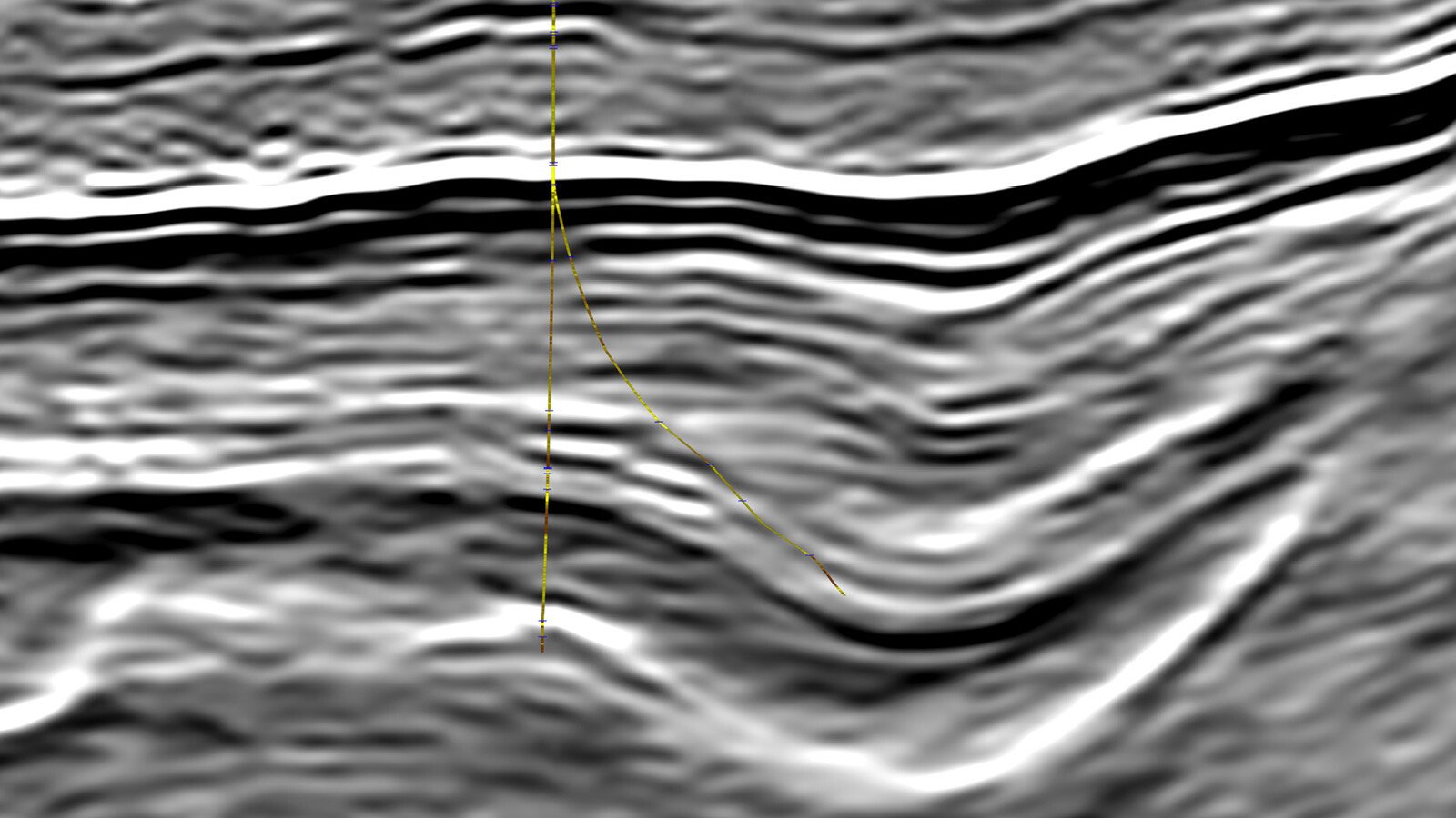
​Better Illumination with GeoStreamer X Enables Much Improved Fault Definition

Before Image After Image
Legacy
GeoStreamer X
Improved fault detection and resolution in the GeoStreamer X multi-azimuth data is illustrated in this top Balder incoherency map which displays the prominent polygonal fault pattern in the vicinity of the Lille Prinsen field (green). Incoherence provides a measure of dissimilarity between nearby seismic traces which in single azimuth data is considerably noisier and less accentuated. The GeoStreamer X illumination enhances the discontinuity contrast and visibility.

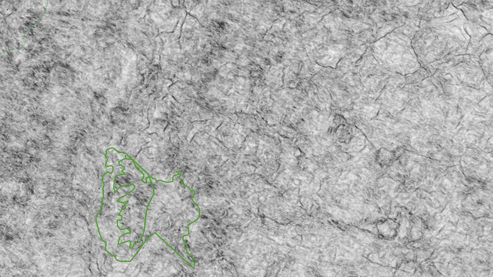
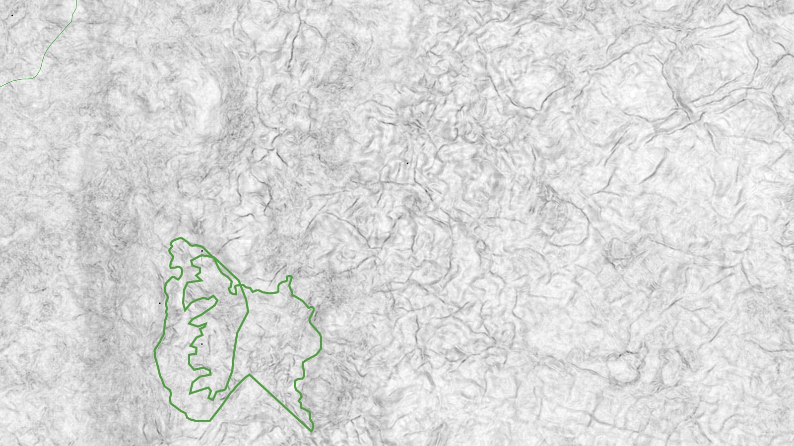
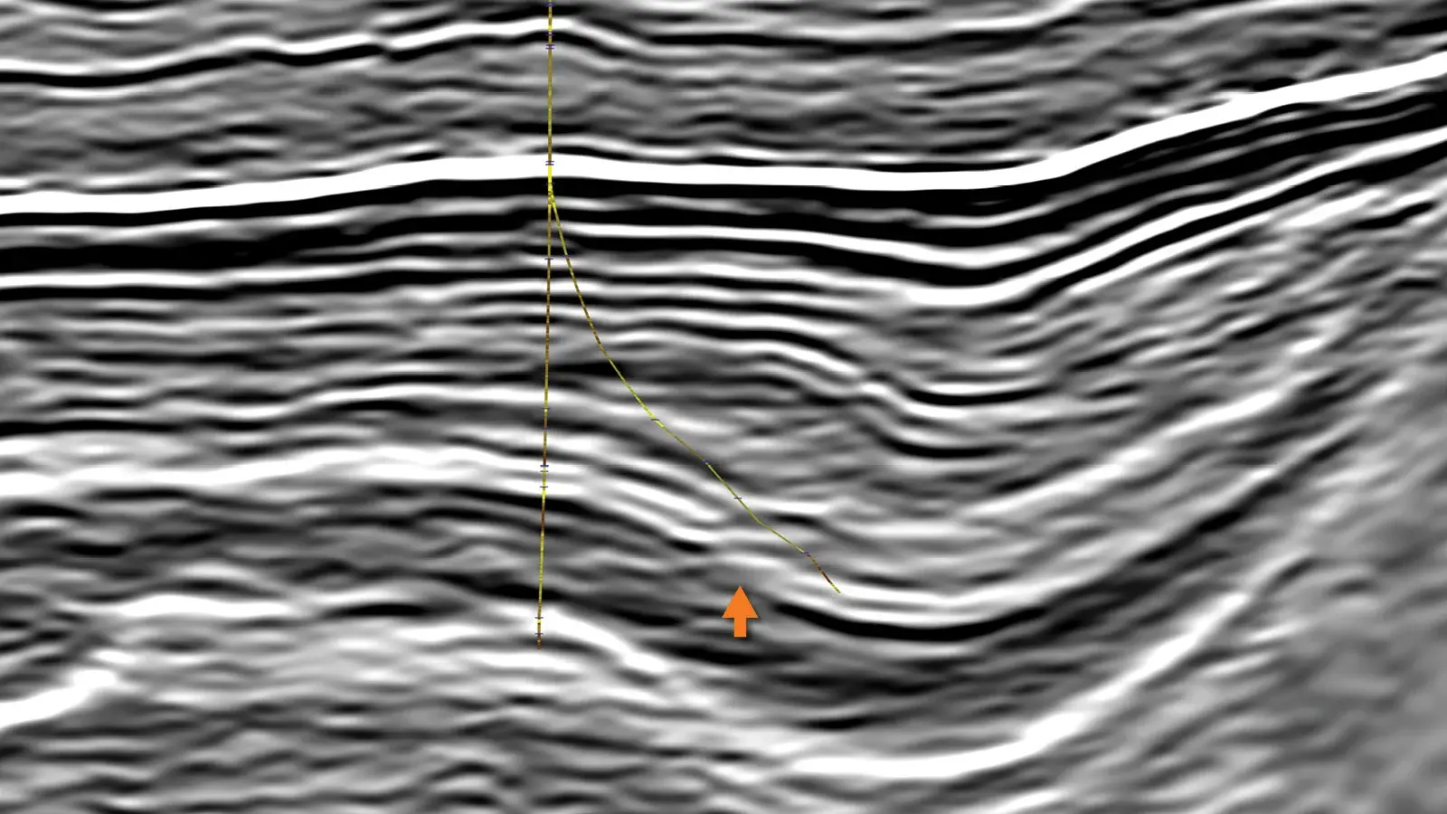
Save Drill Time with Accurate Target Positioning with GeoStreamer X

Before Image After Image
Legacy
GeoStreamer X
The GeoStreamer X illumination advantage is exemplified on a field scale in this example of a well sidetrack trajectory intended to evaluate OWCs for discoveries made in Jurassic and Triassic reservoir sands in the main hole. The sidetrack’s objective was to detect the OWCs in a downflank position, with the Triassic reservoir predicted close to sidetrack TD. While the OWC was penetrated in the Jurassic, the top Triassic reservoir came in higher than expected and the contact was not detected. GeoStreamer X reveals greater detail and improved reflector continuity in the Jurassic-Triassic section, where a small fault block indicated by reflector offsets and a change in dip (arrow) is visible towards the sidetrack TD. With this new data, the structure and stratigraphic prediction used for well planning would have been more accurate, and the sidetrack could have been planned to avoid the fault block altogether. ​
light-bulb

The Results

Seismic Quality Enables Excellent Well-to-Seismic Tie

The seismic quality of the GeoStreamer X multi-azimuth multisensor data enables excellent well-to-seismic tie in all azimuths and associated angle stack directions. For example, over 10 wells, the average cross-correlation is an impressive 80-85% match between the well and the seismic. The AVO class observed at various reservoir levels in the well has been confirmed with this GeoStreamer X dataset.

geostreamerx-vikinggraben-11