Unlocking Prospectivity on the Kwanza Shelf
3D GeoStreamer acquisition combined with advanced processing techniques unveil key elements for a successful petroleum system in both the pre- and postsalt sections on the Kwanza Shelf

The Location
Location
Kwanza Shelf, Angola
Survey Year
2019 and 2020
Survey Type
3D GeoStreamer
Streamer Configuration
12 streamers x 112.5 m x 8 025 m
Source Configuration
Triple
Survey Size
8 304 sq. km
In partnership with Agência Nacional de Petróleo, Gás e Biocombustíveis (ANPG), TGS has acquired a multisensor GeoStreamer survey over the Kwanza Shelf (orange polygon). This data provides enhanced subsurface illumination through broadband acquisition and the use of modern processing workflows tailored to the unique imaging challenges of shallow water and salt presence. This broadband 3D multiclient dataset will equip explorers with the tools to identify and unlock the pre- and post-salt plays in this underexplored area of the Angolan offshore.

The Challenge
Historical Absence of Data Presents Challenges
The historical absence of high-quality seismic data over the Kwanza Shelf has presented a significant challenge to recent hydrocarbon exploration efforts. With proven plays encountered in the syn-rift, sag phase, and post-rift sections, clearer imaging of presalt stratigraphy and structure is needed to unlock prospectivity. Complex geometries associated with the overlying Loeme Salt Formation require detailed velocity model building to create an accurate presalt image.


The Solution
Data
Broadband 3D GeoStreamer
Ultra Efficient
Single vessel, wide-tow sources, dense spreads, long tails
Well Data
rockAVO
Processing
Deblending, full 3D demultiple and 4D regularization
Velocity Model Building
Reflection and refraction tomography, FWI and RTM for salt model building
Imaging
Kirchhoff, RTM and SWIM
Q modeling
Variable Q model using tomographic and scanning method
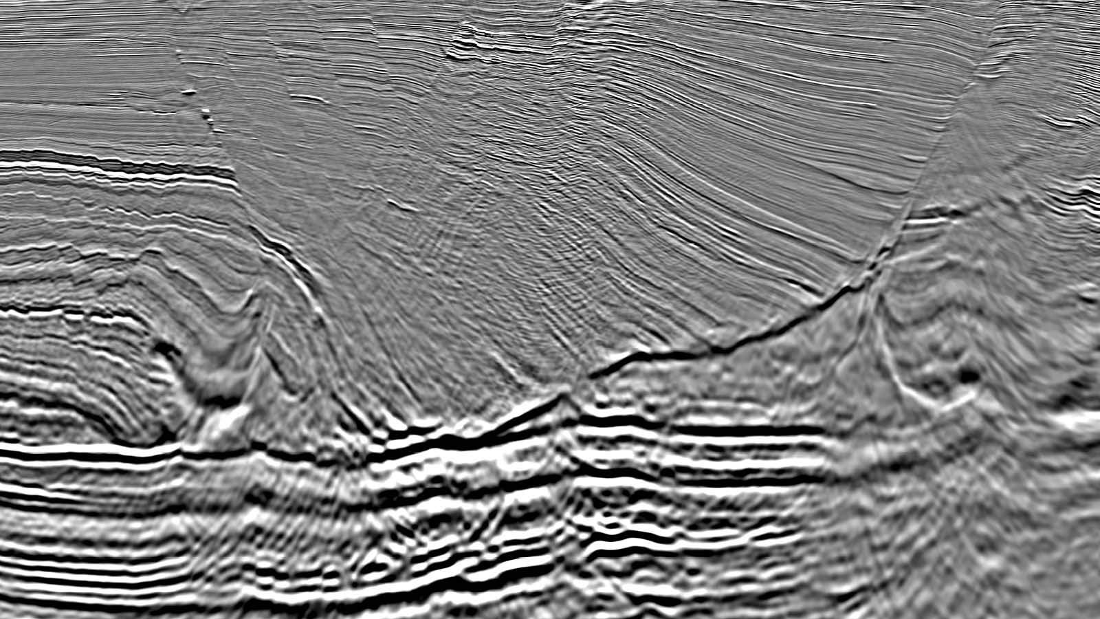
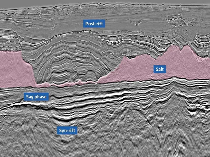
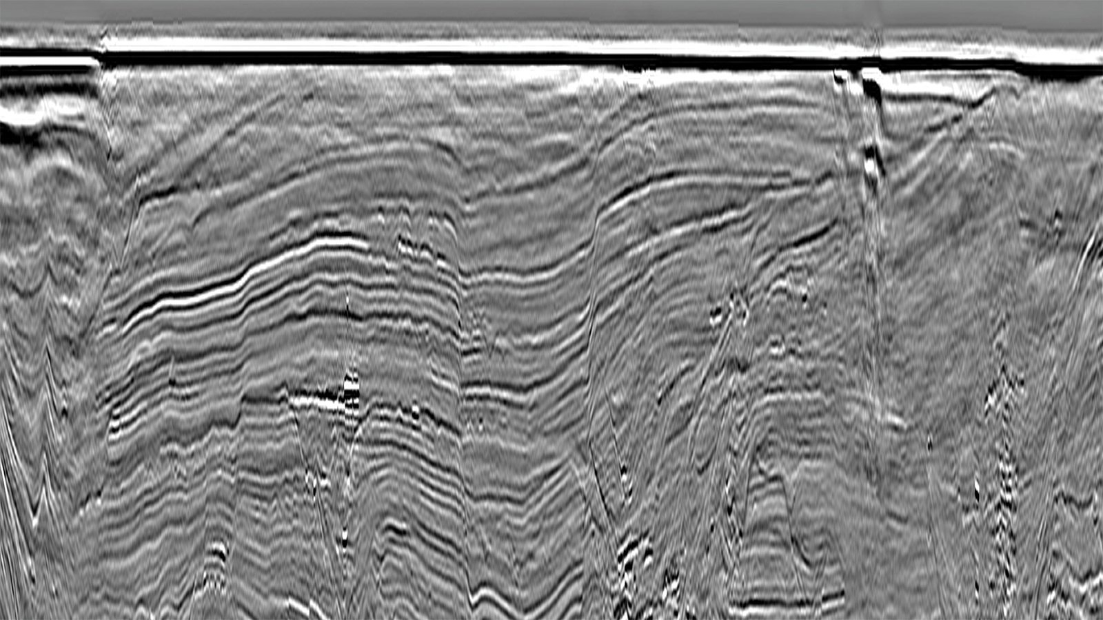
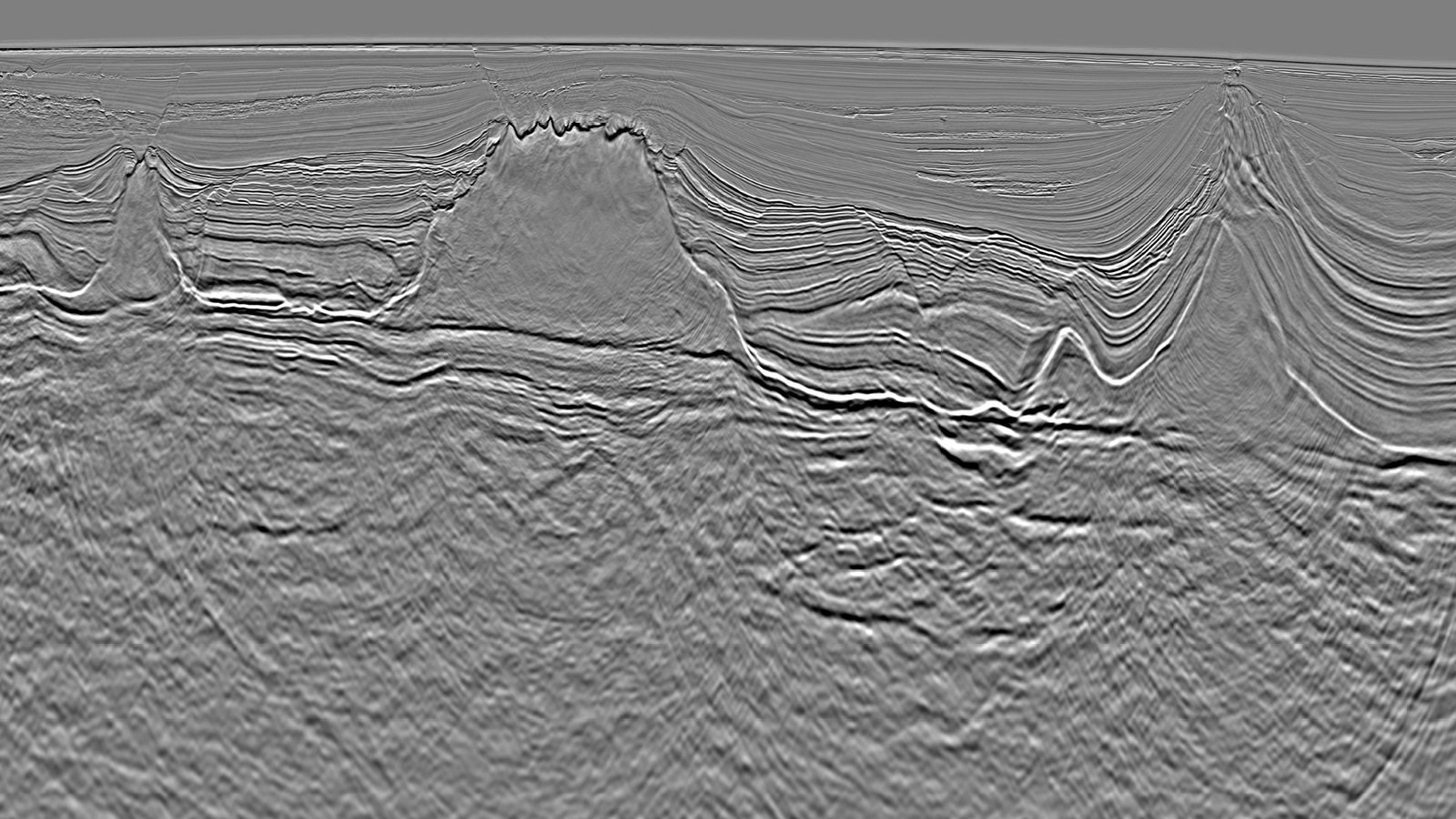
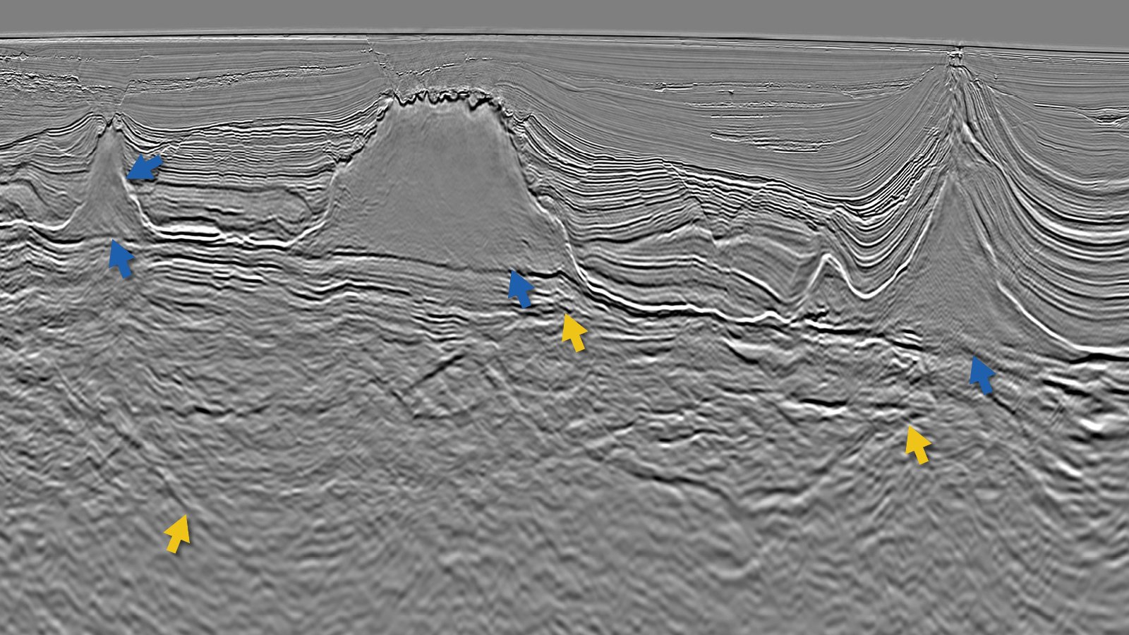
A combination of reflection and refraction tomography has been used in conjunction with FWI to generate a detailed velocity model which gives enhanced imaging of complex salt bodies and presalt reflections. A variety of migration algorithms including SWIM, RTM and KPSDM have been utilized to produce multiple volumes which contribute to improved interpretation in a geologically complex region.
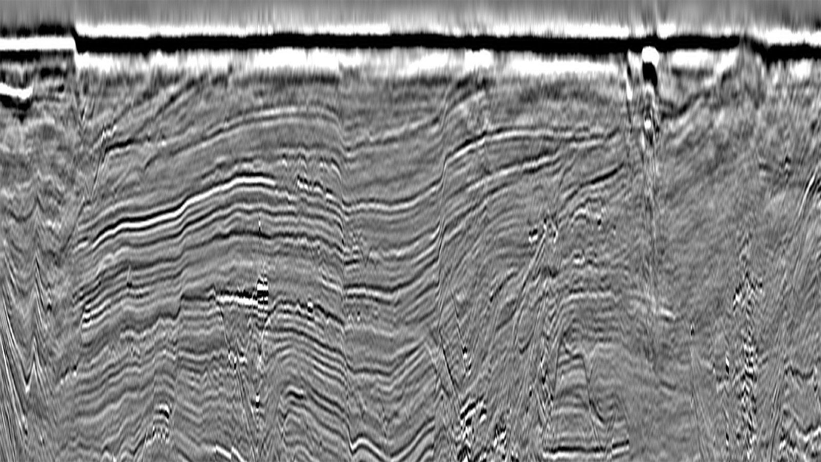
SWIM Delivers High Resolution Shallow Imaging


Salt and Presalt Better Imaged with RTM


The Results
High-quality 3D data allows for detailed mapping
Tertiary sandstones deposited in turbidite channel systems offer excellent potential reservoirs (26-30% porosity and >400md permeabilities) and are analogous to those established in the prolific Lower Congo Basin. High-quality 3D data allows for detailed mapping of extensive stacked channel networks with additional reservoir potential also occurring in postsalt Albian carbonates. Quantitative Interpretation has identified AVO anomalies associated with hydrocarbon presence in these deposits. Hydrocarbons generated from source rocks in the presalt section have the potential to migrate into the post-rift via salt welds. Reservoirs can also be charged from postsalt sources through faults created by halokenisis, or by simple up-dip migration through carrier beds.
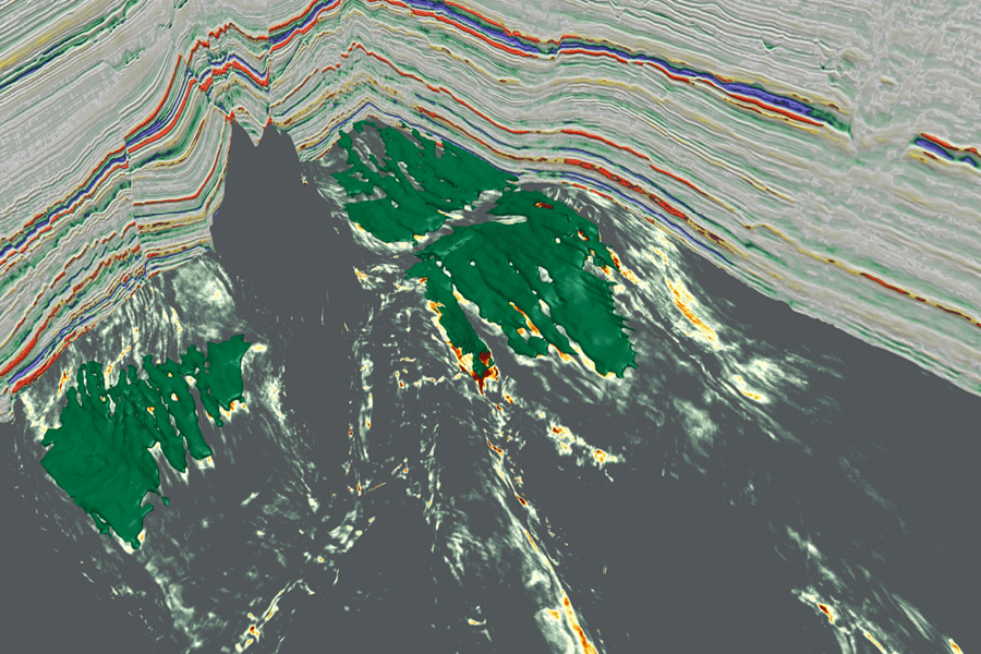
QI Reveals a Working Petroleum System


Speak to Our Experts
Get in touch with a TGS representative today to book your demo and learn more about how TGS solutions can support your energy needs.