


The Location
Location
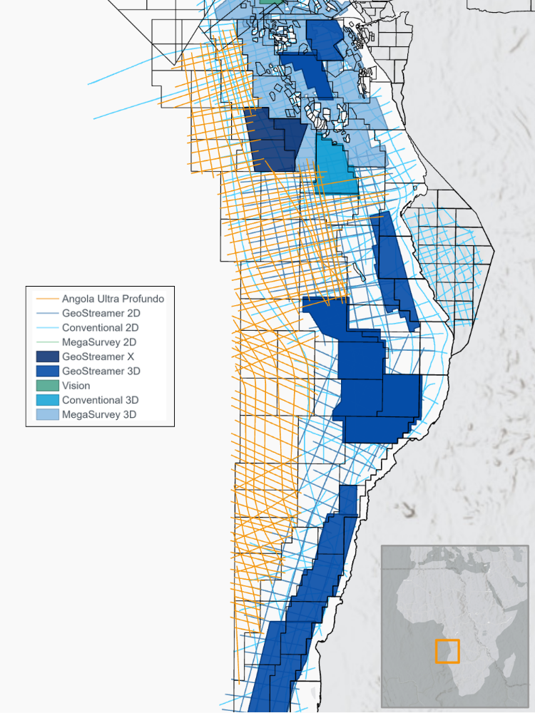
Lower Congo, Kwanza and Namibe basins, Offshore Angola
Survey
Angola Ultra Profundo MC2D
Survey Year
2026
Data acquisition (in this study)
Multi-client 2D
Data Deliverables
Ultra-Fast Track KPSTM, Fast-Track KPSDM, Final KPSDM & RTM
Survey Size
~17,000 km
Water depth
Up to 3,500m

The Challenge
Imaging Frontier Ultra-Deepwater Complex Geology
The Lower Congo, Kwanza and Namibe basins are highly variable in their geology across pre- and post-salt megasequeces, with the presence of deepwater slope channel complexes interacting with complex mobile salt, volcanics and an underexplored pre-salt section. These geological features create significant imaging challenges due to strong velocity contrasts and structurally complex subsurface geometries.
The project required acquisition parameters capable of improving illumination and regional continuity from shallow post-rift systems down to crustal-scale structures.
Adapting Acquisition to Emerging Prospectivity
The survey covered frontier areas with limited modern seismic coverage, meaning geological understanding evolved continuously during acquisition. As interpreters identified new subsurface features of interest, the acquisition program needed to adapt rapidly to maximize coverage over identified play potential.
Traditional offshore workflows often lack the operational flexibility required to dynamically reposition seismic lines during acquisition campaigns, especially in ultra-deepwater environments spanning multiple basins and geological domains.

Accelerating Frontier Exploration Decisions
As operators continuously assess opportunities across Angola’s ultra-deepwater margin, compressed licensing timelines and portfolio reviews reinforce the need for fast access to high-quality seismic data and subsurface insights.
Conventional workflows and traditional data delivery methods could not provide interpreters and explorers with sufficiently rapid access to high-quality data for prospect screening and acreage evaluation.


The Solution
Acquisition Design
- Gemini EFS deployment
- 12 km GeoStreamer configuration
Pre-Processing Solution(s)
Modern broadband processing, including:
- Machine learning denoise
- Wavefield Separation & P-UP generation
- Seismic interference and multiple attenuation
VMB and Imaging
- Elastic Dynamic Matching FWI
- KPSTM (Ultra-Fast Track), KPSDM and RTM imaging
Data Management
- Accelerated LEO satellite transfer
TGS designed the Angola Ultra Profundo MC2D survey around an integrated acquisition-and-delivery workflow optimized for frontier exploration. The program combined Gemini EFS with a 12 km GeoStreamer length configuration to improve low-frequency penetration, broadband signal quality and deep imaging capability across Angola’s ultra-deepwater margin.
Near-real-time satellite data transfer enabled seismic data to be transmitted directly from the vessel to TGS processing centers, allowing ultra-fast-track products to be generated within two weeks after acquisition. This integrated workflow enabled interpreters to rapidly evaluate emerging geological features and dynamically adapt the acquisition program to maximize exploration value across the basin portfolio.


The Results
Ultra-Fast Seismic Delivery
Seismic data was transmitted directly from the Ramform Victory vessel to the TGS cloud environment using low-earth-orbit (LEO) satellite communications, enabling near-real-time processing workflows. Ultra-fast-track seismic products were delivered within two weeks of acquisition, significantly accelerating interpretation and exploration screening activities. This rapid turnaround enables explorers to evaluate frontier acreage opportunities within the acquisition campaign, supporting faster technical and commercial decision-making.
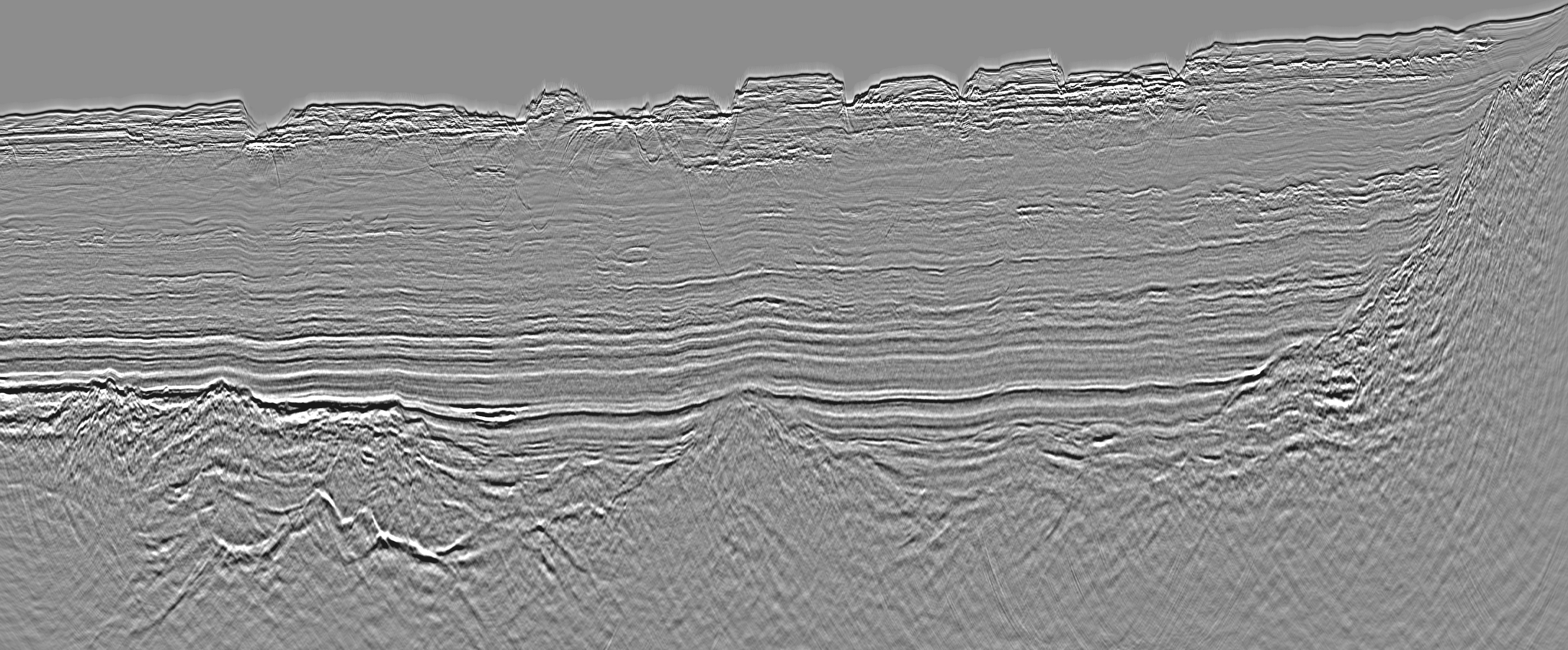
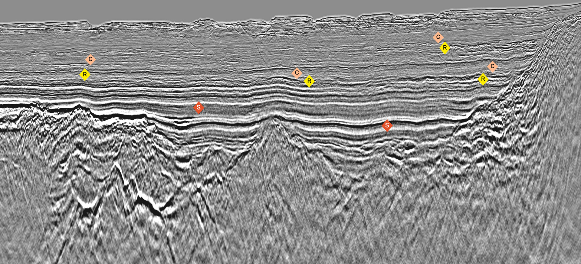
Ultra-fast-track PSTM line delivered just two weeks after acquisition.
Conclusion
The Angola Ultra Profundo MC2D survey demonstrates how integrated acquisition, rapid data delivery, and adaptive survey design can accelerate exploration in frontier ultra-deepwater environments. By combining Gemini EFS, long-offset GeoStreamer technology, and near-real-time satellite transfer, the project delivers modern seismic imaging capable of resolving complex pre-salt and deepwater geological systems across Angola’s offshore margin.
TGS' integrated workflow enables faster interpretation cycles, improves operational flexibility, and expands regional geological understanding across some of West Africa’s most prospective frontier basins.
Commercial impact
Accelerated Licensing Decisions
Enabled explorers to evaluate frontier acreage under short licensing timelines using ultra-fast-track seismic products.