
-
Separate Wavefields
-
Steerable Streamers
Separate Wavefields
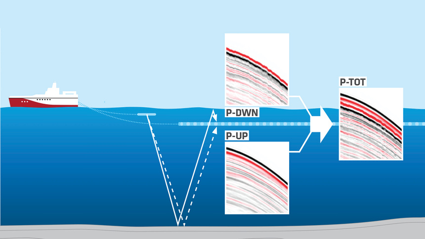
Schematic illustration of the continuous interference between the up-going and time-delayed down-going wavefields recorded by hydrophone-only streamers. Wavefield separation of multisensor streamer (GeoStreamer) data accurately recovers the P-UP and P-DWN wavefields.
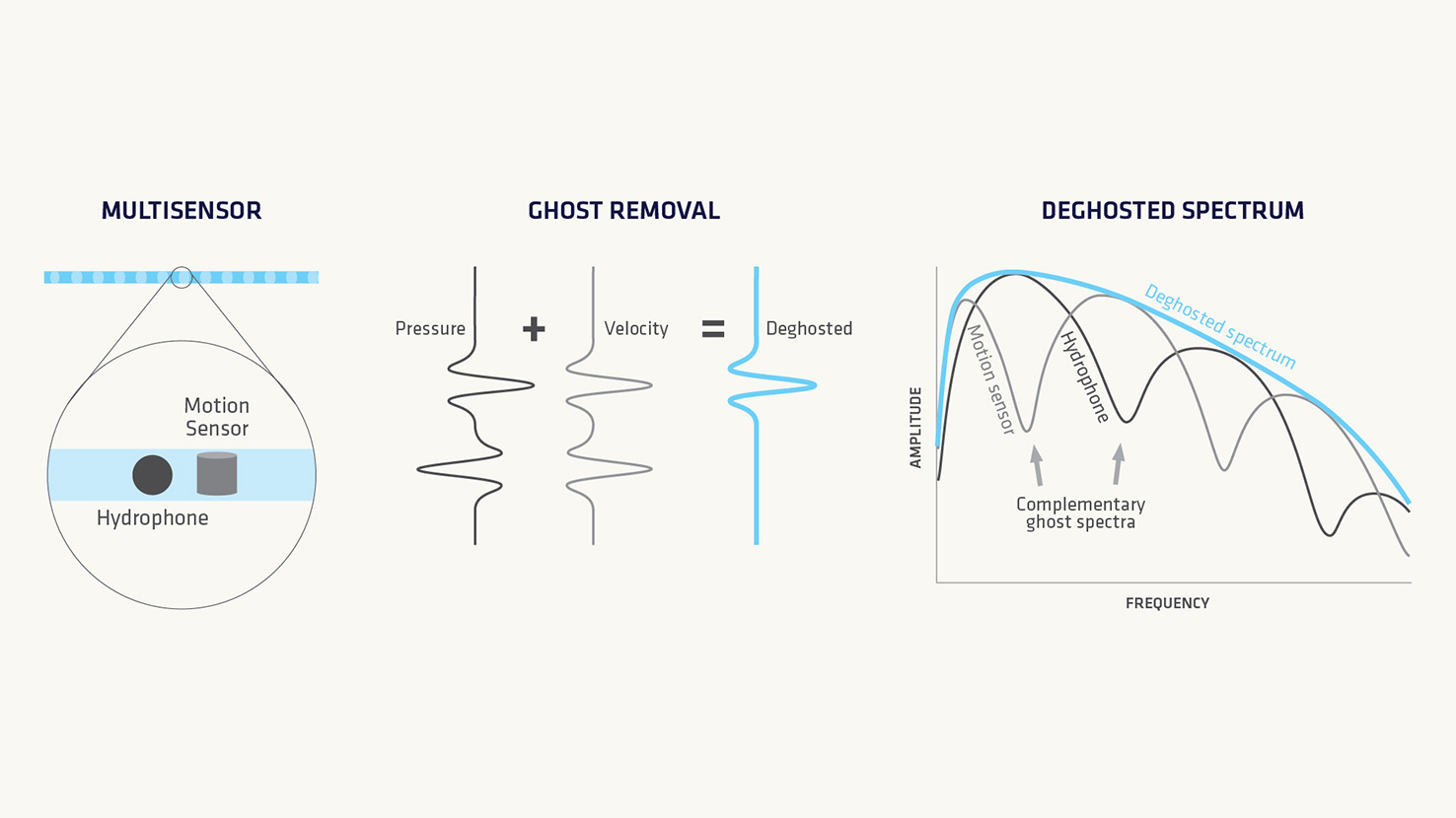
Multisensor GeoStreamer has both pressure and particle velocity sensors collocated in the streamer body. Two signals are recorded and using a processing step called wavefield separation two complementary data volumes are created: an up-going pressure wavefield and a down-going pressure wavefield. These wavefields are used in complementary ways for various subsurface imaging and characterization pursuits.
Steerable Streamers
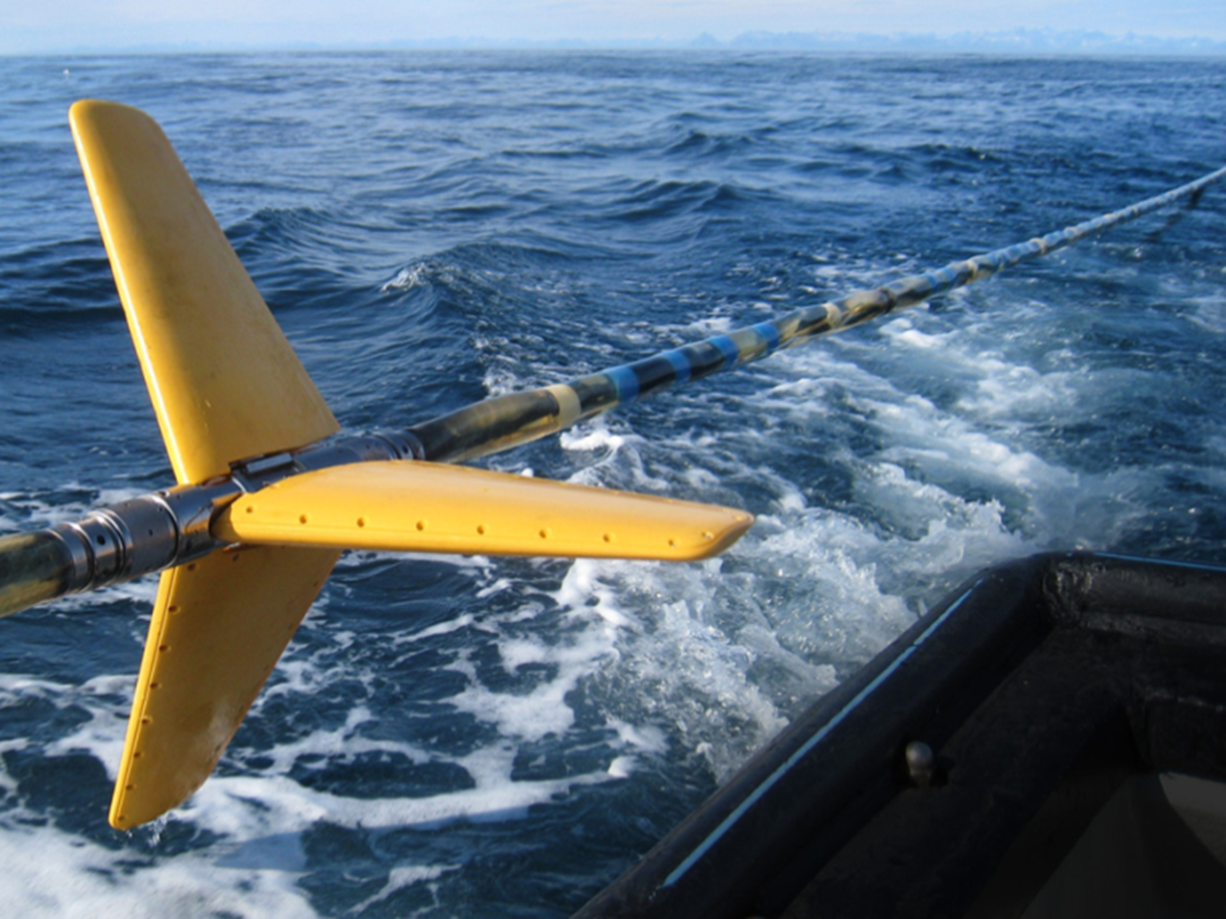
Three-wing eBirds provide lateral steering and depth control of GeoStreamer equipment on all TGS vessels. The eBird solution is built on an inline body and has three detachable wings (above). The snap-on/snap-off mechanism makes attachment/removal of wings an easy task both during streamer deployment/retrieval and work-boat maintenance. eBird bodies remain on the GeoStreamer when reeled onto the vessel, and wings are easily stowed on the back deck.