


The Location
Location
Lower Congo Basin, offshore Angola
Survey
Angola Blocks 33,49,50 MC3D
Survey Year
2024-2025
Data acquisition (in this study)
Wide-Azimuth (WAZ) Towed Streamer
Data Deliverables
KPSDM, RTM and LS-RTM
Survey Size
~8,750 sq. km
Water depth
~2,000 – 3,000 m

The Challenge

Resolving Heterogeneous Post-Salt Reservoir Systems
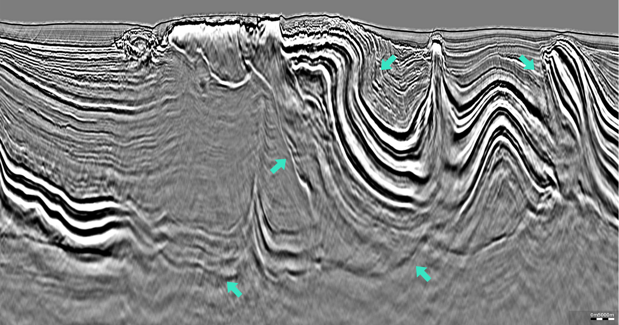
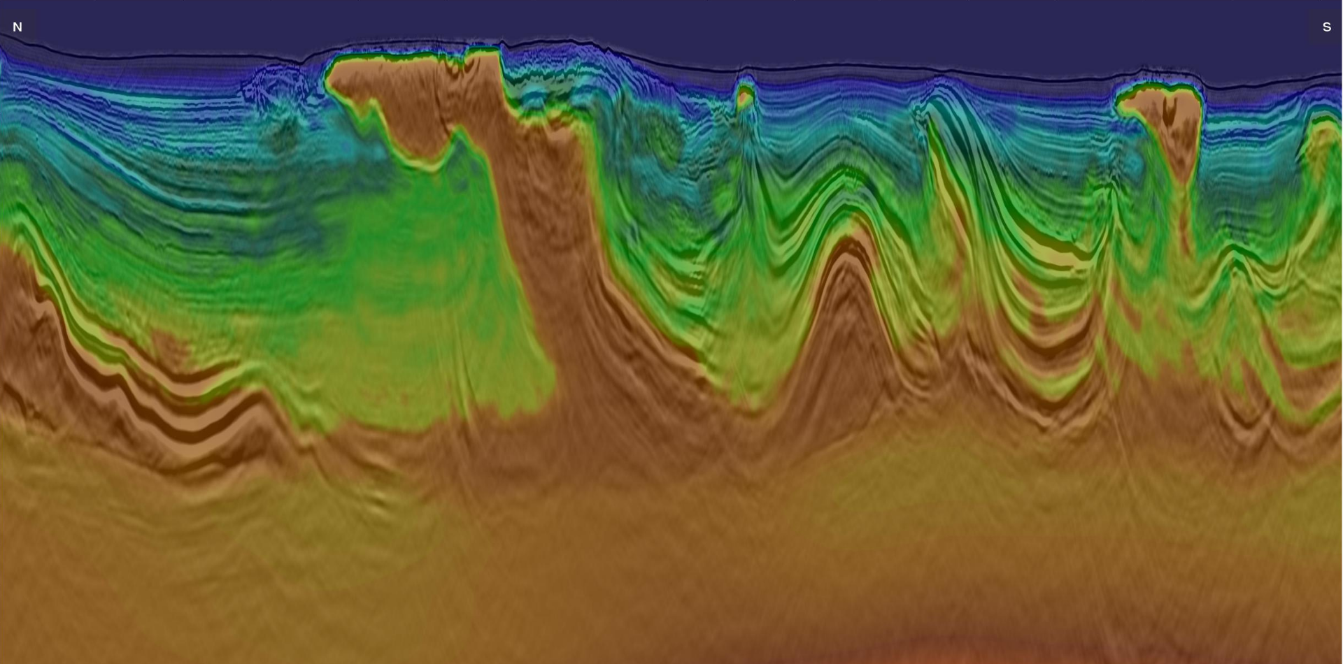
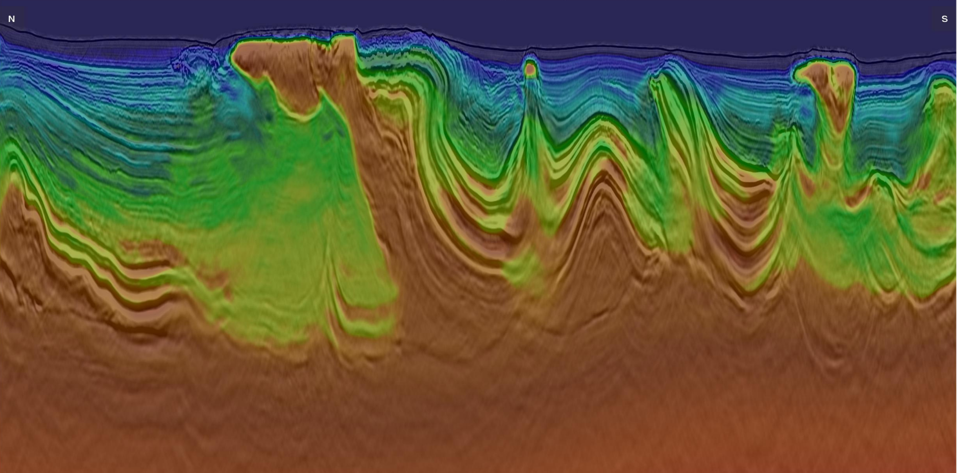
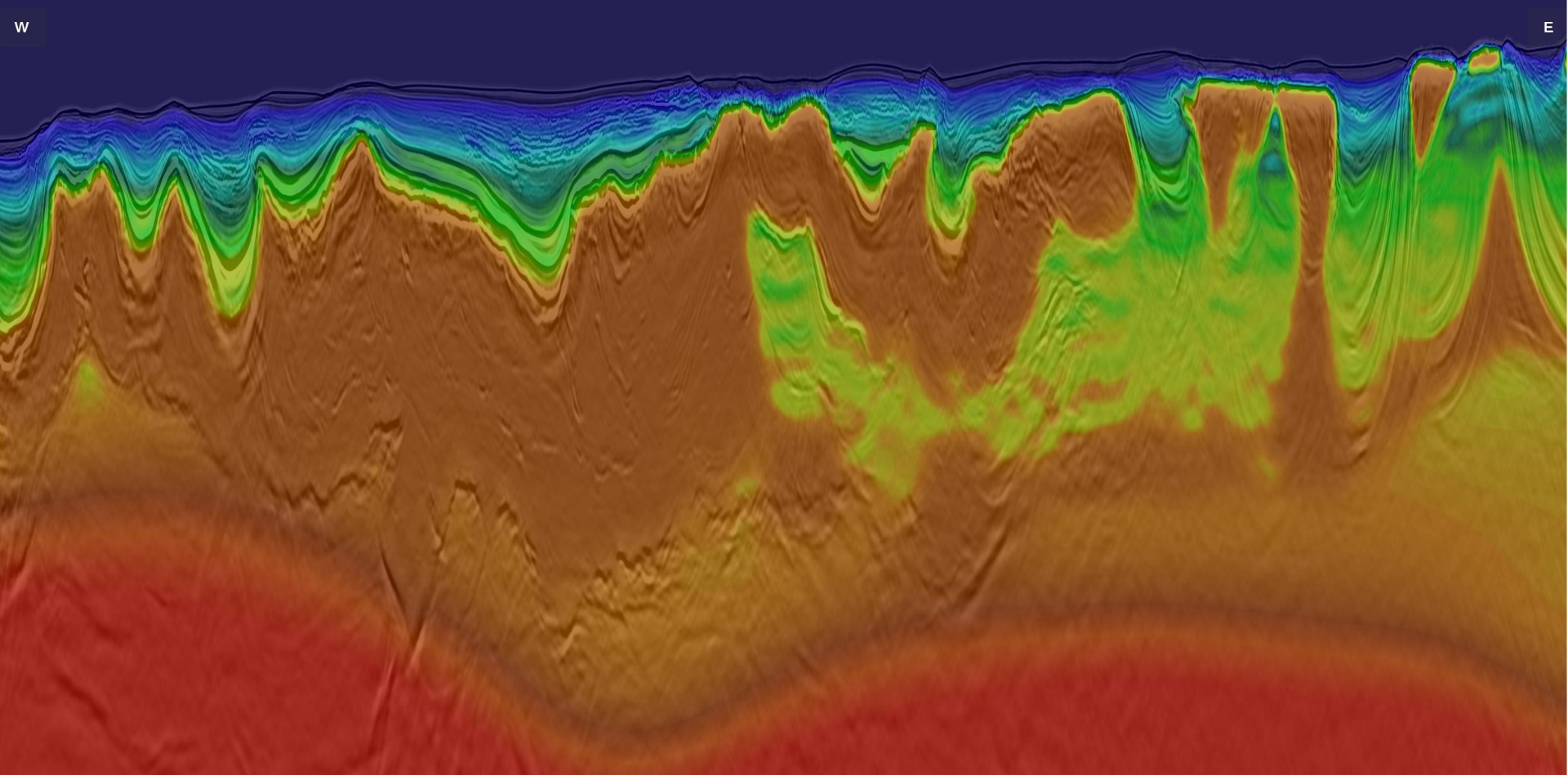
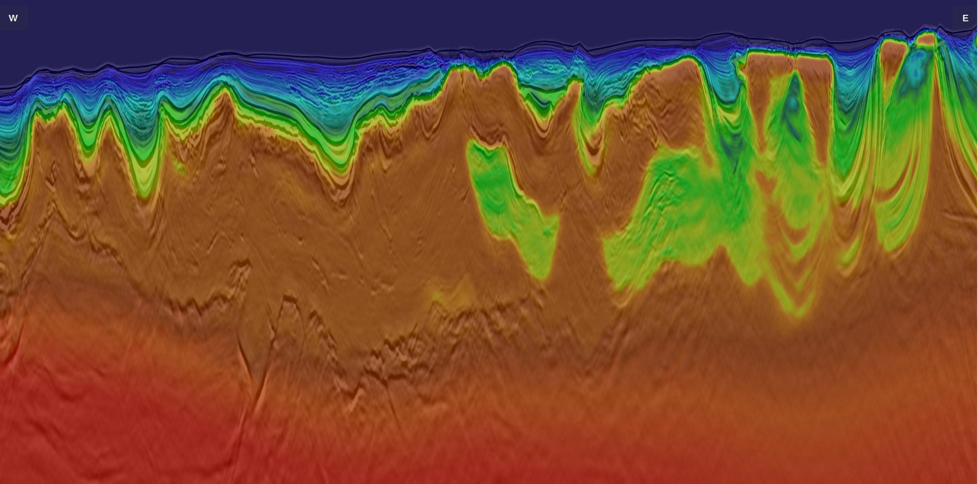
The Lower Congo Basin post-salt section is dominated by thick Neogene deepwater turbidite systems, consisting of complex channel systems with significant heterogeneity. The deposition of these reservoirs is controlled by salt movement, resulting in intricate geometries with strong lateral complexity. Accurate imaging is critical for reservoir characterization, yet conventional acquisition and processing can struggle to preserve reflector continuity and amplitude fidelity, limiting confidence in reservoir mapping and distribution.
Imaging Beneath Deep Complex Salt into Pre-salt Targets
Mobilization of the Aptian salt through sediment loading by Albian carbonates and Oligo-Miocene deposits resulted in complex salt geometries that strongly affect seismic illumination and distort seismic wave propagation, particularly along steep salt flanks, overhangs, and subsalt, where wavefield distortion and shadow zones degrade seismic imaging, increasing subsalt uncertainty and impacting confidence in prospect definition. Detailed salt geometry mapping is critical to the understanding of shallow traps within the mature Miocene fairway and of the underexplored deeper post- and pre-salt petroleum systems.
Cost Constraints in Deepwater Frontier Exploration
While ocean floor-based acquisition methods, such as ocean bottom nodes (OBN), can improve imaging in complex salt environments, they require substantially higher investment and operational complexity, making them less suitable for large-scale deepwater frontier exploration programs with extensive survey coverage. Exploration teams require a solution that delivers high-quality imaging across the full petroleum system while remaining economically viable for regional evaluation.


The Solution
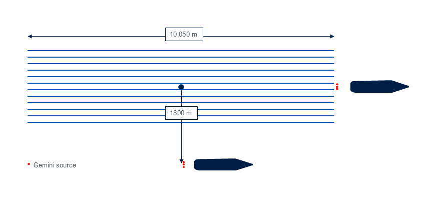
Acquisition Design
- One-sided WAZ configuration
- Six Gemini EFS deployment
- GeoStreamer multisensor technology
Pre-Processing Solution(s)
Modern broadband processing, including:
- Machine learning denoise
- FISTA inversion-based deblending
- 4D regularization and interpolation
VMB and Imaging
- Elastic Dynamic Matching FWI
- KPSDM, RTM and LS-RTM depth imaging
Data Management
- Vessel-to-shore LEO satellite data transfer
- Imaging AnyWare® processing platform
A fully integrated acquisition‑to‑imaging solution engineered to reduce exploration uncertainty, increase overall imaging robustness, and provide cost‑efficient value for early‑stage exploration. The acquisition utilized a multi-vessel one-sided WAZ geometry with GeoStreamer and six Gemini Enhanced Frequency Sources (EFS). This approach enabled simultaneous acquisition of NAZ and WAZ data while maintaining operational efficiency. It delivered a cost‑effective alternative to OBN or full‑WAZ acquisition, reducing acquisition time while providing enhanced subsurface illumination and improved spatial resolution, which is critical for accurately imaging the complex salt structures characteristic of the study area.
Machine learning denoising, inversion-based deblending, and 4D regularization composed a tailored pre-processing sequence, designed to ensure that quality and spatial continuity were preserved without requiring denser acquisition. Velocity model building using Elastic Dynamic Matching FWI (E-DMFWI) refined salt and carbonate geometries and improved imaging, maximizing the value of the acquired dataset.
Together, these technologies enabled a fit-for-purpose deepwater exploration solution that balances imaging quality with cost-efficiency, allowing operators to evaluate large frontier areas without the need for high-cost programs.

The Results
A Smart Design for Large Frontier Acreage Exploration
One-sided WAZ acquisition combined with the Gemini EFS yielded improved illumination within an efficient framework, without the operational burden of more complex configurations, while advanced processing and E-DMFWI maximized the value of the dataset. The approach delivered consistent imaging uplift from early fast-track products to final imaging, enabling earlier interpretation and progressive model refinement. This scalable solution allows exploration teams to evaluate extensive acreage, mature prospects and reduce uncertainty, providing a cost-efficient alternative to OBN surveys for early-stage exploration across large frontier areas.
Clearer Post-salt Reservoir Definition
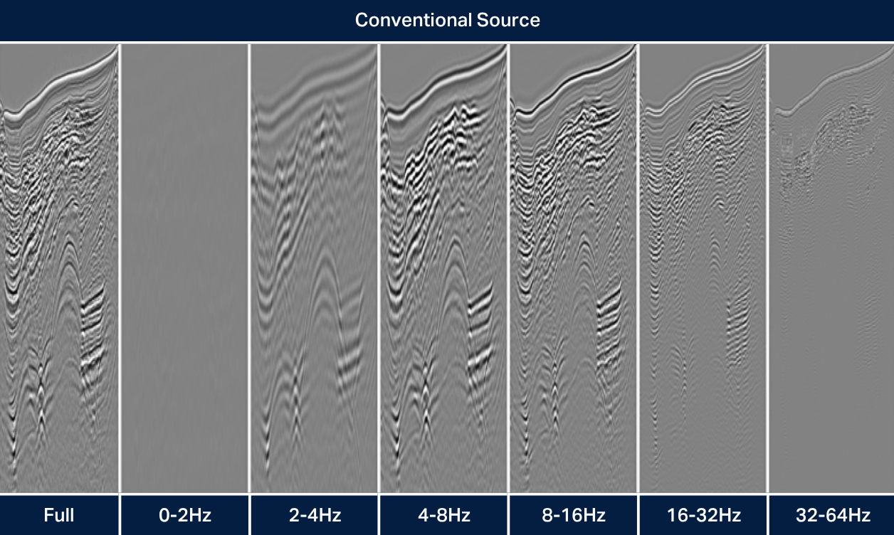
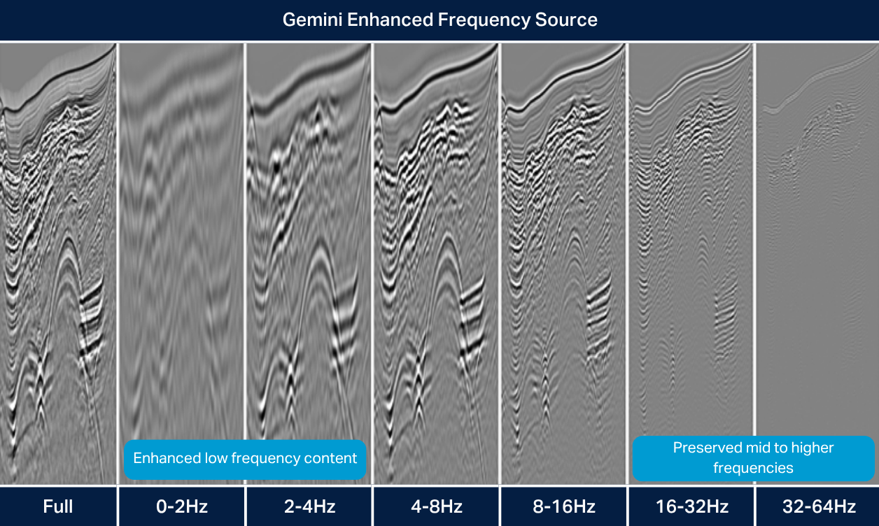
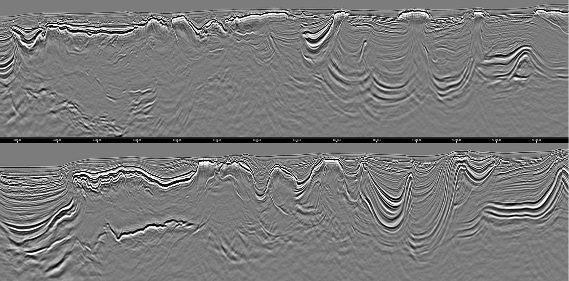
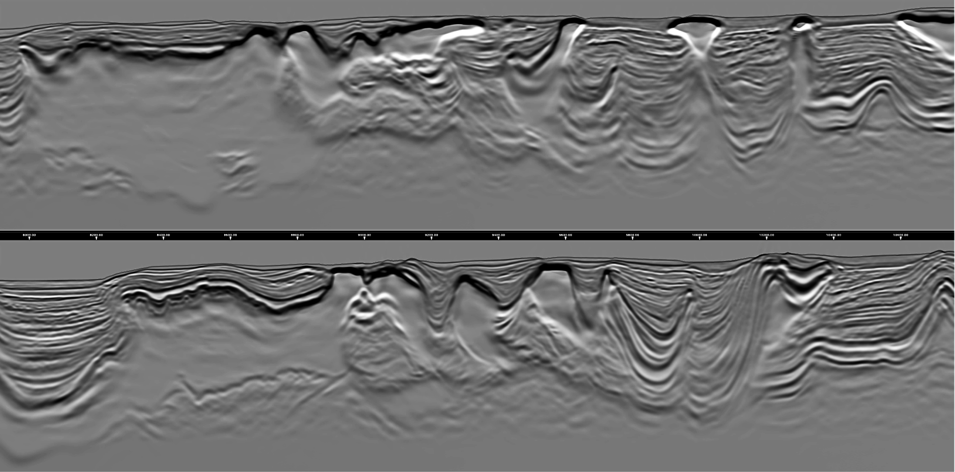
The integration of broadband GeoStreamer acquisition and advanced pre-processing delivered noticeable improvements in imaging quality within the post-salt section. Enhanced frequency content improved signal penetration through complex overburden, providing robust low-frequency content to the E-DMFWI while higher frequencies preserved vertical resolution and amplitude fidelity. Machine learning denoise and FISTA deblending effectively removed noise and blending artifacts, resulting in cleaner gathers. In combination with 4D regularization, these processes ensured spatial continuity across azimuth and offset domains, resulting in clearer delineation of channel systems, levees, and basin-floor fans, improving confidence in reservoir connectivity and distribution.
Reliable Deepwater Subsalt Imaging
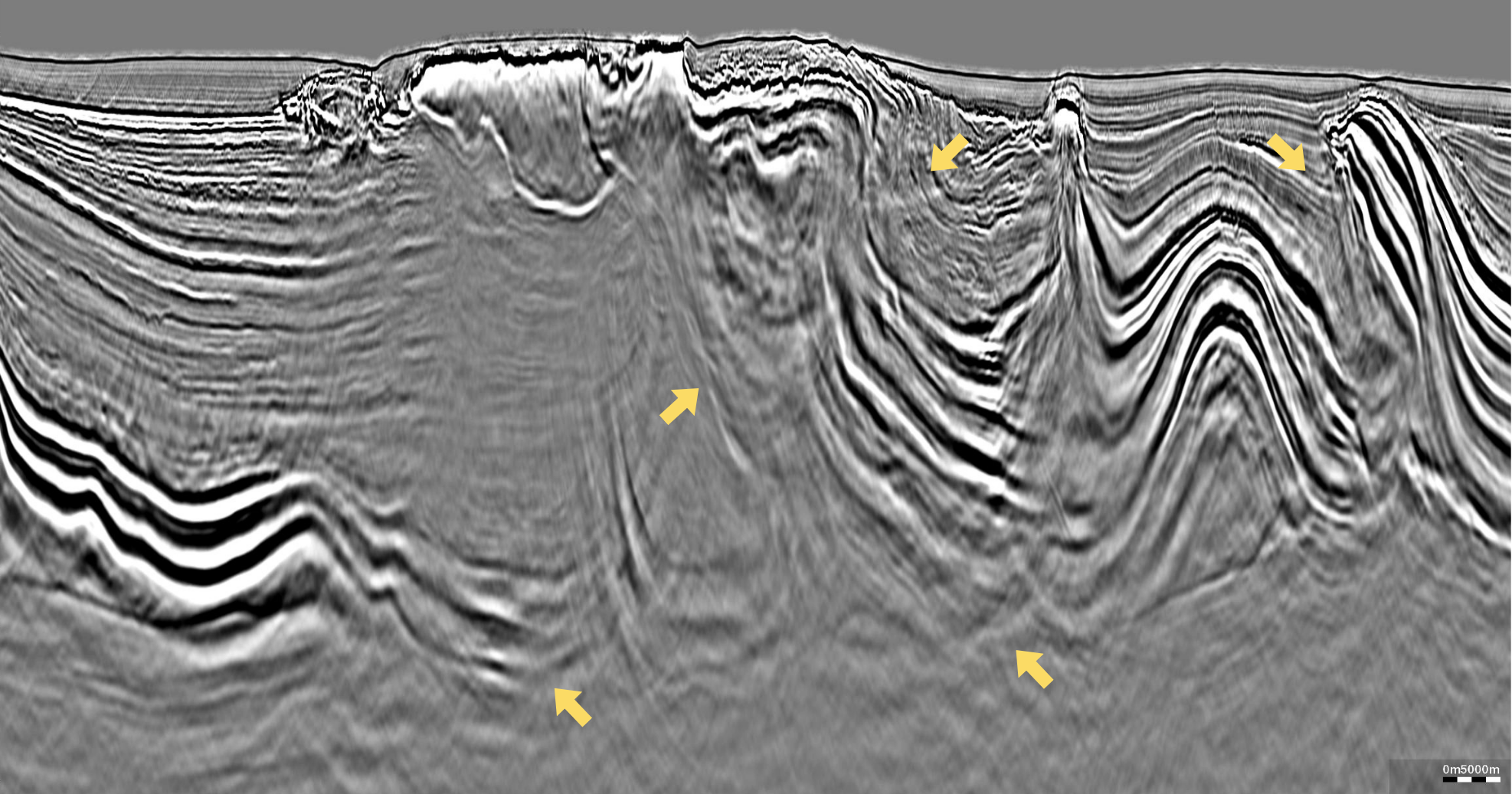
The combination of one-sided WAZ acquisition, the Gemini EFS and Elastic Dynamic Matching Full Waveform Inversion (E-DMFWI) significantly improved imaging beneath complex salt bodies. Increased azimuthal coverage enhanced illumination in and beneath salt overhangs, while broadband low-frequency energy allowed long-wavelength FWI updates to build a reliable background velocity model and enabled deeper velocity updates. The iterative E-DMFWI workflow refined salt and carbonate geometries, reducing overburden velocity uncertainty and improving imaging. As a result, subsalt reflections exhibit improved continuity and focusing, enabling more reliable interpretation of deeper structures.
Conclusion
This case study demonstrates how an integrated seismic strategy spanning from acquisition to imaging can effectively address the full range of challenges in deepwater salt provinces, ranging from post-salt reservoir imaging and de-risking to improved pre- and subsalt exploration. Efficient one-sided WAZ acquisition combined with GeoStreamer multi-sensor streamers and 6 Gemini sources provided improved illumination and high-quality data. Advanced pre-processing solutions and Elastic Dynamic Matching Full Waveform Inversion (E-DMFWI) enabled accurate velocity model building and improved imaging in subsalt sediment and across complex salt and carbonate bodies.
This integrated workflow delivers more reliable imaging across complex salt provinces while preserving acquisition efficiency, enabling better-informed exploration decisions and providing a cost-effective alternative in deepwater environments.
Commercial impact
Reduced Exploration Risk
Improved salt definition and subsalt imaging support more reliable prospect identification and structural interpretation.