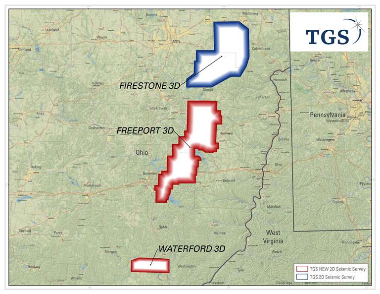
HOUSTON (25 February 2014) - TGS announces two new multi-client onshore 3D surveys, Freeport and Waterford, located within the central Appalachian Basin in Ohio. These high resolution, wide aperture surveys will provide critical data for geotechnical evaluations of the emerging Utica-Point Pleasant fairway while enabling further exploration and development of secondary zones within the Cambrian to Devonian interval.
Freeport covers 1,217 km2 across Carroll, Harrison, Tuscarawas, Guernsey, Belmont and Noble counties in central Ohio and is located south of TGS' existing Firestone (1,054 km2) survey. Waterford covers 210 km2 in Washington County, Ohio within the current southern core of the Utica-Point Pleasant wet gas window.
TGS will support these new investments with data from its expansive well log library and new advanced products that will improve play, trend and prospect delineation. In addition to over 7,000 LAS well logs in the Ohio portion of the Appalachian Basin, TGS also offers its proprietary formation tops database, updated well performance data through its LongbowTM solution and Basin Temperature Modeling (BTM) products.
"With the addition of Freeport and Waterford, TGS will have more than 2,480 km2 of high quality 3D seismic data and an extensive amount of geological data over the Utica formation," stated Rod Starr, Senior VP Western Hemisphere for TGS. "No other company offers a more comprehensive geoscience data library over the emerging liquid rich Utica."
Acquisition of both surveys will begin Q4 2014 utilizing high channel count wireless equipped 3D crews. Data processing will be performed by TGS' Calgary-based subsidiary, Arcis Seismic Solutions, and available to clients late Q4 2015.
This survey is supported by industry funding.