Towed Streamer Solutions
High-Fidelity Data for Complex Targets
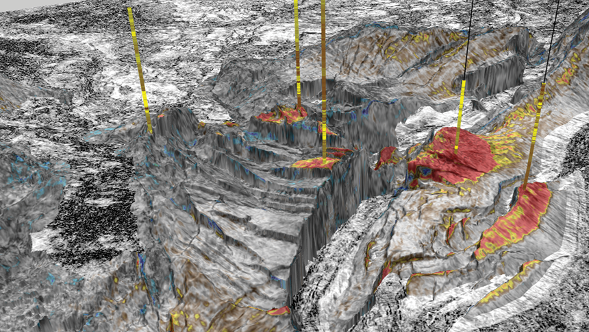
TGS provides a portfolio of towed streamer acquisition technologies engineered to deliver reliable, high-fidelity seismic data across a wide range of survey environments. Built around the GeoStreamer platform, our solutions support advanced imaging techniques, including full waveform inversion and high-resolution velocity model building, while maintaining operational efficiency at scale.
From true broadband acquisition (GeoStreamer) to richer azimuth and offset coverage (GeoStreamer X, Extended Long Offsets), TGS enables more accurate subsurface characterization, particularly in complex or data-sparse settings. Ultra-high resolution 3D (UHR3D) and hybrid streamer-node configurations further extend the utility of streamer data into shallow imaging and infrastructure-led exploration. Each solution is designed to integrate with modern processing and data delivery workflows, supporting faster turnaround and consistent data quality from acquisition through to imaging and interpretation.
Our Solutions
TGS towed streamer configurations are each designed to address specific imaging and geological challenges while maintaining broadband fidelity and efficient survey design.

GeoStreamer
Dual-sensor streamer delivering true broadband data with high signal-to-noise and reliable low-frequency content. Supports modern imaging techniques like FWI and least-squares migration.

GeoStreamer X
Adding rich azimuth and offset coverage to GeoStreamer. Configurations include wide-tow sources, dense streamer spreads, and long offsets, improving illumination and velocity model accuracy in complex settings.
Ultra-High Resolution 3D (UHR3D)
Ultra-High Resolution 3D (UHR3D) imaging captures the shallow subsurface with exceptional clarity by sampling the seismic wavefield at high spatial and temporal density. The result is detailed, continuous data suited for near-surface interpretation where conventional 3D methods may lack the required resolution.
In oil and gas, UHR3D is used for near-field exploration, site surveys, and infrastructure-led projects. It supports shallow hazard identification, platform planning, and development around existing assets.
In offshore wind, UHR3D enables foundation assessment, cable routing, and environmental baseline studies. It’s also applied in marine mineral exploration and UXO detection where shallow detail and wide-area coverage are required.
Extended Long Offsets (ELO) Surveys
Streamer configurations with extended offsets improve velocity model building, support deeper full waveform inversion (FWI), and enhance imaging beneath complex overburden. By capturing a broader range of wave paths, ELO delivers more reliable model updates and clearer imaging at depth.
Dual-vessel operations enable efficient acquisition of offsets beyond the limits of conventional streamer length, making ELO especially effective in deepwater, subsalt, and structurally complex areas. It can be applied standalone or combined with other acquisition techniques to meet specific imaging challenges.
Hybrid Solutions
Hybrid acquisition integrates towed streamer and ocean bottom node technologies to optimize subsurface coverage. This approach improves near-offset sampling and azimuthal illumination in areas with complex geology or access constraints, without the cost of full-node deployment.
TGS provides a complete hybrid solution, supplying all required equipment and managing the full workflow from survey design and acquisition through to final imaging. This integrated capability ensures consistent data quality, streamlined execution, and better alignment between acquisition and processing objectives.
Let’s Discuss Your Acquisition Needs
With the industry’s most diverse fleet and integrated expertise, from survey design and acquisition to seismic data imaging, TGS delivers trusted, tailored solutions for complex exploration challenges.
Learn More About Our Fleet
Discover the capabilities, configurations and proven performance of our diverse fleet. Built for reliability and efficiency, our vessels are ready to meet your exploration needs, anywhere in the world.
Start the Conversation
Every project is different. Talk to a TGS expert about your specific acquisition requirements. With decades of trusted experience and integrated capabilities, we’ll help you design the right solution from the start.


