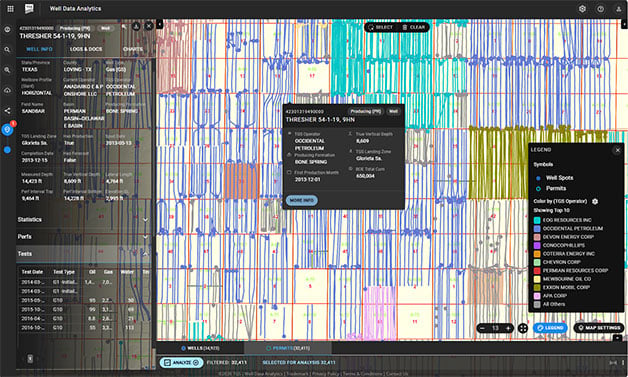
Permit Lifecycle Tracking
Comprehensive U.S. coverage of drilling, completion, and recompletion permits, updated daily to monitor regulatory activity and development timelines.
We hold the industry's largest well data library comprised of over 100 years of public and non-public sources, providing you with a complete picture of oil and gas well records, from permit to abandonment.
Interpretation-ready, fully processed well data that accelerates exploration and development decisions. Skip the data processing bottleneck and focus on high value interpretation from day one, supporting workflows from new play exploration and acreage evaluation to reservoir characterization, development planning, completions benchmarking, and wellbore placement.


Comprehensive U.S. coverage of drilling, completion, and recompletion permits, updated daily to monitor regulatory activity and development timelines.
Nationwide well header and surface location data derived from all available sources, validated using Digital Elevation Models (DEMs) and verified with satellite imagery to ensure positional accuracy.
Fully researched and spatially accurate representations of wellbores from surface to total depth, enabling precise subsurface interpretation and spacing analysis.
Horizontal and vertical spacing measurements to parent, sibling, and child wells, visualized through gun barrel diagrams and available in tabular format to assess spacing and interference.
Standardized and interpreted pressure data sourced from Drill Stem Tests (DSTs) through an exclusive partnership with the American Institute of Formation Evaluation (AIFE), and Wireline Formation Tests (WFTs) from the TGS raster library, spanning more than 20 states. The dataset includes flow/drawdown and shut-in pressures, interpreted incremental pressures, Horner analysis, fluid recoveries, and time- and volume-based gas measurements during flow periods. These insights support reservoir characterization, pressure evaluation, fluid prediction, deliverability assessment, and drilling risk mitigation.
Calculated completion attributes including casing details, perforation intervals, treatment volumes, and stimulation design to support completion analysis and benchmarking.
Comprehensive records of all regulatory-required initial and annual production tests used to evaluate well performance and ensure reporting compliance.
A unified production model combining historical and forecasted oil, gas, and water data to provide a consistent view of past, current, and projected production performance.
Well-level allocated production datasets, enhanced with proprietary regional historical data across North America, enabling accurate performance, ownership, and economic analysis.
Monthly production forecasts for every active well, including estimated ultimate recovery (EUR) normalized by lateral length and remaining reserves.
State-reported gas disposition data, including vented and flared volumes allocated to the well level, supporting emissions tracking and regulatory analysis.
Nationwide injection datasets covering volumes, target formations, and injection purpose, including enhanced oil recovery (EOR), water disposal, and storage.

Producing formations derived from TGS stratigraphic models, enabling consistent landing zone identification and cross-play comparisons.
Quality matters when making exploration and development decisions to meet today’s oil and gas demand. All of TGS well data products are tied to one master well record. From permits to wellbore construction and completion, oil, gas, and water production, vent and flare volumes and injection volumes, TGS well data is workflow-ready and can be used in projects immediately making it easier for subsurface data managers and technicians to get their teams up and running. PPDM and OSDU-compliant Application Programming Interfaces (APIs), SQL Direct Connect, and industry-standard export formats and loaders ensure seamless export and integration.
Interested in a product demo or trial? Let us know your needs and we’ll connect you to the right person on our Well Data Products team.