.png "Wind (1)")


About our Floating LiDAR Buoys
We deploy certified floating LiDAR buoys to ensure the highest quality wind resource data. These LiDAR buoy platforms have successfully met or exceeded key performance indicators across multiple validation campaigns, demonstrating the accuracy, reliability, and thus the low uncertainty of the collected wind resource data. Collecting high-quality metocean data is also critically important.
Our FLiDAR partners: 
![]()
-
TGS Floating LiDAR Opportunities
-
Public LiDAR Data
-
Lease Coverage
TGS Floating LiDAR Opportunities
- Central Atlantic (2 buoys)
- New York Bight (2 buoys)
- Massachusetts
- Norway: Utsira Nord
- Offshore Germany (2 buoys)
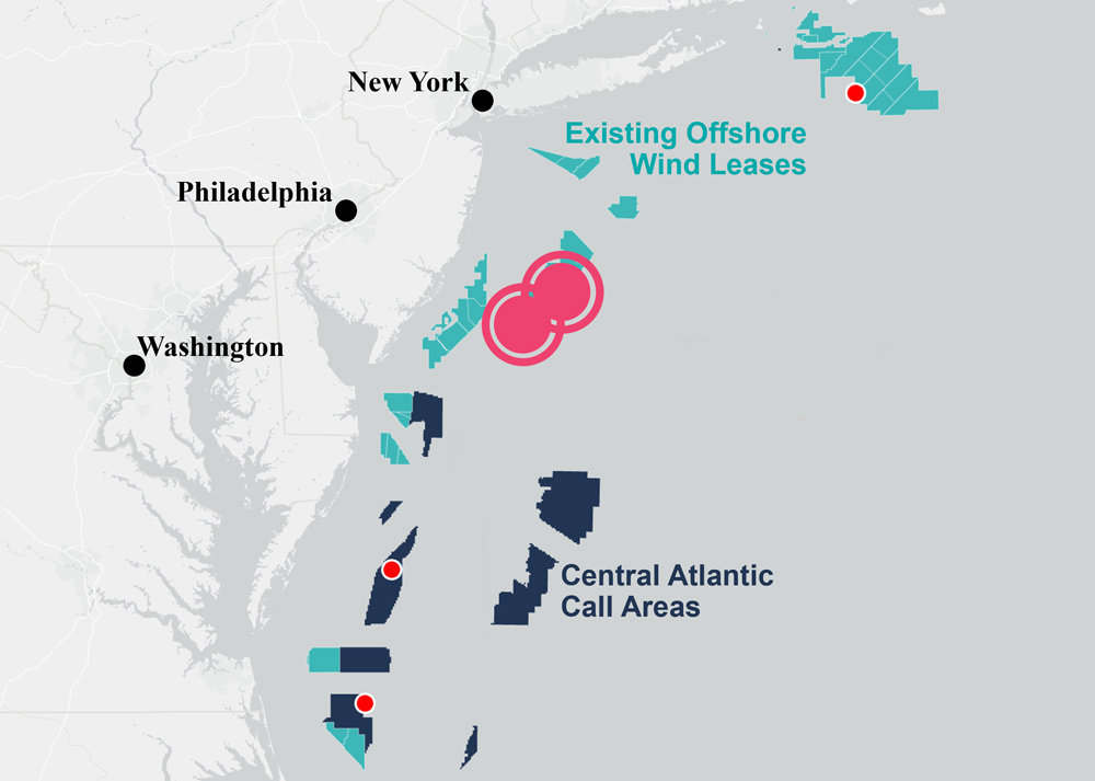
Central Atlantic (2 buoys)
These new, high-quality floating LiDAR will create the only modern and full dataset covering the Central Atlantic lease areas, due to open for bidding in 2024. Access to such data at this early stage is expected to significantly enhance the decision-making ability of all stakeholders investing in the wind development future of this region.
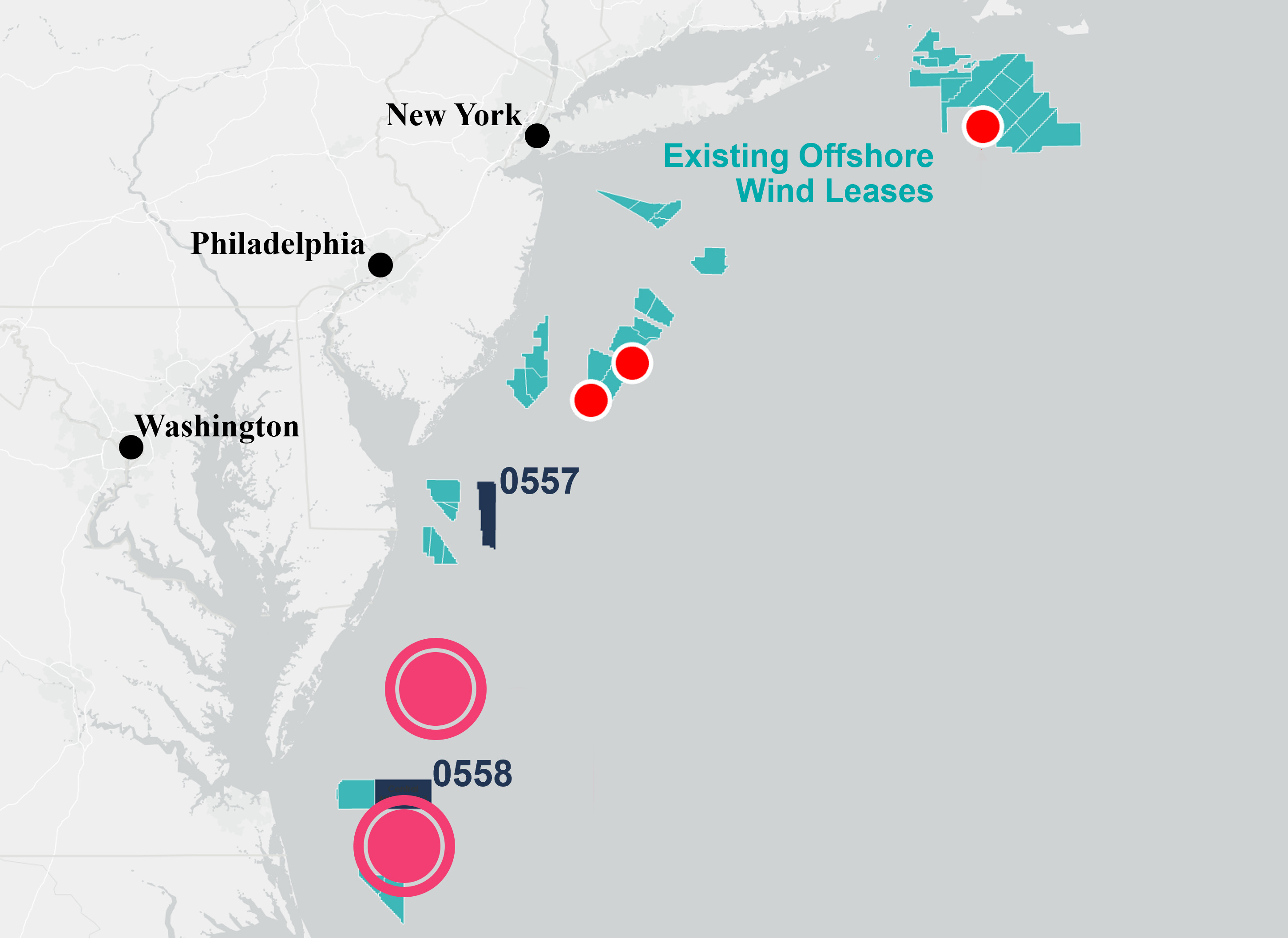
New York Bight (2 buoys)
TGS floating LiDAR buoys covering the NYB lease area will reduce wind and ocean modeling uncertainties and cycle times for those embarking on site assessment activities. It will further validate TGS' expansive high-resolution numerical weather prediction (NWP) model data coverage.
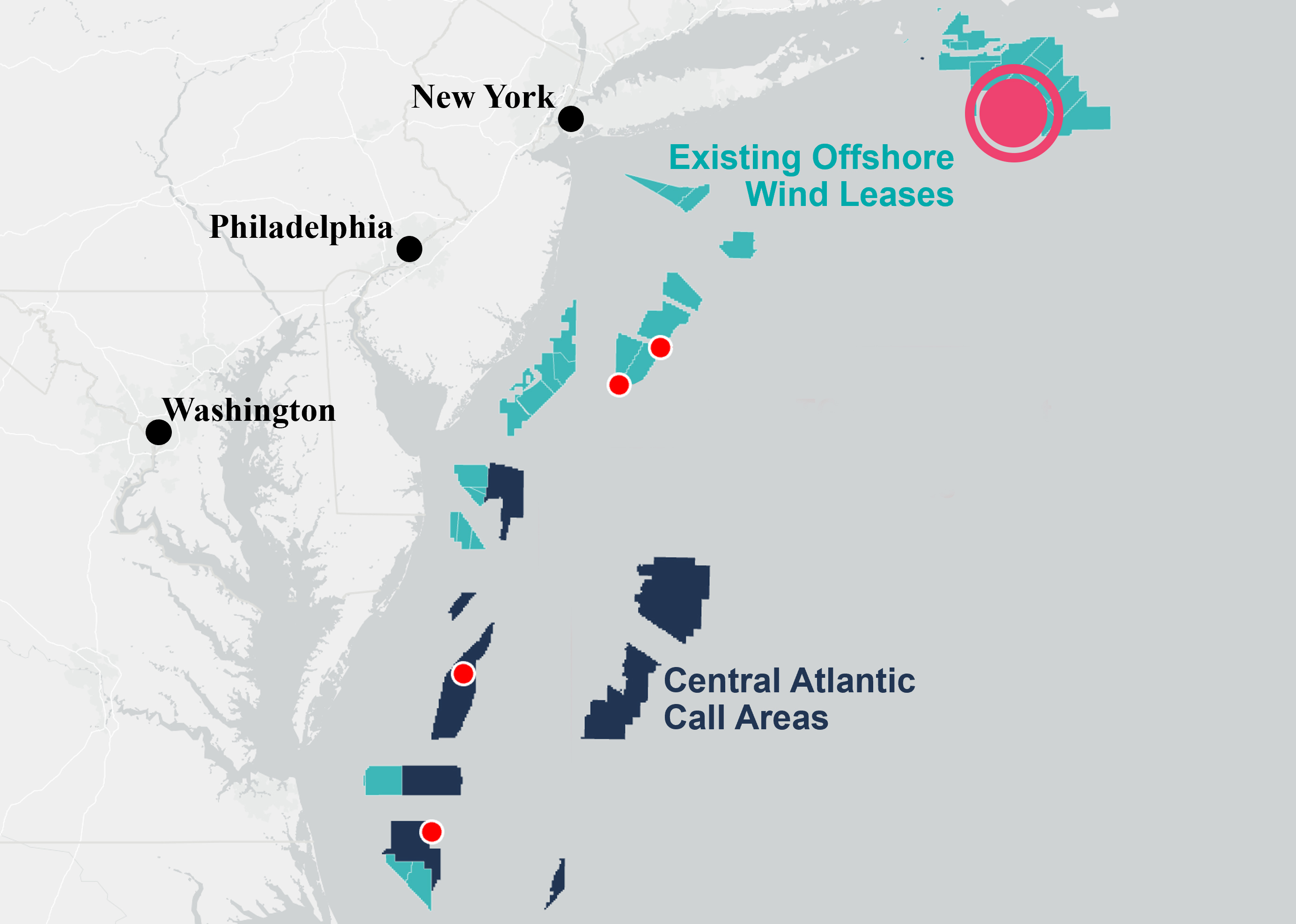
Massachusetts
Our FLiDAR buoy offshore Massachusetts will allow those companies working on wind development in the area to acquire additional stage 3 accredited data to de-risk Final Investment Decisions (FIDs) or enhance Construction and Operations Plans (COPs).
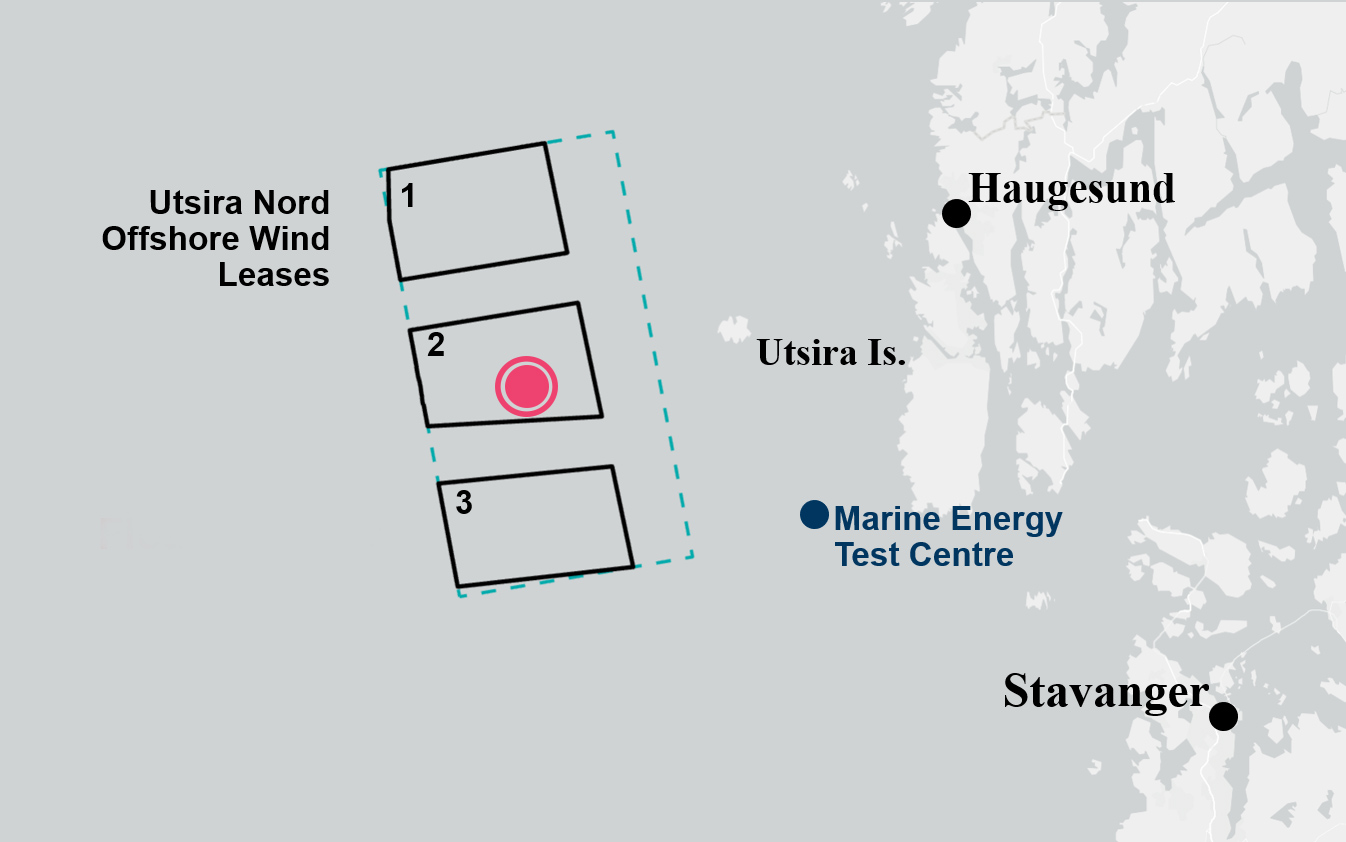
Norway: Utsira Nord
The first-ever floating LiDAR buoy measurement campaign to support Norwegian offshore wind development. Deployed in June 2023, this buoy will enhance decision-making for the three floating wind project areas.
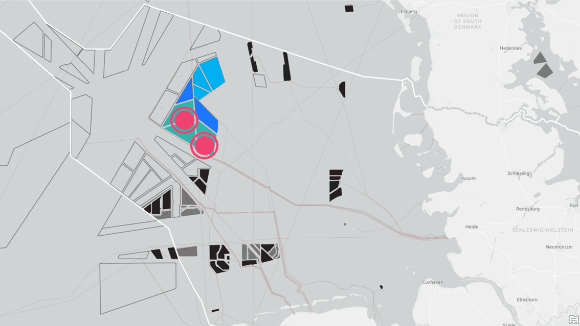
Offshore Germany (2 buoys)
TGS has launched a multi-client wind measurement campaign using LiDAR buoys to enhance decision-making and support several current and future wind lease rounds in the German Bight. The coverage area includes lease areas N-11.2 and N-12.3, offered in the June 2024 lease round and the 2023-awarded lease areas N-11.1, N-12.1 and N-12.2.