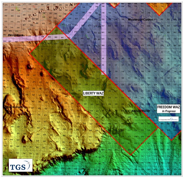
Asker, Norway (3 August, 2009) Following the success of the Freedom Wide Azimuth (WAZ) survey, TGS-NOPEC Geophysical Company (TGS) is pleased to announce an extension to the Cooperation Agreement with WesternGeco. The companies will acquire a second multi-client WAZ 3D survey, called Liberty, in the Green Canyon and Atwater Valley areas of the Gulf of Mexico.
The Liberty WAZ multi-client 3D project covers approximately 3,000 square kilometers and is adjacent to the 15,000 square kilometer Freedom WAZ 3D project where data acquisition will soon be completed. Both surveys utilize the WesternGeco Q-Technology♦ and offer onboard Wave Equation Migration in order to provide a quick look data volume to participating clients. The final data volumes will offer seamless Wide Azimuth 3D data coverage over more than 18,000 square kilometers.
Acquisition of the data, utilizing a 2X4 configuration (two streamer vessels with source and two source vessels), will commence in Q3 of 2009. TGS and WesternGeco will collaborate on the data processing and provide a wide range of final depth imaged products to clients. Sales and marketing of the Liberty WAZ 3D program will be coordinated by TGS.
"We are pleased to expand our multi-client WAZ coverage in this highly prolific region of Miocene and lower Tertiary hydrocarbon plays," stated Stein Ove Isaksen, VP of North and South America for TGS. "This contiguous coverage of high-end data will provide improved imaging so critical to solving the complex subsurface challenges that our clients face."
The Liberty WAZ 3D project is funded by clients.